![214, [Surveys in Austin's Colony along the Brazos River], General Map Collection](https://historictexasmaps.com/wmedia_w1800h1800/maps/214.tif.jpg)
[Surveys in Austin's Colony along the Brazos River]
Atlas D, Sketch 41 (D-41)
D-41
-
Map/Doc
214
-
Collection
General Map Collection
-
Counties
Fort Bend
-
Subjects
Atlas
-
Height x Width
9.0 x 8.7 inches
22.9 x 22.1 cm
-
Medium
paper, manuscript
-
Comments
Conserved in 2003.
Part of: General Map Collection
Lee County Sketch File 9

Print $4.00
- Digital $50.00
Lee County Sketch File 9
Size 8.8 x 8.2 inches
Map/Doc 29709
Orange County Working Sketch 41

Print $20.00
- Digital $50.00
Orange County Working Sketch 41
1979
Size 28.0 x 18.2 inches
Map/Doc 71373
Hudspeth County Rolled Sketch 18

Print $40.00
- Digital $50.00
Hudspeth County Rolled Sketch 18
1886
Size 15.7 x 105.0 inches
Map/Doc 9204
Kendall County Sketch File 27

Print $6.00
- Digital $50.00
Kendall County Sketch File 27
1950
Size 12.4 x 10.9 inches
Map/Doc 28731
Kent County Sketch File 3

Print $4.00
- Digital $50.00
Kent County Sketch File 3
Size 14.2 x 8.7 inches
Map/Doc 28825
[Surveys along the Trinity River]
![297, [Surveys along the Trinity River], General Map Collection](https://historictexasmaps.com/wmedia_w700/maps/297.tif.jpg)
Print $3.00
- Digital $50.00
[Surveys along the Trinity River]
Size 17.8 x 9.5 inches
Map/Doc 297
DeWitt County Rolled Sketch 3
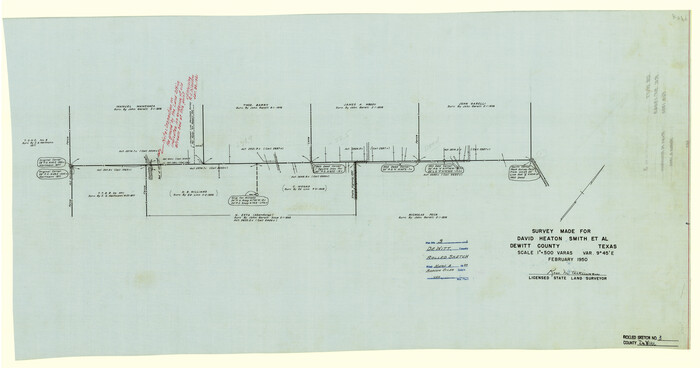
Print $20.00
- Digital $50.00
DeWitt County Rolled Sketch 3
1950
Size 19.9 x 37.8 inches
Map/Doc 5703
Current Miscellaneous File 4

Print $8.00
- Digital $50.00
Current Miscellaneous File 4
1947
Size 11.5 x 9.1 inches
Map/Doc 73723
Map showing location of Texas Prison Farms surveyed for the Texas Prison System

Print $20.00
- Digital $50.00
Map showing location of Texas Prison Farms surveyed for the Texas Prison System
1934
Size 15.6 x 12.3 inches
Map/Doc 94277
Calhoun County Sketch File 12

Print $120.00
- Digital $50.00
Calhoun County Sketch File 12
Size 23.0 x 36.9 inches
Map/Doc 11033
Flight Mission No. CRC-4R, Frame 101, Chambers County

Print $20.00
- Digital $50.00
Flight Mission No. CRC-4R, Frame 101, Chambers County
1956
Size 18.6 x 22.4 inches
Map/Doc 84898
McMullen County Sketch File 23

Print $4.00
- Digital $50.00
McMullen County Sketch File 23
1876
Size 10.0 x 8.0 inches
Map/Doc 31379
You may also like
San Jacinto County Working Sketch 23

Print $40.00
- Digital $50.00
San Jacinto County Working Sketch 23
1940
Size 31.5 x 53.8 inches
Map/Doc 63736
[Blocks M8, M9, M11, W1, RC, M13, M15 and A]
![91928, [Blocks M8, M9, M11, W1, RC, M13, M15 and A], Twichell Survey Records](https://historictexasmaps.com/wmedia_w700/maps/91928-1.tif.jpg)
Print $20.00
- Digital $50.00
[Blocks M8, M9, M11, W1, RC, M13, M15 and A]
Size 17.1 x 34.2 inches
Map/Doc 91928
Denton County Texas

Print $20.00
- Digital $50.00
Denton County Texas
1896
Size 18.4 x 31.6 inches
Map/Doc 4530
Red River County Sketch File 26

Print $4.00
- Digital $50.00
Red River County Sketch File 26
Size 14.7 x 7.9 inches
Map/Doc 35161
Flight Mission No. BQY-4M, Frame 64, Harris County

Print $20.00
- Digital $50.00
Flight Mission No. BQY-4M, Frame 64, Harris County
1953
Size 18.6 x 22.5 inches
Map/Doc 85273
Foard County Sketch File 1

Print $6.00
- Digital $50.00
Foard County Sketch File 1
Size 10.0 x 9.5 inches
Map/Doc 22804
Bexar County Rolled Sketch 6

Print $40.00
- Digital $50.00
Bexar County Rolled Sketch 6
Size 36.6 x 54.9 inches
Map/Doc 81902
Garza County Working Sketch 4

Print $20.00
- Digital $50.00
Garza County Working Sketch 4
1916
Size 19.5 x 23.1 inches
Map/Doc 63151
Fisher County Boundary File 2

Print $18.00
- Digital $50.00
Fisher County Boundary File 2
Size 14.4 x 8.9 inches
Map/Doc 53419
Young County Working Sketch 6

Print $20.00
- Digital $50.00
Young County Working Sketch 6
1919
Size 12.2 x 11.9 inches
Map/Doc 62029
Chambers County Aerial Photograph Index Sheet 5

Print $20.00
- Digital $50.00
Chambers County Aerial Photograph Index Sheet 5
1956
Size 18.2 x 15.8 inches
Map/Doc 83686
Paul McCombs Field Book on 80 Mile Reservation west of the Pecos

Print $148.00
- Digital $50.00
Paul McCombs Field Book on 80 Mile Reservation west of the Pecos
1883
Size 7.8 x 6.0 inches
Map/Doc 2238