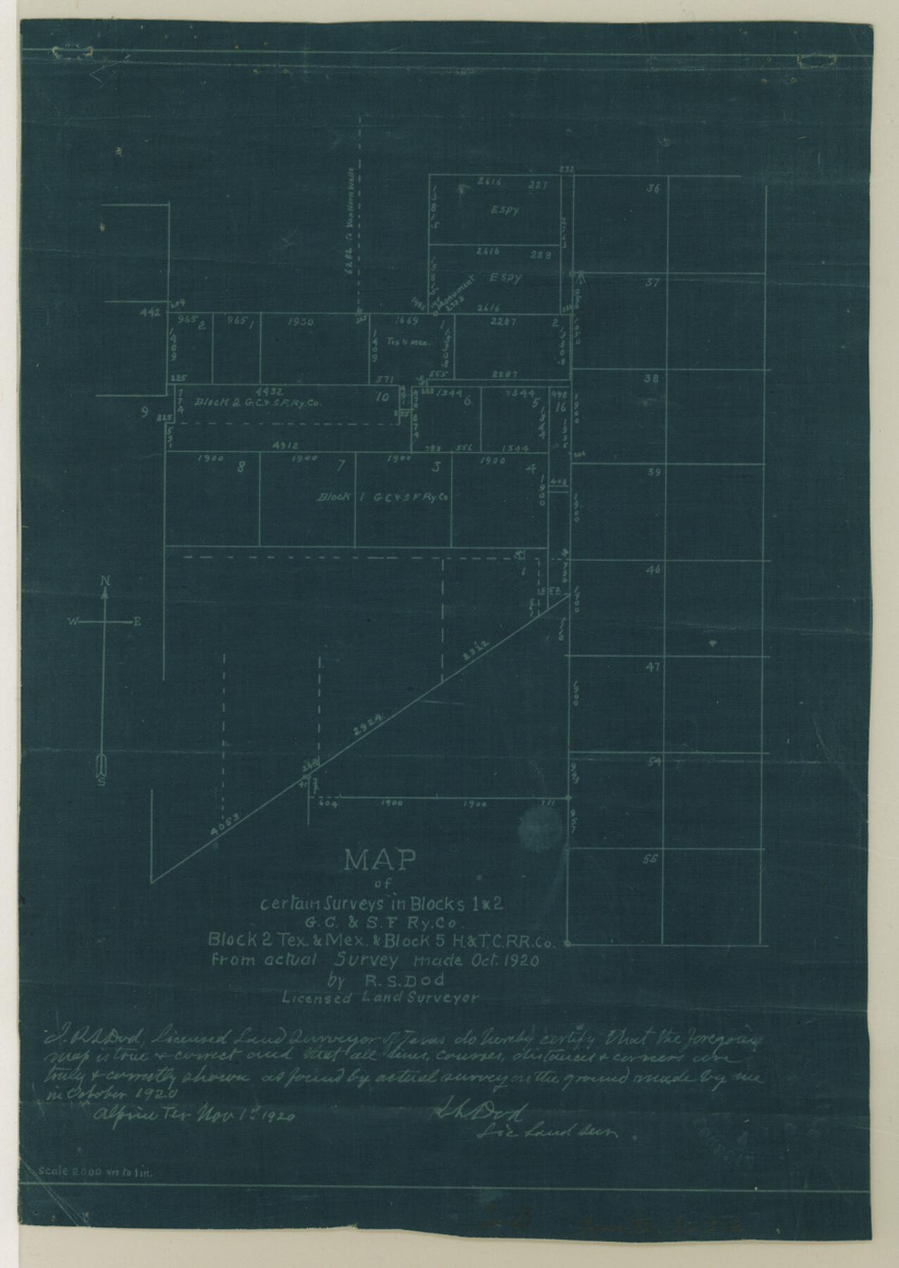
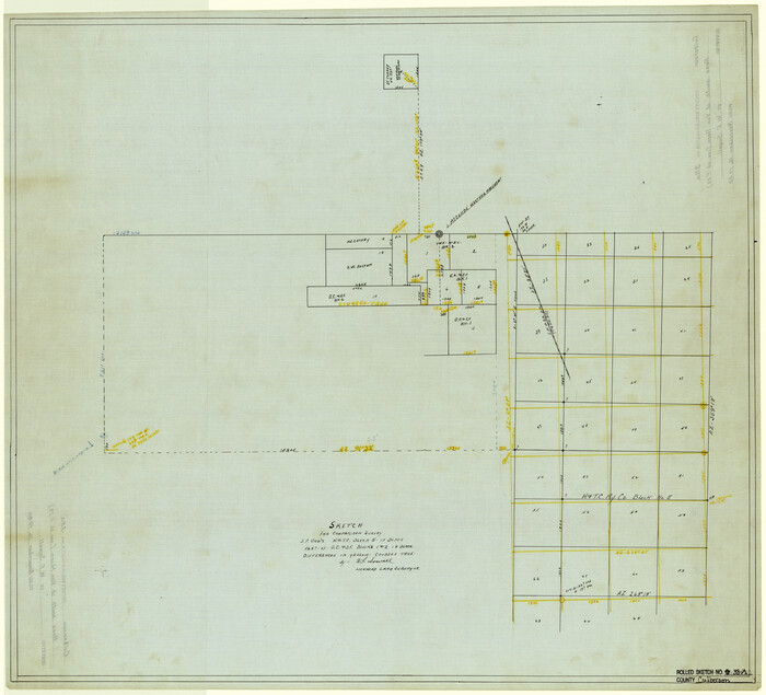
Culberson County Sketch File 41
[Various reports and correspondence of Blocks 1 and 2, G. C. & S. F. RR. Co., Block 2, T. & M. and Block 5, H. & T. C. RR. Co.]
-
Map/Doc
20312
-
Collection
General Map Collection
-
Object Dates
1920 (Creation Date)
1920/11/3 (File Date)
1920 (Survey Date)
-
People and Organizations
R.S. Dod (Surveyor/Engineer)
A.H. Parker (Surveyor/Engineer)
A.Q. Wingo (Surveyor/Engineer)
Paul McCombs (Surveyor/Engineer)
-
Counties
Culberson El Paso
-
Subjects
Surveying Sketch File
-
Height x Width
12.5 x 8.8 inches
31.8 x 22.4 cm
-
Medium
multi-page, multi-format
-
Scale
1:2000
-
Features
Van Horn Wells
Van Horn Wells Stage Stand
Chispa Peak
Part of: General Map Collection
Right of Way and Track Map International & Gt. Northern Ry. operated by the International & Gt. Northern Ry. Co., Gulf Division, Columbia Branch

Print $40.00
- Digital $50.00
Right of Way and Track Map International & Gt. Northern Ry. operated by the International & Gt. Northern Ry. Co., Gulf Division, Columbia Branch
1917
Size 25.1 x 57.0 inches
Map/Doc 64600
Harris County Sketch File 28

Print $14.00
- Digital $50.00
Harris County Sketch File 28
1886
Size 12.7 x 8.2 inches
Map/Doc 25402
Hemphill County Working Sketch 25

Print $40.00
- Digital $50.00
Hemphill County Working Sketch 25
1974
Size 44.0 x 60.7 inches
Map/Doc 66120
Map of Encinal County

Print $20.00
- Digital $50.00
Map of Encinal County
1878
Size 32.8 x 22.7 inches
Map/Doc 3514
Archer County Working Sketch 20

Print $20.00
- Digital $50.00
Archer County Working Sketch 20
1975
Size 31.7 x 24.4 inches
Map/Doc 67161
Map of Goliad County Texas

Print $20.00
- Digital $50.00
Map of Goliad County Texas
1879
Size 19.5 x 21.8 inches
Map/Doc 4548
Comanche County Sketch File 20a

Print $2.00
- Digital $50.00
Comanche County Sketch File 20a
Size 12.9 x 8.2 inches
Map/Doc 19105
[Surveys along the San Antonio and Cibolo Rivers]
![69, [Surveys along the San Antonio and Cibolo Rivers], General Map Collection](https://historictexasmaps.com/wmedia_w700/maps/69.tif.jpg)
Print $20.00
- Digital $50.00
[Surveys along the San Antonio and Cibolo Rivers]
Size 16.9 x 20.2 inches
Map/Doc 69
Red River County Working Sketch 6

Print $20.00
- Digital $50.00
Red River County Working Sketch 6
1919
Size 20.1 x 20.9 inches
Map/Doc 71989
Flight Mission No. DCL-6C, Frame 128, Kenedy County

Print $20.00
- Digital $50.00
Flight Mission No. DCL-6C, Frame 128, Kenedy County
1943
Size 18.6 x 22.3 inches
Map/Doc 85958
Eastland County Working Sketch 62

Print $20.00
- Digital $50.00
Eastland County Working Sketch 62
1989
Size 20.7 x 28.0 inches
Map/Doc 68843
United States Bathymetric and Fishing Maps including Topographic/Bathymetric Maps

Print $40.00
- Digital $50.00
United States Bathymetric and Fishing Maps including Topographic/Bathymetric Maps
1989
Size 20.4 x 54.4 inches
Map/Doc 73557
You may also like
Mappa Geographica Americae Septentrionalis: ad emendatiora exemplaria adhuc edita jussu Acad. Reg. Scient. Et eleg. Litt. Descripta.

Print $20.00
- Digital $50.00
Mappa Geographica Americae Septentrionalis: ad emendatiora exemplaria adhuc edita jussu Acad. Reg. Scient. Et eleg. Litt. Descripta.
1753
Size 14.9 x 17.4 inches
Map/Doc 88882
Leon County Rolled Sketch 30

Print $20.00
- Digital $50.00
Leon County Rolled Sketch 30
Size 30.9 x 25.7 inches
Map/Doc 6613
Wilson County Working Sketch Graphic Index

Print $20.00
- Digital $50.00
Wilson County Working Sketch Graphic Index
1921
Size 39.5 x 47.7 inches
Map/Doc 76743
Houston and Great Northern Railroad Company [North of the 80 mile T. & P. Reserve]
![90895, Houston and Great Northern Railroad Company [North of the 80 mile T. & P. Reserve], Twichell Survey Records](https://historictexasmaps.com/wmedia_w700/maps/90895-1.tif.jpg)
Print $20.00
- Digital $50.00
Houston and Great Northern Railroad Company [North of the 80 mile T. & P. Reserve]
1900
Size 15.6 x 15.8 inches
Map/Doc 90895
Montague County Sketch File 23

Print $6.00
- Digital $50.00
Montague County Sketch File 23
1941
Size 13.9 x 8.4 inches
Map/Doc 31753
Calhoun County Rolled Sketch 29B

Print $20.00
- Digital $50.00
Calhoun County Rolled Sketch 29B
Size 43.4 x 45.0 inches
Map/Doc 8558
Leon County Working Sketch 18

Print $20.00
- Digital $50.00
Leon County Working Sketch 18
1960
Size 43.2 x 36.8 inches
Map/Doc 70417
Travis County Working Sketch 10

Print $20.00
- Digital $50.00
Travis County Working Sketch 10
1918
Size 24.7 x 16.3 inches
Map/Doc 69394
Brewster County Rolled Sketch 14

Print $20.00
- Digital $50.00
Brewster County Rolled Sketch 14
1889
Size 31.5 x 27.3 inches
Map/Doc 8469
[Castro, Lamb, Hockley, Swisher, Hale, and Lubbock Counties]
![91026, [Castro, Lamb, Hockley, Swisher, Hale, and Lubbock Counties], Twichell Survey Records](https://historictexasmaps.com/wmedia_w700/maps/91026-1.tif.jpg)
Print $20.00
- Digital $50.00
[Castro, Lamb, Hockley, Swisher, Hale, and Lubbock Counties]
Size 28.7 x 37.6 inches
Map/Doc 91026
Culberson County Rolled Sketch 47

Print $20.00
- Digital $50.00
Culberson County Rolled Sketch 47
1959
Size 35.1 x 31.5 inches
Map/Doc 8755
Culberson County Rolled Sketch 38A
Print $20.00
- Digital $50.00
Culberson County Rolled Sketch 38A
Size 27.2 x 30.0 inches
Map/Doc 5662