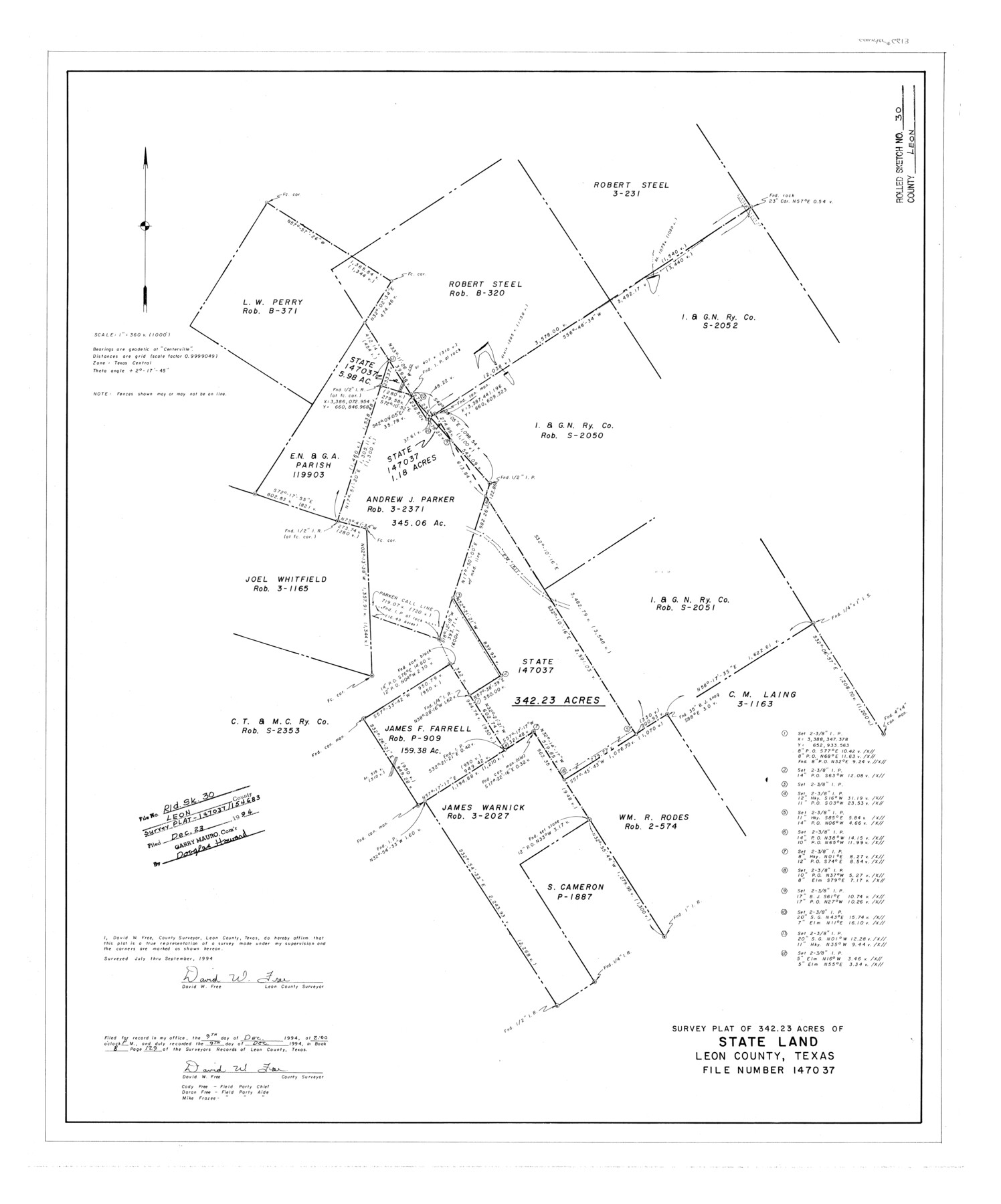
Leon County Rolled Sketch 30
Survey plat of 342.23 acres of state land, Leon County, Texas, file number 147037
-
Map/Doc
6613
-
Collection
General Map Collection
-
Object Dates
1994 (Survey Date)
1994/12/23 (File Date)
-
People and Organizations
David W. Free (Surveyor/Engineer)
Cody Free (Chainman/Field Personnel)
Daran Free (Chainman/Field Personnel)
Mike Frazee (Chainman/Field Personnel)
-
Counties
Leon
-
Subjects
Surveying Rolled Sketch
-
Height x Width
30.9 x 25.7 inches
78.5 x 65.3 cm
-
Medium
mylar, print
-
Scale
1" = 360 varas
-
Comments
See Leon County Sketch File 36 (29850) for report.
Related maps
Leon County Sketch File 36

Print $6.00
- Digital $50.00
Leon County Sketch File 36
1994
Size 14.2 x 8.7 inches
Map/Doc 29850
Part of: General Map Collection
Clay County Sketch File 32

Print $22.00
- Digital $50.00
Clay County Sketch File 32
Size 8.6 x 7.8 inches
Map/Doc 18458
Young County Working Sketch 14

Print $20.00
- Digital $50.00
Young County Working Sketch 14
1944
Size 15.3 x 16.0 inches
Map/Doc 62037
Brewster County Rolled Sketch 156

Print $156.00
- Digital $50.00
Brewster County Rolled Sketch 156
2005
Map/Doc 85390
Terrell County Working Sketch 58

Print $40.00
- Digital $50.00
Terrell County Working Sketch 58
1960
Size 36.3 x 48.9 inches
Map/Doc 69579
Flight Mission No. CGI-4N, Frame 20, Cameron County

Print $20.00
- Digital $50.00
Flight Mission No. CGI-4N, Frame 20, Cameron County
1954
Size 18.6 x 22.3 inches
Map/Doc 84653
Flight Mission No. DQN-2K, Frame 190, Calhoun County

Print $20.00
- Digital $50.00
Flight Mission No. DQN-2K, Frame 190, Calhoun County
1953
Size 18.5 x 22.2 inches
Map/Doc 84331
Topographical Map of the Rio Grande, Sheet No. 10

Print $20.00
- Digital $50.00
Topographical Map of the Rio Grande, Sheet No. 10
1912
Map/Doc 89534
Hardin County Rolled Sketch 24

Print $20.00
- Digital $50.00
Hardin County Rolled Sketch 24
1998
Size 27.2 x 38.6 inches
Map/Doc 6092
Burleson County

Print $20.00
- Digital $50.00
Burleson County
1920
Size 40.7 x 45.2 inches
Map/Doc 66740
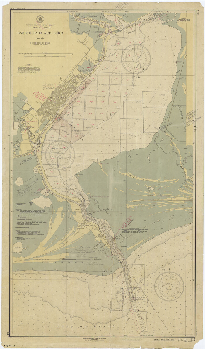
Sabine Pass and Lake
Print $20.00
- Digital $50.00
Sabine Pass and Lake
1945
Size 46.5 x 27.3 inches
Map/Doc 69822
Frio County Rolled Sketch 27

Print $20.00
- Digital $50.00
Frio County Rolled Sketch 27
2013
Size 36.0 x 24.6 inches
Map/Doc 93417
Gaines County Rolled Sketch G3

Print $20.00
- Digital $50.00
Gaines County Rolled Sketch G3
1902
Size 22.7 x 31.4 inches
Map/Doc 5946
You may also like
Hudspeth County Rolled Sketch 45

Print $20.00
- Digital $50.00
Hudspeth County Rolled Sketch 45
1958
Size 20.5 x 35.6 inches
Map/Doc 6254
Jefferson County Working Sketch 9

Print $20.00
- Digital $50.00
Jefferson County Working Sketch 9
1937
Size 19.5 x 22.0 inches
Map/Doc 66552
Working Sketch in Moore County

Print $2.00
- Digital $50.00
Working Sketch in Moore County
1909
Size 7.0 x 8.6 inches
Map/Doc 91518
The Chief Justice County of Brazoria. April 24, 1837

Print $20.00
The Chief Justice County of Brazoria. April 24, 1837
2020
Size 14.8 x 21.7 inches
Map/Doc 96042
Dallas, Ft. Worth, & Vicinity, Texas - Regional Map

Dallas, Ft. Worth, & Vicinity, Texas - Regional Map
1997
Size 25.9 x 36.7 inches
Map/Doc 97288
Motley County Sketch File 19 (N)

Print $24.00
- Digital $50.00
Motley County Sketch File 19 (N)
1940
Size 14.2 x 8.8 inches
Map/Doc 32064
Uvalde County Rolled Sketch 19

Print $20.00
- Digital $50.00
Uvalde County Rolled Sketch 19
Size 21.9 x 20.2 inches
Map/Doc 8103
Hill County Sketch File 1

Print $4.00
- Digital $50.00
Hill County Sketch File 1
1857
Size 9.0 x 7.9 inches
Map/Doc 26459
Zapata County Working Sketch 7

Print $40.00
- Digital $50.00
Zapata County Working Sketch 7
1946
Size 42.8 x 53.4 inches
Map/Doc 62058
Comal County Working Sketch 11

Print $20.00
- Digital $50.00
Comal County Working Sketch 11
1978
Size 33.2 x 35.2 inches
Map/Doc 68177
Midland County Working Sketch 22

Print $40.00
- Digital $50.00
Midland County Working Sketch 22
1956
Size 97.0 x 43.1 inches
Map/Doc 71003
Calhoun County Working Sketch Graphic Index

Print $40.00
- Digital $50.00
Calhoun County Working Sketch Graphic Index
1948
Size 48.2 x 40.1 inches
Map/Doc 76484