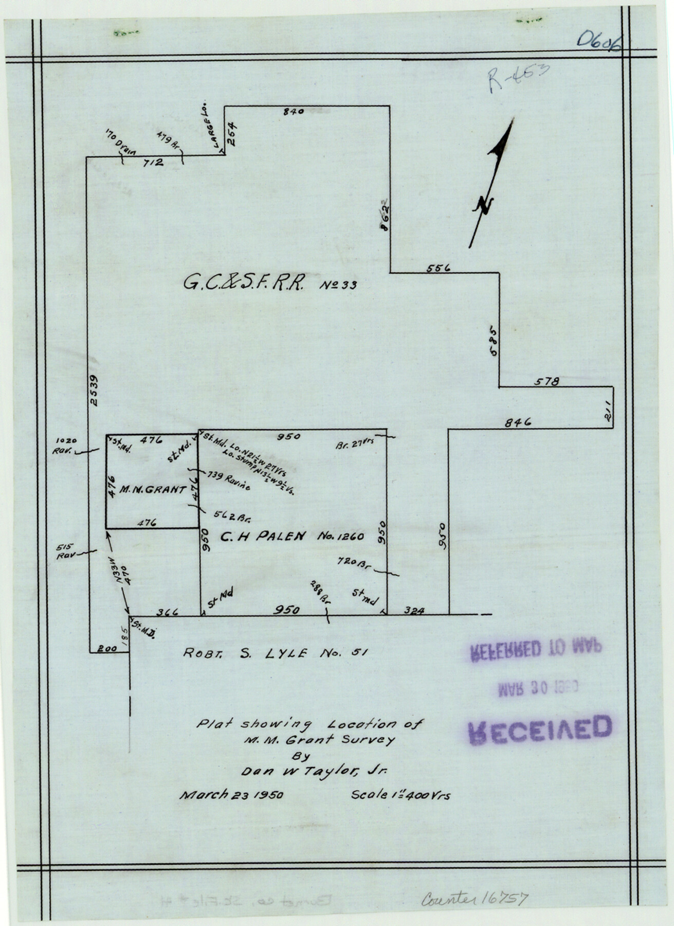
Burnet County Sketch File 41
[Plat and report of re-survey of the M.M. Grant survey northeast of Burnet]
-
Map/Doc
16757
-
Collection
General Map Collection
-
Object Dates
1950/3/23 (Creation Date)
1950/4/1 (File Date)
-
People and Organizations
Dan W. Taylor, Jr. (Surveyor/Engineer)
-
Counties
Burnet
-
Subjects
Surveying Sketch File
-
Height x Width
11.8 x 8.6 inches
30.0 x 21.8 cm
-
Medium
multi-page, multi-format
Part of: General Map Collection
Swisher County Boundary File 2

Print $106.00
- Digital $50.00
Swisher County Boundary File 2
Size 14.3 x 9.0 inches
Map/Doc 59093
Flight Mission No. DAG-24K, Frame 154, Matagorda County

Print $20.00
- Digital $50.00
Flight Mission No. DAG-24K, Frame 154, Matagorda County
1953
Size 18.5 x 22.2 inches
Map/Doc 86568
Glasscock County

Print $20.00
- Digital $50.00
Glasscock County
1899
Size 38.1 x 33.9 inches
Map/Doc 4707
Kleberg County Rolled Sketch 10-40

Print $20.00
- Digital $50.00
Kleberg County Rolled Sketch 10-40
1952
Size 38.1 x 34.0 inches
Map/Doc 9392
Flight Mission No. BRA-3M, Frame 193, Jefferson County

Print $20.00
- Digital $50.00
Flight Mission No. BRA-3M, Frame 193, Jefferson County
1953
Size 18.6 x 22.3 inches
Map/Doc 85408
Jack County Working Sketch 4

Print $20.00
- Digital $50.00
Jack County Working Sketch 4
1951
Size 24.0 x 32.2 inches
Map/Doc 66430
Val Verde County Rolled Sketch 65

Print $20.00
- Digital $50.00
Val Verde County Rolled Sketch 65
1956
Size 43.0 x 45.0 inches
Map/Doc 10083
Harris County Historic Topographic 17

Print $20.00
- Digital $50.00
Harris County Historic Topographic 17
1916
Size 29.5 x 22.7 inches
Map/Doc 65827
Right of Way and Track Map, the Missouri, Kansas and Texas Ry. of Texas operated by the Missouri, Kansas and Texas Ry. of Texas, San Antonio Division

Print $40.00
- Digital $50.00
Right of Way and Track Map, the Missouri, Kansas and Texas Ry. of Texas operated by the Missouri, Kansas and Texas Ry. of Texas, San Antonio Division
1918
Size 25.4 x 59.2 inches
Map/Doc 64580
Map of Panola County Texas

Print $20.00
- Digital $50.00
Map of Panola County Texas
1850
Size 25.6 x 35.9 inches
Map/Doc 78317
Titus County Boundary File 2

Print $6.00
- Digital $50.00
Titus County Boundary File 2
Size 7.7 x 6.7 inches
Map/Doc 59297
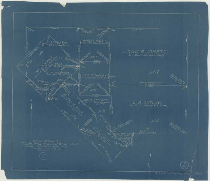
Collin County Working Sketch 2
Print $20.00
- Digital $50.00
Collin County Working Sketch 2
1926
Size 15.2 x 17.7 inches
Map/Doc 68096
You may also like
Brewster County Working Sketch 54

Print $20.00
- Digital $50.00
Brewster County Working Sketch 54
1952
Size 23.7 x 37.0 inches
Map/Doc 67655

Aransas County Rolled Sketch 17

Aransas County Rolled Sketch 17
1953
Size 10.5 x 15.2 inches
Map/Doc 42219
Foard County Sketch File 21

Print $14.00
- Digital $50.00
Foard County Sketch File 21
Size 13.1 x 8.6 inches
Map/Doc 22839
Jones County Sketch File 11a

Print $40.00
- Digital $50.00
Jones County Sketch File 11a
Size 37.5 x 49.5 inches
Map/Doc 10510
Hemphill County Working Sketch 15

Print $20.00
- Digital $50.00
Hemphill County Working Sketch 15
1969
Size 20.2 x 20.0 inches
Map/Doc 66110
Corrected Map of T&P Ry. surveys in counties Pecos-Presidio-El Paso

Print $20.00
- Digital $50.00
Corrected Map of T&P Ry. surveys in counties Pecos-Presidio-El Paso
1884
Size 27.9 x 39.0 inches
Map/Doc 2301
Flight Mission No. BRA-6M, Frame 142, Jefferson County

Print $20.00
- Digital $50.00
Flight Mission No. BRA-6M, Frame 142, Jefferson County
1953
Size 18.6 x 22.3 inches
Map/Doc 85443
University of Texas System University Lands

Print $20.00
- Digital $50.00
University of Texas System University Lands
Size 23.1 x 17.5 inches
Map/Doc 93238
General Highway Map. Detail of Cities and Towns in Bexar County, Texas. City Map of San Antonio, Alamo Heights, Olmos Park, Terrell Hills, Castle Hills, Balcones Heights, and vicinity, Bexar County, Texas

Print $20.00
General Highway Map. Detail of Cities and Towns in Bexar County, Texas. City Map of San Antonio, Alamo Heights, Olmos Park, Terrell Hills, Castle Hills, Balcones Heights, and vicinity, Bexar County, Texas
1961
Size 18.1 x 25.1 inches
Map/Doc 79373
Reeves County Working Sketch 24

Print $40.00
- Digital $50.00
Reeves County Working Sketch 24
1966
Size 38.7 x 76.5 inches
Map/Doc 63467
Hale County Sketch File 21

Print $20.00
- Digital $50.00
Hale County Sketch File 21
Size 7.0 x 26.6 inches
Map/Doc 11597