Oldham County Working Sketch 11

Print $20.00
- Digital $50.00
Oldham County Working Sketch 11
2014
Size: 26.6 x 32.7 inches
93686
Oldham County Working Sketch 10

Print $20.00
- Digital $50.00
Oldham County Working Sketch 10
1983
Size: 29.6 x 44.3 inches
71332
Oldham County Working Sketch 8

Print $20.00
- Digital $50.00
Oldham County Working Sketch 8
1982
Size: 33.4 x 35.8 inches
71330
Oldham County Working Sketch 9

Print $20.00
- Digital $50.00
Oldham County Working Sketch 9
1982
Size: 33.3 x 37.2 inches
71331
Hartley County Working Sketch 8

Print $20.00
- Digital $50.00
Hartley County Working Sketch 8
1982
Size: 34.0 x 32.6 inches
66058
Moore County Working Sketch 17

Print $20.00
- Digital $50.00
Moore County Working Sketch 17
1982
Size: 37.0 x 36.2 inches
71199
Oldham County Working Sketch 7

Print $20.00
- Digital $50.00
Oldham County Working Sketch 7
1982
Size: 33.4 x 35.6 inches
71329
Potter County Working Sketch 14

Print $20.00
- Digital $50.00
Potter County Working Sketch 14
1982
Size: 33.7 x 32.6 inches
71674
Moore County Rolled Sketch 14A

Print $20.00
- Digital $50.00
Moore County Rolled Sketch 14A
1981
Size: 21.8 x 27.5 inches
6831
Oldham County Rolled Sketch 12

Print $20.00
- Digital $50.00
Oldham County Rolled Sketch 12
1981
Size: 25.2 x 38.0 inches
7177
Oldham County Working Sketch 6

Print $40.00
- Digital $50.00
Oldham County Working Sketch 6
1981
Size: 32.4 x 50.4 inches
71328
Potter County Working Sketch 8

Print $40.00
- Digital $50.00
Potter County Working Sketch 8
1961
Size: 68.7 x 37.2 inches
71668
General Highway Map, Oldham County, Texas

Print $20.00
General Highway Map, Oldham County, Texas
1961
Size: 24.5 x 18.1 inches
79619
General Highway Map, Oldham County, Texas

Print $20.00
General Highway Map, Oldham County, Texas
1961
Size: 24.6 x 18.2 inches
79620
Hartley County Working Sketch 5

Print $20.00
- Digital $50.00
Hartley County Working Sketch 5
1957
Size: 46.3 x 28.9 inches
66055
Hartley County Rolled Sketch 7

Print $20.00
- Digital $50.00
Hartley County Rolled Sketch 7
1952
Size: 24.2 x 27.4 inches
6161
Oldham County Working Sketch 5

Print $40.00
- Digital $50.00
Oldham County Working Sketch 5
1951
Size: 43.0 x 59.3 inches
71327
Oldham County Working Sketch 4

Print $20.00
- Digital $50.00
Oldham County Working Sketch 4
1948
Size: 28.8 x 26.2 inches
71326
Oldham County Working Sketch 3

Print $20.00
- Digital $50.00
Oldham County Working Sketch 3
1946
Size: 26.2 x 19.3 inches
71325
General Highway Map, Oldham County, Deaf Smith County, Texas

Print $20.00
General Highway Map, Oldham County, Deaf Smith County, Texas
1940
Size: 18.3 x 25.2 inches
79072
Oldham County Rolled Sketch 9

Print $20.00
- Digital $50.00
Oldham County Rolled Sketch 9
1931
Size: 13.4 x 45.2 inches
7175
Oldham County Rolled Sketch 8

Print $20.00
- Digital $50.00
Oldham County Rolled Sketch 8
1931
Size: 39.2 x 29.0 inches
7174
Oldham County Working Sketch Graphic Index

Print $40.00
- Digital $50.00
Oldham County Working Sketch Graphic Index
1925
Size: 42.2 x 51.7 inches
76657
Hartley County Working Sketch 2

Print $20.00
- Digital $50.00
Hartley County Working Sketch 2
1920
Size: 41.8 x 30.7 inches
66052
Chicago, Rock Island, Texas & Mexico

Print $40.00
- Digital $50.00
Chicago, Rock Island, Texas & Mexico
1920
Size: 24.8 x 122.0 inches
64421
[Sketch showing Block 47, sections 77-108]
Print $20.00
- Digital $50.00
[Sketch showing Block 47, sections 77-108]
1919
Size: 20.5 x 34.1 inches
91732
Oldham County Working Sketch 11
Print $20.00
- Digital $50.00
Oldham County Working Sketch 11
2014
-
Size
26.6 x 32.7 inches
-
Map/Doc
93686
-
Creation Date
2014
Oldham County Working Sketch 10
Print $20.00
- Digital $50.00
Oldham County Working Sketch 10
1983
-
Size
29.6 x 44.3 inches
-
Map/Doc
71332
-
Creation Date
1983
Oldham County Working Sketch 8
Print $20.00
- Digital $50.00
Oldham County Working Sketch 8
1982
-
Size
33.4 x 35.8 inches
-
Map/Doc
71330
-
Creation Date
1982
Oldham County Working Sketch 9
Print $20.00
- Digital $50.00
Oldham County Working Sketch 9
1982
-
Size
33.3 x 37.2 inches
-
Map/Doc
71331
-
Creation Date
1982
Hartley County Working Sketch 8
Print $20.00
- Digital $50.00
Hartley County Working Sketch 8
1982
-
Size
34.0 x 32.6 inches
-
Map/Doc
66058
-
Creation Date
1982
Moore County Working Sketch 17
Print $20.00
- Digital $50.00
Moore County Working Sketch 17
1982
-
Size
37.0 x 36.2 inches
-
Map/Doc
71199
-
Creation Date
1982
Oldham County Working Sketch 7
Print $20.00
- Digital $50.00
Oldham County Working Sketch 7
1982
-
Size
33.4 x 35.6 inches
-
Map/Doc
71329
-
Creation Date
1982
Potter County Working Sketch 14
Print $20.00
- Digital $50.00
Potter County Working Sketch 14
1982
-
Size
33.7 x 32.6 inches
-
Map/Doc
71674
-
Creation Date
1982
Moore County Rolled Sketch 14A
Print $20.00
- Digital $50.00
Moore County Rolled Sketch 14A
1981
-
Size
21.8 x 27.5 inches
-
Map/Doc
6831
-
Creation Date
1981
Oldham County Rolled Sketch 12
Print $20.00
- Digital $50.00
Oldham County Rolled Sketch 12
1981
-
Size
25.2 x 38.0 inches
-
Map/Doc
7177
-
Creation Date
1981
Oldham County Working Sketch 6
Print $40.00
- Digital $50.00
Oldham County Working Sketch 6
1981
-
Size
32.4 x 50.4 inches
-
Map/Doc
71328
-
Creation Date
1981
Potter County Working Sketch 8
Print $40.00
- Digital $50.00
Potter County Working Sketch 8
1961
-
Size
68.7 x 37.2 inches
-
Map/Doc
71668
-
Creation Date
1961
General Highway Map, Oldham County, Texas
Print $20.00
General Highway Map, Oldham County, Texas
1961
-
Size
24.5 x 18.1 inches
-
Map/Doc
79619
-
Creation Date
1961
General Highway Map, Oldham County, Texas
Print $20.00
General Highway Map, Oldham County, Texas
1961
-
Size
24.6 x 18.2 inches
-
Map/Doc
79620
-
Creation Date
1961
Hartley County Working Sketch 5
Print $20.00
- Digital $50.00
Hartley County Working Sketch 5
1957
-
Size
46.3 x 28.9 inches
-
Map/Doc
66055
-
Creation Date
1957
Hartley County Rolled Sketch 7
Print $20.00
- Digital $50.00
Hartley County Rolled Sketch 7
1952
-
Size
24.2 x 27.4 inches
-
Map/Doc
6161
-
Creation Date
1952
Oldham County Working Sketch 5
Print $40.00
- Digital $50.00
Oldham County Working Sketch 5
1951
-
Size
43.0 x 59.3 inches
-
Map/Doc
71327
-
Creation Date
1951
Oldham County Working Sketch 4
Print $20.00
- Digital $50.00
Oldham County Working Sketch 4
1948
-
Size
28.8 x 26.2 inches
-
Map/Doc
71326
-
Creation Date
1948
Oldham County Working Sketch 3
Print $20.00
- Digital $50.00
Oldham County Working Sketch 3
1946
-
Size
26.2 x 19.3 inches
-
Map/Doc
71325
-
Creation Date
1946
General Highway Map, Oldham County, Deaf Smith County, Texas
Print $20.00
General Highway Map, Oldham County, Deaf Smith County, Texas
1940
-
Size
18.3 x 25.2 inches
-
Map/Doc
79072
-
Creation Date
1940
Oldham County Rolled Sketch 9
Print $20.00
- Digital $50.00
Oldham County Rolled Sketch 9
1931
-
Size
13.4 x 45.2 inches
-
Map/Doc
7175
-
Creation Date
1931
Oldham County Rolled Sketch 8
Print $20.00
- Digital $50.00
Oldham County Rolled Sketch 8
1931
-
Size
39.2 x 29.0 inches
-
Map/Doc
7174
-
Creation Date
1931
Oldham County

Print $40.00
- Digital $50.00
Oldham County
1925
-
Size
43.6 x 53.5 inches
-
Map/Doc
66960
-
Creation Date
1925
Oldham County

Print $40.00
- Digital $50.00
Oldham County
1925
-
Size
40.5 x 52.1 inches
-
Map/Doc
73254
-
Creation Date
1925
Oldham County

Print $40.00
- Digital $50.00
Oldham County
1925
-
Size
42.6 x 51.5 inches
-
Map/Doc
77387
-
Creation Date
1925
Oldham County Working Sketch Graphic Index
Print $40.00
- Digital $50.00
Oldham County Working Sketch Graphic Index
1925
-
Size
42.2 x 51.7 inches
-
Map/Doc
76657
-
Creation Date
1925
Oldham County

Print $40.00
- Digital $50.00
Oldham County
1925
-
Size
41.5 x 53.2 inches
-
Map/Doc
95604
-
Creation Date
1925
Hartley County Working Sketch 2
Print $20.00
- Digital $50.00
Hartley County Working Sketch 2
1920
-
Size
41.8 x 30.7 inches
-
Map/Doc
66052
-
Creation Date
1920
Chicago, Rock Island, Texas & Mexico
Print $40.00
- Digital $50.00
Chicago, Rock Island, Texas & Mexico
1920
-
Size
24.8 x 122.0 inches
-
Map/Doc
64421
-
Creation Date
1920
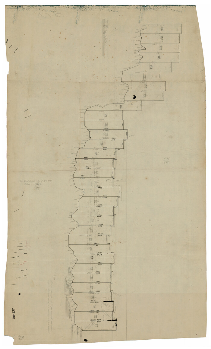
[Sketch showing Block 47, sections 77-108]
Print $20.00
- Digital $50.00
[Sketch showing Block 47, sections 77-108]
1919
-
Size
20.5 x 34.1 inches
-
Map/Doc
91732
-
Creation Date
1919