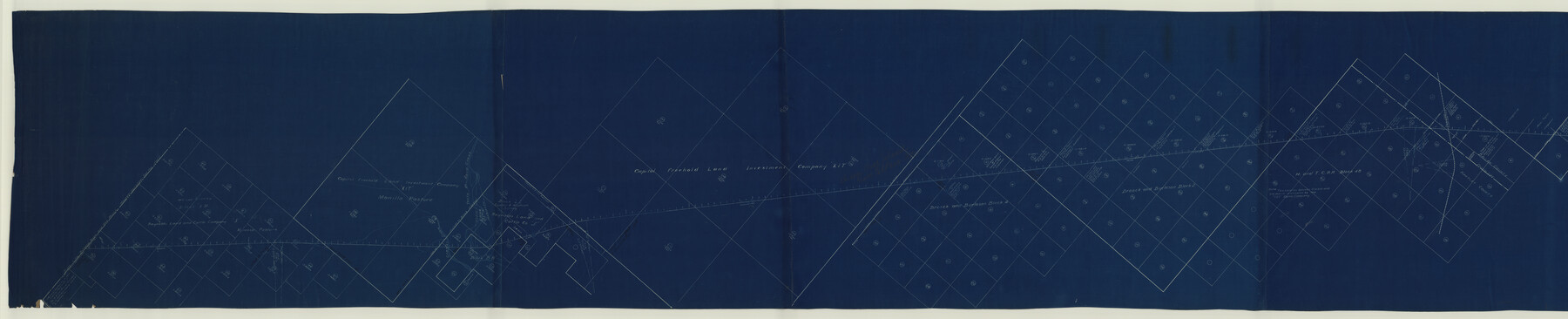
Chicago, Rock Island, Texas & Mexico
Z-2-109
-
Map/Doc
64421
-
Collection
General Map Collection
-
Object Dates
1920 (Creation Date)
-
Counties
Hartley Oldham Dallam
-
Subjects
Railroads
-
Height x Width
24.8 x 122.0 inches
63.0 x 309.9 cm
-
Medium
blueprint/diazo
-
Comments
Chicago, Rock Island and El Paso Railroad. Segment 1; see counter nos. 64422 and 64423 for other segments.
-
Features
Cramer Draw
Ponta de Agua Creek
Middlewater
Chicago, Rock Island and El Paso Railroad
Romero
Bravo
State Line between Texas and New Mexico
Chicago, Rock Island, Texas & Mexico
Part of: General Map Collection
Marion County Working Sketch 5

Print $20.00
- Digital $50.00
Marion County Working Sketch 5
1910
Size 24.5 x 15.2 inches
Map/Doc 70780
King County Working Sketch 11

Print $40.00
- Digital $50.00
King County Working Sketch 11
1971
Size 49.7 x 25.0 inches
Map/Doc 70175
[Bastrop District]
![83518, [Bastrop District], General Map Collection](https://historictexasmaps.com/wmedia_w700/maps/83518-1.tif.jpg)
Print $20.00
- Digital $50.00
[Bastrop District]
1838
Size 19.5 x 44.2 inches
Map/Doc 83518
Ellis County Sketch File 15

Print $40.00
- Digital $50.00
Ellis County Sketch File 15
1861
Size 15.7 x 12.5 inches
Map/Doc 21856
Wilbarger County Boundary File 1c

Print $6.00
- Digital $50.00
Wilbarger County Boundary File 1c
Size 12.2 x 9.6 inches
Map/Doc 59954
Hays County State Real Property Sketch 3

Print $20.00
- Digital $50.00
Hays County State Real Property Sketch 3
2003
Size 24.0 x 37.2 inches
Map/Doc 96638
Hall County Sketch File 18

Print $20.00
- Digital $50.00
Hall County Sketch File 18
Size 16.8 x 35.1 inches
Map/Doc 11609
Map of the Fort Worth & Denver City Railway

Print $40.00
- Digital $50.00
Map of the Fort Worth & Denver City Railway
1887
Size 21.7 x 72.8 inches
Map/Doc 64479
Reeves County Rolled Sketch 20

Print $20.00
- Digital $50.00
Reeves County Rolled Sketch 20
Size 32.1 x 38.4 inches
Map/Doc 9852
Aransas County Sketch File 23

Print $6.00
- Digital $50.00
Aransas County Sketch File 23
1927
Size 14.5 x 8.9 inches
Map/Doc 13174
Orange County Working Sketch 43

Print $20.00
- Digital $50.00
Orange County Working Sketch 43
1980
Size 18.3 x 18.4 inches
Map/Doc 71375
Fort Bend County Rolled Sketch P

Print $20.00
- Digital $50.00
Fort Bend County Rolled Sketch P
Size 32.2 x 15.5 inches
Map/Doc 5906
You may also like
Motley County Sketch File 16 (N)

Print $16.00
- Digital $50.00
Motley County Sketch File 16 (N)
1911
Size 11.0 x 8.6 inches
Map/Doc 32052
San Saba County Sketch File 19

Print $8.00
- Digital $50.00
San Saba County Sketch File 19
1873
Size 12.8 x 8.1 inches
Map/Doc 36466
Refugio County Sketch File 5

Print $8.00
- Digital $50.00
Refugio County Sketch File 5
1849
Size 12.8 x 8.3 inches
Map/Doc 35245
[Leagues 11 and 22]
![91111, [Leagues 11 and 22], Twichell Survey Records](https://historictexasmaps.com/wmedia_w700/maps/91111-1.tif.jpg)
Print $20.00
- Digital $50.00
[Leagues 11 and 22]
1925
Size 14.0 x 13.6 inches
Map/Doc 91111
Flight Mission No. CUG-1P, Frame 161, Kleberg County

Print $20.00
- Digital $50.00
Flight Mission No. CUG-1P, Frame 161, Kleberg County
1956
Size 18.5 x 22.3 inches
Map/Doc 86168
Galveston County NRC Article 33.136 Sketch 18

Print $66.00
- Digital $50.00
Galveston County NRC Article 33.136 Sketch 18
2003
Size 22.4 x 33.9 inches
Map/Doc 78545
Coke County Sketch File 27

Print $26.00
- Digital $50.00
Coke County Sketch File 27
1937
Size 11.2 x 8.7 inches
Map/Doc 18638
Map showing lands surveyed by Sylvan Sanders in the Southwestern Part of Jack County, Texas for Buttram Petroleum Corporation

Print $20.00
- Digital $50.00
Map showing lands surveyed by Sylvan Sanders in the Southwestern Part of Jack County, Texas for Buttram Petroleum Corporation
1926
Size 29.3 x 25.6 inches
Map/Doc 92159
Dallam County Sketch File 11

Print $4.00
- Digital $50.00
Dallam County Sketch File 11
1935
Size 11.8 x 7.2 inches
Map/Doc 20377
Laguna Madre from Lone Palmetto Triangulation Station to Gum Pen Triangulation Station

Print $20.00
- Digital $50.00
Laguna Madre from Lone Palmetto Triangulation Station to Gum Pen Triangulation Station
1881
Size 16.2 x 27.5 inches
Map/Doc 73497
Kimble County Working Sketch 31

Print $20.00
- Digital $50.00
Kimble County Working Sketch 31
1944
Size 34.8 x 34.6 inches
Map/Doc 70099
Ownership Map SW 1/4 Lubbock County

Print $20.00
- Digital $50.00
Ownership Map SW 1/4 Lubbock County
Size 33.7 x 36.8 inches
Map/Doc 89697