[Surveys near Keechi Creek and the Trinity River]
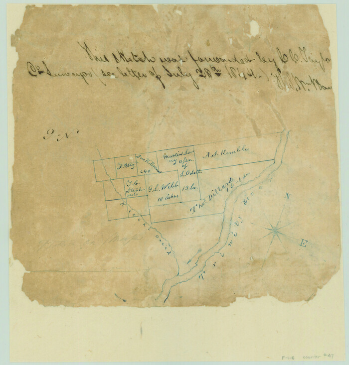
Print $2.00
- Digital $50.00
[Surveys near Keechi Creek and the Trinity River]
1841
Size: 8.6 x 8.2 inches
47
[Surveys between Upper Keechi Creek and the Trinity River]
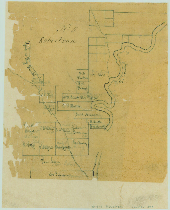
Print $2.00
- Digital $50.00
[Surveys between Upper Keechi Creek and the Trinity River]
Size: 8.5 x 6.9 inches
293
[Surveys between Big Keechi Creek and the Trinity River]
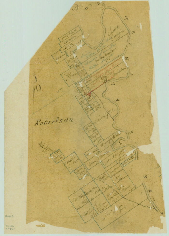
Print $2.00
- Digital $50.00
[Surveys between Big Keechi Creek and the Trinity River]
Size: 10.1 x 7.3 inches
69753
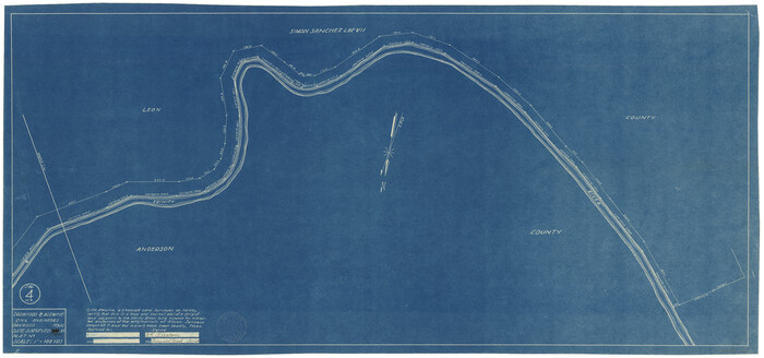
[Sketch for Mineral Application 27670 - Strip between Simon Sanchez leagues and Trinity River]

Print $20.00
- Digital $50.00
[Sketch for Mineral Application 27670 - Strip between Simon Sanchez leagues and Trinity River]
1934
Size: 25.7 x 39.9 inches
2862
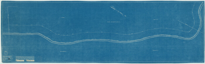
[Sketch for Mineral Application 27670 - Strip between Simon Sanchez leagues and Trinity River]

Print $20.00
- Digital $50.00
[Sketch for Mineral Application 27670 - Strip between Simon Sanchez leagues and Trinity River]
1934
Size: 17.2 x 31.7 inches
2864
[Sketch for Mineral Application 27670 - Strip between Simon Sanchez leagues and Trinity River]
Print $40.00
- Digital $50.00
[Sketch for Mineral Application 27670 - Strip between Simon Sanchez leagues and Trinity River]
1934
Size: 17.3 x 50.5 inches
2865
[Sketch for Mineral Application 27670 - Strip between Simon Sanchez leagues and Trinity River]
Print $20.00
- Digital $50.00
[Sketch for Mineral Application 27670 - Strip between Simon Sanchez leagues and Trinity River]
1934
Size: 17.3 x 36.7 inches
2866
[Sketch for Mineral Application 27670 - Strip between Simon Sanchez leagues and Trinity River]
Print $40.00
- Digital $50.00
[Sketch for Mineral Application 27670 - Strip between Simon Sanchez leagues and Trinity River]
Size: 17.5 x 55.2 inches
65645
[Sketch for Mineral Application 27670 - Strip between Simon Sanchez leagues and Trinity River]
Print $40.00
- Digital $50.00
[Sketch for Mineral Application 27670 - Strip between Simon Sanchez leagues and Trinity River]
Size: 55.5 x 17.8 inches
65646
[Large surveys along the Navasota River]
Print $20.00
- Digital $50.00
[Large surveys along the Navasota River]
1840
Size: 24.5 x 14.3 inches
48
Wayland Crossing Sheet Robertson, Limestone and Leon Counties, Navasota River

Print $20.00
- Digital $50.00
Wayland Crossing Sheet Robertson, Limestone and Leon Counties, Navasota River
1934
Size: 43.9 x 40.9 inches
65072
Trinity River, Reynard Sheet

Print $20.00
- Digital $50.00
Trinity River, Reynard Sheet
1925
Size: 42.3 x 45.3 inches
65181
Trinity River, Levee Improvement Districts Widths of Floodways

Print $6.00
- Digital $50.00
Trinity River, Levee Improvement Districts Widths of Floodways
1920
Size: 33.3 x 21.7 inches
65251
Topographic Map, Reynard Sheet, Trinity River; Houston and Leon Counties

Print $20.00
- Digital $50.00
Topographic Map, Reynard Sheet, Trinity River; Houston and Leon Counties
1925
Size: 45.6 x 41.4 inches
2469
Robertson County Sketch File 2

Print $16.00
Robertson County Sketch File 2
1858
Size: 10.1 x 8.2 inches
35343
Ramon de la Garza 11 Leagues Houston and Robertson Districts

Print $2.00
- Digital $50.00
Ramon de la Garza 11 Leagues Houston and Robertson Districts
Size: 11.5 x 8.5 inches
181
Navasota River, Grayson Crossing Sheet

Print $20.00
- Digital $50.00
Navasota River, Grayson Crossing Sheet
1937
Size: 42.8 x 21.1 inches
65071
Map of Leon County

Print $40.00
- Digital $50.00
Map of Leon County
1916
Size: 48.4 x 40.8 inches
16877
Map of Leon County

Print $20.00
- Digital $50.00
Map of Leon County
1873
Size: 26.2 x 21.9 inches
3807
Map of Leon County

Print $20.00
- Digital $50.00
Map of Leon County
1871
Size: 23.6 x 21.2 inches
3808
Map of Leon County

Print $20.00
- Digital $50.00
Map of Leon County
1867
Size: 25.5 x 23.1 inches
3809
Map of Leon County

Print $20.00
- Digital $50.00
Map of Leon County
1871
Size: 25.4 x 23.2 inches
4579
Map of Leon County

Print $40.00
- Digital $50.00
Map of Leon County
1916
Size: 49.3 x 42.5 inches
66901
Limestone County Working Sketch 22

Print $40.00
- Digital $50.00
Limestone County Working Sketch 22
1980
Size: 43.3 x 60.2 inches
70572
Leon County, Texas

Print $20.00
- Digital $50.00
Leon County, Texas
1879
Size: 25.6 x 22.3 inches
563
Leon County Working Sketch Graphic Index

Print $20.00
- Digital $50.00
Leon County Working Sketch Graphic Index
1977
Size: 46.8 x 41.5 inches
76618
Leon County Working Sketch 9

Print $20.00
- Digital $50.00
Leon County Working Sketch 9
1949
Size: 16.7 x 18.1 inches
70408
Leon County Working Sketch 8

Print $20.00
- Digital $50.00
Leon County Working Sketch 8
1931
Size: 28.9 x 42.8 inches
70407
Leon County Working Sketch 7

Print $20.00
- Digital $50.00
Leon County Working Sketch 7
1913
Size: 13.7 x 16.7 inches
70406
[Surveys near Keechi Creek and the Trinity River]
Print $2.00
- Digital $50.00
[Surveys near Keechi Creek and the Trinity River]
1841
-
Size
8.6 x 8.2 inches
-
Map/Doc
47
-
Creation Date
1841
[Surveys between Upper Keechi Creek and the Trinity River]
Print $2.00
- Digital $50.00
[Surveys between Upper Keechi Creek and the Trinity River]
-
Size
8.5 x 6.9 inches
-
Map/Doc
293
[Surveys between Big Keechi Creek and the Trinity River]
Print $2.00
- Digital $50.00
[Surveys between Big Keechi Creek and the Trinity River]
-
Size
10.1 x 7.3 inches
-
Map/Doc
69753
[Sketch for Mineral Application 27670 - Strip between Simon Sanchez leagues and Trinity River]
Print $20.00
- Digital $50.00
[Sketch for Mineral Application 27670 - Strip between Simon Sanchez leagues and Trinity River]
1934
-
Size
25.7 x 39.9 inches
-
Map/Doc
2862
-
Creation Date
1934
[Sketch for Mineral Application 27670 - Strip between Simon Sanchez leagues and Trinity River]
Print $20.00
- Digital $50.00
[Sketch for Mineral Application 27670 - Strip between Simon Sanchez leagues and Trinity River]
1934
-
Size
17.2 x 31.7 inches
-
Map/Doc
2864
-
Creation Date
1934
[Sketch for Mineral Application 27670 - Strip between Simon Sanchez leagues and Trinity River]
Print $40.00
- Digital $50.00
[Sketch for Mineral Application 27670 - Strip between Simon Sanchez leagues and Trinity River]
1934
-
Size
17.3 x 50.5 inches
-
Map/Doc
2865
-
Creation Date
1934
[Sketch for Mineral Application 27670 - Strip between Simon Sanchez leagues and Trinity River]
Print $20.00
- Digital $50.00
[Sketch for Mineral Application 27670 - Strip between Simon Sanchez leagues and Trinity River]
1934
-
Size
17.3 x 36.7 inches
-
Map/Doc
2866
-
Creation Date
1934
[Sketch for Mineral Application 27670 - Strip between Simon Sanchez leagues and Trinity River]
Print $40.00
- Digital $50.00
[Sketch for Mineral Application 27670 - Strip between Simon Sanchez leagues and Trinity River]
-
Size
17.5 x 55.2 inches
-
Map/Doc
65645
[Sketch for Mineral Application 27670 - Strip between Simon Sanchez leagues and Trinity River]
Print $40.00
- Digital $50.00
[Sketch for Mineral Application 27670 - Strip between Simon Sanchez leagues and Trinity River]
-
Size
55.5 x 17.8 inches
-
Map/Doc
65646
[Large surveys along the Navasota River]
Print $20.00
- Digital $50.00
[Large surveys along the Navasota River]
1840
-
Size
24.5 x 14.3 inches
-
Map/Doc
48
-
Creation Date
1840
Wayland Crossing Sheet Robertson, Limestone and Leon Counties, Navasota River
Print $20.00
- Digital $50.00
Wayland Crossing Sheet Robertson, Limestone and Leon Counties, Navasota River
1934
-
Size
43.9 x 40.9 inches
-
Map/Doc
65072
-
Creation Date
1934
Trinity River, Reynard Sheet
Print $20.00
- Digital $50.00
Trinity River, Reynard Sheet
1925
-
Size
42.3 x 45.3 inches
-
Map/Doc
65181
-
Creation Date
1925
Trinity River, Levee Improvement Districts Widths of Floodways
Print $6.00
- Digital $50.00
Trinity River, Levee Improvement Districts Widths of Floodways
1920
-
Size
33.3 x 21.7 inches
-
Map/Doc
65251
-
Creation Date
1920
Topographic Map, Reynard Sheet, Trinity River; Houston and Leon Counties
Print $20.00
- Digital $50.00
Topographic Map, Reynard Sheet, Trinity River; Houston and Leon Counties
1925
-
Size
45.6 x 41.4 inches
-
Map/Doc
2469
-
Creation Date
1925
Robertson County Sketch File 2
Print $16.00
Robertson County Sketch File 2
1858
-
Size
10.1 x 8.2 inches
-
Map/Doc
35343
-
Creation Date
1858
Ramon de la Garza 11 Leagues Houston and Robertson Districts
Print $2.00
- Digital $50.00
Ramon de la Garza 11 Leagues Houston and Robertson Districts
-
Size
11.5 x 8.5 inches
-
Map/Doc
181
Navasota River, Grayson Crossing Sheet
Print $20.00
- Digital $50.00
Navasota River, Grayson Crossing Sheet
1937
-
Size
42.8 x 21.1 inches
-
Map/Doc
65071
-
Creation Date
1937
Map of Leon County
Print $40.00
- Digital $50.00
Map of Leon County
1916
-
Size
48.4 x 40.8 inches
-
Map/Doc
16877
-
Creation Date
1916
Map of Leon County
Print $20.00
- Digital $50.00
Map of Leon County
1873
-
Size
26.2 x 21.9 inches
-
Map/Doc
3807
-
Creation Date
1873
Map of Leon County
Print $20.00
- Digital $50.00
Map of Leon County
1871
-
Size
23.6 x 21.2 inches
-
Map/Doc
3808
-
Creation Date
1871
Map of Leon County
Print $20.00
- Digital $50.00
Map of Leon County
1867
-
Size
25.5 x 23.1 inches
-
Map/Doc
3809
-
Creation Date
1867
Map of Leon County
Print $20.00
- Digital $50.00
Map of Leon County
1871
-
Size
25.4 x 23.2 inches
-
Map/Doc
4579
-
Creation Date
1871
Map of Leon County

Print $40.00
- Digital $50.00
Map of Leon County
-
Size
49.7 x 42.0 inches
-
Map/Doc
66900
Map of Leon County
Print $40.00
- Digital $50.00
Map of Leon County
1916
-
Size
49.3 x 42.5 inches
-
Map/Doc
66901
-
Creation Date
1916
Limestone County Working Sketch 22
Print $40.00
- Digital $50.00
Limestone County Working Sketch 22
1980
-
Size
43.3 x 60.2 inches
-
Map/Doc
70572
-
Creation Date
1980
Leon County, Texas
Print $20.00
- Digital $50.00
Leon County, Texas
1879
-
Size
25.6 x 22.3 inches
-
Map/Doc
563
-
Creation Date
1879
Leon County Working Sketch Graphic Index
Print $20.00
- Digital $50.00
Leon County Working Sketch Graphic Index
1977
-
Size
46.8 x 41.5 inches
-
Map/Doc
76618
-
Creation Date
1977
Leon County Working Sketch 9
Print $20.00
- Digital $50.00
Leon County Working Sketch 9
1949
-
Size
16.7 x 18.1 inches
-
Map/Doc
70408
-
Creation Date
1949
Leon County Working Sketch 8
Print $20.00
- Digital $50.00
Leon County Working Sketch 8
1931
-
Size
28.9 x 42.8 inches
-
Map/Doc
70407
-
Creation Date
1931
Leon County Working Sketch 7
Print $20.00
- Digital $50.00
Leon County Working Sketch 7
1913
-
Size
13.7 x 16.7 inches
-
Map/Doc
70406
-
Creation Date
1913