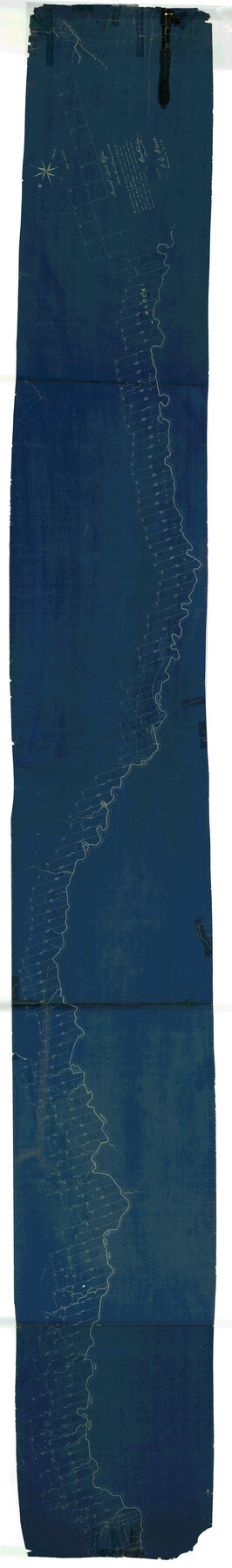
Presidio County Rolled Sketch 24
[Sketch of T. & P. Ry. Co. Blocks on Rio Grande]
-
Map/Doc
9765
-
Collection
General Map Collection
-
Object Dates
1886/2/18 (Creation Date)
-
People and Organizations
E. von Rosenberg (Draftsman)
-
Counties
Presidio
-
Subjects
Surveying Rolled Sketch
-
Height x Width
158.3 x 23.4 inches
402.1 x 59.4 cm
-
Medium
blueprint/diazo
Part of: General Map Collection
United States - Gulf Coast - From Latitude 26° 33' to the Rio Grande Texas

Print $20.00
- Digital $50.00
United States - Gulf Coast - From Latitude 26° 33' to the Rio Grande Texas
1913
Size 18.3 x 23.6 inches
Map/Doc 72844
Bexar County Sketch File 50

Print $40.00
- Digital $50.00
Bexar County Sketch File 50
1874
Size 22.5 x 18.2 inches
Map/Doc 10926
Edwards County Working Sketch 140

Print $20.00
- Digital $50.00
Edwards County Working Sketch 140
2014
Size 36.1 x 41.1 inches
Map/Doc 93665
Brazoria County Rolled Sketch 34

Print $20.00
- Digital $50.00
Brazoria County Rolled Sketch 34
1944
Size 29.8 x 18.3 inches
Map/Doc 5171
Colorado River, Lissie Sheet

Print $20.00
- Digital $50.00
Colorado River, Lissie Sheet
1941
Size 24.2 x 43.0 inches
Map/Doc 65306
Flight Mission No. DQN-2K, Frame 124, Calhoun County

Print $20.00
- Digital $50.00
Flight Mission No. DQN-2K, Frame 124, Calhoun County
1953
Size 18.5 x 22.2 inches
Map/Doc 84300
Val Verde County Working Sketch 39

Print $20.00
- Digital $50.00
Val Verde County Working Sketch 39
1943
Size 26.0 x 26.5 inches
Map/Doc 72174
Archer County Sketch File 25

Print $40.00
- Digital $50.00
Archer County Sketch File 25
Size 22.3 x 46.6 inches
Map/Doc 10348
Starr County Rolled Sketch 41

Print $6.00
- Digital $50.00
Starr County Rolled Sketch 41
1971
Size 10.8 x 15.8 inches
Map/Doc 49030
Duval County Rolled Sketch Pressly No. 2A

Print $20.00
- Digital $50.00
Duval County Rolled Sketch Pressly No. 2A
1935
Size 22.3 x 34.4 inches
Map/Doc 5771

Burleson County Sketch File 7

Print $40.00
- Digital $50.00
Burleson County Sketch File 7
1935
Size 17.0 x 14.5 inches
Map/Doc 16653
You may also like
Walker County Working Sketch 17

Print $20.00
- Digital $50.00
Walker County Working Sketch 17
1982
Size 19.9 x 20.8 inches
Map/Doc 72297

Right-of-Way and Track Map, Texas State Railroad operated by the T. and N. O. R.R. Co.

Print $40.00
- Digital $50.00
Right-of-Way and Track Map, Texas State Railroad operated by the T. and N. O. R.R. Co.
1917
Size 24.3 x 55.7 inches
Map/Doc 64176
Fractional Township No. 7 South Range No. 6 East of the Indian Meridian, Indian Territory

Print $20.00
- Digital $50.00
Fractional Township No. 7 South Range No. 6 East of the Indian Meridian, Indian Territory
1898
Size 19.2 x 24.3 inches
Map/Doc 75211
Flight Mission No. BQR-9K, Frame 44, Brazoria County

Print $20.00
- Digital $50.00
Flight Mission No. BQR-9K, Frame 44, Brazoria County
1952
Size 18.7 x 22.3 inches
Map/Doc 84048
Clay County Sketch File 44

Print $20.00
- Digital $50.00
Clay County Sketch File 44
Size 24.7 x 36.0 inches
Map/Doc 11096
Hudspeth County Rolled Sketch 71

Print $40.00
- Digital $50.00
Hudspeth County Rolled Sketch 71
1992
Size 38.2 x 48.6 inches
Map/Doc 9234
Waller County Working Sketch 6

Print $20.00
- Digital $50.00
Waller County Working Sketch 6
1988
Size 31.1 x 20.0 inches
Map/Doc 72305
Lavaca County Working Sketch 24

Print $20.00
- Digital $50.00
Lavaca County Working Sketch 24
1985
Size 29.5 x 35.7 inches
Map/Doc 70377
[I. & G. N. Block 1]
![93028, [I. & G. N. Block 1], Twichell Survey Records](https://historictexasmaps.com/wmedia_w700/maps/93028-1.tif.jpg)
Print $20.00
- Digital $50.00
[I. & G. N. Block 1]
Size 42.3 x 32.8 inches
Map/Doc 93028
Jim Wells County Working Sketch 5

Print $20.00
- Digital $50.00
Jim Wells County Working Sketch 5
1942
Size 44.3 x 42.9 inches
Map/Doc 66603
The Republic County of Fayette. December 29, 1845

Print $20.00
The Republic County of Fayette. December 29, 1845
2020
Size 14.7 x 21.7 inches
Map/Doc 96136