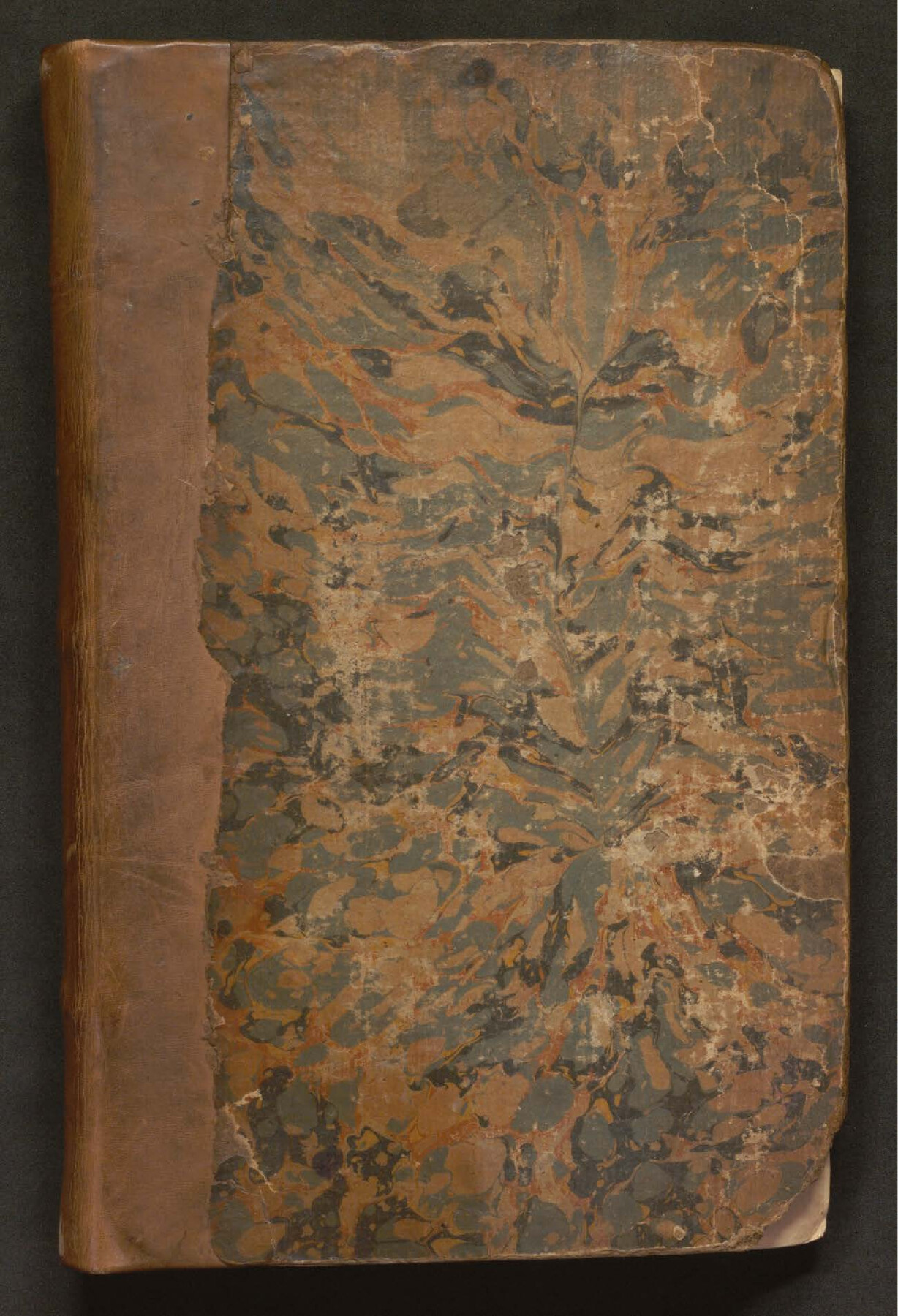
The American Military Pocket Atlas; being an approved Collection of Correct Maps, both general and particular, of the British Colonies; Especially those which now are, or probably may be the Theatre of War
-
Map/Doc
97398
-
Collection
General Map Collection
-
Object Dates
1776 (Creation Date)
-
People and Organizations
Robert Sayer (Cartographer)
John Bennett (Cartographer)
-
Subjects
North America Bound Volume Military
-
Medium
pdf
-
Comments
This pocket atlas housed 6 maps which have been detached. See maps 97399 through 97404 for the individual maps.
Related maps
North America, as divided amongst the European Powers

Print $20.00
- Digital $50.00
North America, as divided amongst the European Powers
1774
Size 14.1 x 18.7 inches
Map/Doc 97399
A Compleat Map of the West Indies, containing the Coasts of Florida, Louisiana, New Spain, and Terra Firma: with all the Islands

Print $20.00
- Digital $50.00
A Compleat Map of the West Indies, containing the Coasts of Florida, Louisiana, New Spain, and Terra Firma: with all the Islands
1774
Size 13.9 x 19.0 inches
Map/Doc 97400
A General Map of the Northern British Colonies in America which comprehends the Province of Quebec, the Government of Newfoundland, Nova-Scotia, New England and New York

Print $20.00
- Digital $50.00
A General Map of the Northern British Colonies in America which comprehends the Province of Quebec, the Government of Newfoundland, Nova-Scotia, New England and New York
1776
Size 21.3 x 27.3 inches
Map/Doc 97401
A General Map of the Middle British Colonies, in America. containing Virginia, Maryland, the Delaware Counties, Pennsylvania and New Jersey. With the addition of New York and of the Greatest Part of New England

Print $20.00
- Digital $50.00
A General Map of the Middle British Colonies, in America. containing Virginia, Maryland, the Delaware Counties, Pennsylvania and New Jersey. With the addition of New York and of the Greatest Part of New England
1776
Size 21.6 x 27.2 inches
Map/Doc 97402
A General Map of the Southern British Colonies, in America. comprehending North and South Carolina, Georgia, East and West Florida, with the Neighbouring Indian Countries

Print $20.00
- Digital $50.00
A General Map of the Southern British Colonies, in America. comprehending North and South Carolina, Georgia, East and West Florida, with the Neighbouring Indian Countries
1776
Size 21.3 x 26.4 inches
Map/Doc 97403
A Survey of Lake Champlain, including Lake George, Crown Point and St. John

Print $20.00
- Digital $50.00
A Survey of Lake Champlain, including Lake George, Crown Point and St. John
1762
Size 29.0 x 20.9 inches
Map/Doc 97404
Part of: General Map Collection
Flight Mission No. DCL-6C, Frame 115, Kenedy County

Print $20.00
- Digital $50.00
Flight Mission No. DCL-6C, Frame 115, Kenedy County
1943
Size 18.5 x 22.4 inches
Map/Doc 85945
Upshur County Working Sketch 1

Print $20.00
- Digital $50.00
Upshur County Working Sketch 1
1934
Size 28.9 x 32.6 inches
Map/Doc 69557
Map of Hays County

Print $20.00
- Digital $50.00
Map of Hays County
1877
Size 21.2 x 19.8 inches
Map/Doc 3646
Upton County Rolled Sketch 56

Print $158.00
- Digital $50.00
Upton County Rolled Sketch 56
1934
Size 10.0 x 15.1 inches
Map/Doc 49413
Pecos County Rolled Sketch 178

Print $20.00
- Digital $50.00
Pecos County Rolled Sketch 178
1979
Size 38.5 x 28.7 inches
Map/Doc 7298
Hudspeth County Sketch File 44

Print $6.00
- Digital $50.00
Hudspeth County Sketch File 44
1886
Size 11.0 x 8.5 inches
Map/Doc 27027
Flight Mission No. CLL-4N, Frame 35, Willacy County

Print $20.00
- Digital $50.00
Flight Mission No. CLL-4N, Frame 35, Willacy County
1954
Size 18.3 x 22.0 inches
Map/Doc 87108
Harris County Boundary File 39 (21)

Print $6.00
- Digital $50.00
Harris County Boundary File 39 (21)
Size 10.2 x 8.1 inches
Map/Doc 54365
[San Antonio & Aransas Pass Railway Co.]
![64261, [San Antonio & Aransas Pass Railway Co.], General Map Collection](https://historictexasmaps.com/wmedia_w700/maps/64261.tif.jpg)
Print $20.00
- Digital $50.00
[San Antonio & Aransas Pass Railway Co.]
Size 22.9 x 35.1 inches
Map/Doc 64261
Upton County Rolled Sketch 7

Print $62.00
- Digital $50.00
Upton County Rolled Sketch 7
1911
Size 10.5 x 15.0 inches
Map/Doc 49398
Leon County Working Sketch 6

Print $20.00
- Digital $50.00
Leon County Working Sketch 6
1905
Size 46.0 x 21.5 inches
Map/Doc 70405
San Jacinto County Sketch File 10

Print $5.00
San Jacinto County Sketch File 10
1859
Size 11.7 x 6.6 inches
Map/Doc 35714
You may also like
Cherokee County Sketch File 26

Print $4.00
- Digital $50.00
Cherokee County Sketch File 26
1852
Size 8.1 x 8.2 inches
Map/Doc 18169


Smith County Rolled Sketch 7

Print $20.00
- Digital $50.00
Smith County Rolled Sketch 7
2003
Size 46.4 x 35.3 inches
Map/Doc 80141
Flight Mission No. BRA-8M, Frame 142, Jefferson County

Print $20.00
- Digital $50.00
Flight Mission No. BRA-8M, Frame 142, Jefferson County
1953
Size 18.5 x 22.1 inches
Map/Doc 85634
Harris County Working Sketch 127

Print $20.00
- Digital $50.00
Harris County Working Sketch 127
1996
Size 20.7 x 26.0 inches
Map/Doc 66019
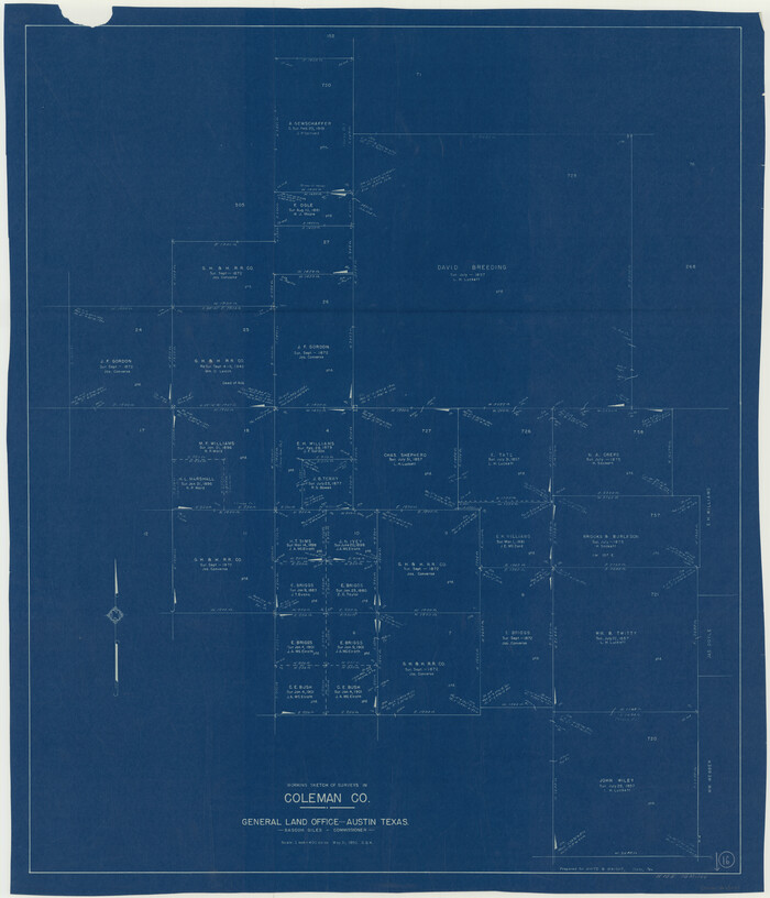
Coleman County Working Sketch 16
Print $20.00
- Digital $50.00
Coleman County Working Sketch 16
1950
Size 41.7 x 35.7 inches
Map/Doc 68082
San Patricio County Rolled Sketch 57

Print $40.00
- Digital $50.00
San Patricio County Rolled Sketch 57
2006
Size 37.2 x 50.0 inches
Map/Doc 83554
Jeff Davis County Texas

Print $20.00
- Digital $50.00
Jeff Davis County Texas
Size 15.9 x 21.3 inches
Map/Doc 4573
Hardin County Working Sketch 13

Print $20.00
- Digital $50.00
Hardin County Working Sketch 13
1934
Size 25.5 x 17.6 inches
Map/Doc 63411
Cochran County Rolled Sketch 5

Print $20.00
- Digital $50.00
Cochran County Rolled Sketch 5
1949
Size 21.5 x 22.0 inches
Map/Doc 5502
Val Verde County Working Sketch 8

Print $20.00
- Digital $50.00
Val Verde County Working Sketch 8
1917
Size 31.4 x 32.0 inches
Map/Doc 72143