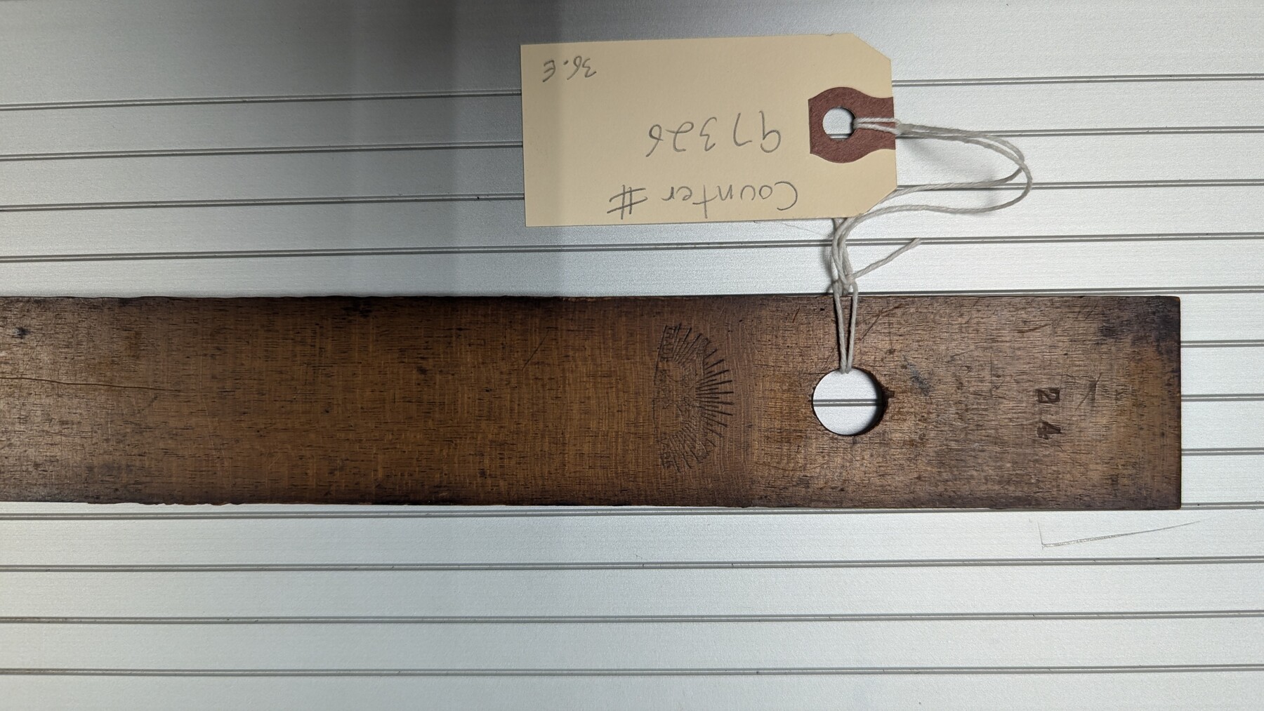
Wooden 24" T Square
Branded with "W/M"
-
Map/Doc
97326
-
Collection
Equipment and Tools
-
Height x Width
26.4 x 11.0 inches
67.0 x 27.9 cm
Part of: Equipment and Tools


K&E Leroy Lettering Set - 3240

K&E Leroy Lettering Set - 3240
1950
Size 1.8 x 15.8 inches
Map/Doc 97313


Metal Straight Edge Scale 1/20,000 Yard

Metal Straight Edge Scale 1/20,000 Yard
Size 24.0 x 1.6 inches
Map/Doc 97323

You may also like
Jefferson County

Print $20.00
- Digital $50.00
Jefferson County
1882
Size 22.8 x 20.0 inches
Map/Doc 3730
Starr County Rolled Sketch 43

Print $20.00
- Digital $50.00
Starr County Rolled Sketch 43
1982
Size 36.1 x 30.9 inches
Map/Doc 7836
Jasper County Working Sketch Graphic Index

Print $20.00
- Digital $50.00
Jasper County Working Sketch Graphic Index
1946
Size 47.9 x 41.0 inches
Map/Doc 76591
Map showing lands acquired for reservoir purposes in connection with Lake Worth and the boundary of territory annexed to the City of Fort Worth, Texas

Print $40.00
- Digital $50.00
Map showing lands acquired for reservoir purposes in connection with Lake Worth and the boundary of territory annexed to the City of Fort Worth, Texas
Size 46.6 x 59.6 inches
Map/Doc 62210
Throckmorton County Working Sketch 2

Print $20.00
- Digital $50.00
Throckmorton County Working Sketch 2
1919
Size 20.9 x 16.9 inches
Map/Doc 62111
Irion County Rolled Sketch 9

Print $20.00
- Digital $50.00
Irion County Rolled Sketch 9
1940
Size 31.9 x 30.6 inches
Map/Doc 6321
Hansford County Working Sketch 5

Print $20.00
- Digital $50.00
Hansford County Working Sketch 5
1967
Size 30.2 x 28.3 inches
Map/Doc 63377
Mitchell County Working Sketch 3

Print $20.00
- Digital $50.00
Mitchell County Working Sketch 3
1925
Size 30.4 x 33.9 inches
Map/Doc 71060
[Sketch N, showing H. & G. N. Block 7, and Blocks C-1 through C-5]
![91768, [Sketch N, showing H. & G. N. Block 7, and Blocks C-1 through C-5], Twichell Survey Records](https://historictexasmaps.com/wmedia_w700/maps/91768-1.tif.jpg)
Print $20.00
- Digital $50.00
[Sketch N, showing H. & G. N. Block 7, and Blocks C-1 through C-5]
Size 14.6 x 16.7 inches
Map/Doc 91768
Dimmit County Sketch File 55

Print $20.00
- Digital $50.00
Dimmit County Sketch File 55
1926
Size 23.1 x 15.7 inches
Map/Doc 11359
Atascosa County Rolled Sketch 18

Print $20.00
- Digital $50.00
Atascosa County Rolled Sketch 18
1955
Size 17.6 x 23.9 inches
Map/Doc 5098
Edwards County Sketch File 10

Print $40.00
- Digital $50.00
Edwards County Sketch File 10
Size 26.3 x 19.0 inches
Map/Doc 11421