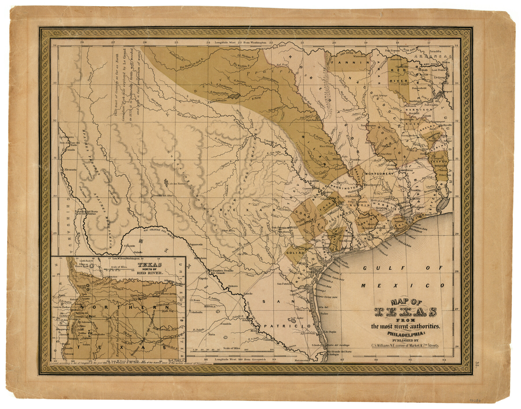
Map of Texas from the most recent authorities
-
Map/Doc
97280
-
Collection
General Map Collection
-
Object Dates
1845 (Creation Date)
-
People and Organizations
C.S. Williams (Publisher)
Chase Untermeyer (Donor)
-
Subjects
Republic of Texas
-
Height x Width
14.1 x 17.9 inches
35.8 x 45.5 cm
-
Comments
Donated by Ambassador Chase Untermeyer in June 2024.
Part of: General Map Collection
Brooks County Sketch File 3

Print $40.00
- Digital $50.00
Brooks County Sketch File 3
Size 21.5 x 19.0 inches
Map/Doc 11016
Chambers County Boundary File 3

Print $112.00
- Digital $50.00
Chambers County Boundary File 3
Size 52.5 x 3.9 inches
Map/Doc 51249
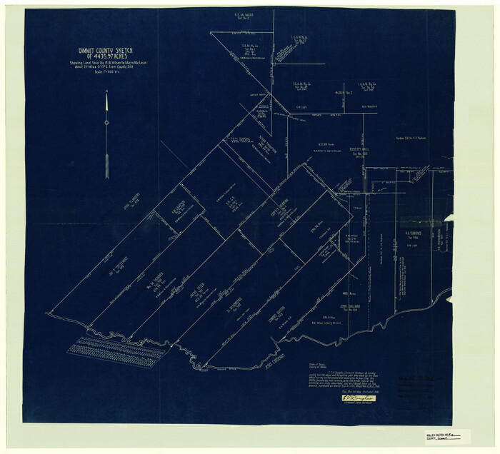
Dimmit County Rolled Sketch 10
Print $20.00
- Digital $50.00
Dimmit County Rolled Sketch 10
1941
Size 29.2 x 32.1 inches
Map/Doc 5719
Calhoun County Rolled Sketch 32

Print $40.00
- Digital $50.00
Calhoun County Rolled Sketch 32
1978
Size 87.1 x 44.6 inches
Map/Doc 8560
Jones County Working Sketch 4

Print $20.00
- Digital $50.00
Jones County Working Sketch 4
1946
Size 35.5 x 20.6 inches
Map/Doc 66642
Irion County Working Sketch 14

Print $40.00
- Digital $50.00
Irion County Working Sketch 14
1973
Size 56.3 x 30.8 inches
Map/Doc 66423
Hockley County Sketch File 15

Print $6.00
- Digital $50.00
Hockley County Sketch File 15
1912
Size 11.4 x 8.9 inches
Map/Doc 26550
Webb County Sketch File VOLP

Print $40.00
- Digital $50.00
Webb County Sketch File VOLP
1937
Size 18.9 x 33.8 inches
Map/Doc 12607
Travis County Rolled Sketch 25

Print $20.00
- Digital $50.00
Travis County Rolled Sketch 25
1942
Size 22.1 x 29.2 inches
Map/Doc 8026
Roberts County

Print $20.00
- Digital $50.00
Roberts County
1884
Size 20.3 x 18.2 inches
Map/Doc 3992
Brewster County Sketch File 43

Print $4.00
- Digital $50.00
Brewster County Sketch File 43
Size 8.8 x 11.3 inches
Map/Doc 16309
Dallas County Sketch File 3

Print $20.00
- Digital $50.00
Dallas County Sketch File 3
1855
Size 22.4 x 14.0 inches
Map/Doc 11282
You may also like
Crockett County Rolled Sketch 64

Print $20.00
- Digital $50.00
Crockett County Rolled Sketch 64
1947
Size 19.8 x 41.2 inches
Map/Doc 5607
Martin County Rolled Sketch 3

Print $20.00
- Digital $50.00
Martin County Rolled Sketch 3
Size 29.2 x 15.4 inches
Map/Doc 6664
Kendall County Sketch File 22B

Print $20.00
- Digital $50.00
Kendall County Sketch File 22B
1937
Size 19.3 x 24.6 inches
Map/Doc 11911
Sketch in Cochran County, Texas

Print $20.00
- Digital $50.00
Sketch in Cochran County, Texas
1949
Size 22.4 x 21.6 inches
Map/Doc 92523
Bosque County

Print $20.00
- Digital $50.00
Bosque County
1945
Size 42.6 x 33.0 inches
Map/Doc 77215
Wood County Working Sketch 22

Print $20.00
- Digital $50.00
Wood County Working Sketch 22
1962
Size 45.9 x 36.6 inches
Map/Doc 62022
Washington County Working Sketch 2

Print $20.00
- Digital $50.00
Washington County Working Sketch 2
1981
Size 23.6 x 20.1 inches
Map/Doc 72363
Trinity County Boundary File 88

Print $42.00
- Digital $50.00
Trinity County Boundary File 88
Size 9.2 x 4.1 inches
Map/Doc 59475
Potter County Sketch File 10

Print $40.00
- Digital $50.00
Potter County Sketch File 10
Size 58.9 x 37.7 inches
Map/Doc 10576
Culberson County Working Sketch 8

Print $20.00
- Digital $50.00
Culberson County Working Sketch 8
1914
Size 35.4 x 36.0 inches
Map/Doc 68460
Childress Co.

Print $20.00
- Digital $50.00
Childress Co.
1978
Size 47.3 x 36.0 inches
Map/Doc 95454
Caldwell County Working Sketch 10

Print $40.00
- Digital $50.00
Caldwell County Working Sketch 10
1977
Size 46.2 x 50.5 inches
Map/Doc 67840