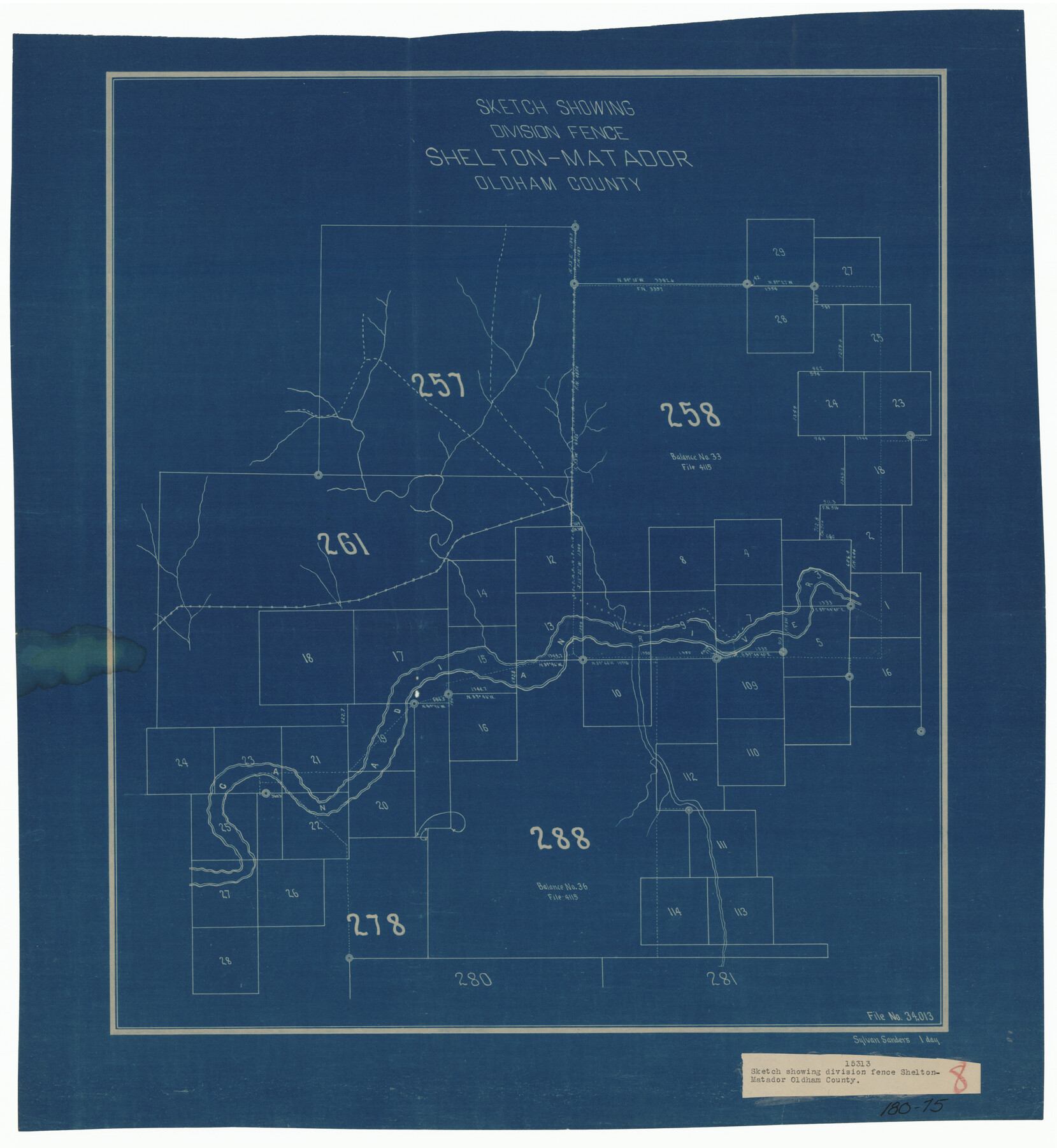
Sketch Showing Division Fence Shelton- Matador, Oldham County, Texas
180-75
-
Map/Doc
91427
-
Collection
Twichell Survey Records
-
Counties
Oldham
-
Height x Width
21.2 x 23.0 inches
53.9 x 58.4 cm
Part of: Twichell Survey Records
[Blocks M-22 and M-25 and vicinity]
![91138, [Blocks M-22 and M-25 and vicinity], Twichell Survey Records](https://historictexasmaps.com/wmedia_w700/maps/91138-1.tif.jpg)
Print $20.00
- Digital $50.00
[Blocks M-22 and M-25 and vicinity]
Size 18.7 x 16.6 inches
Map/Doc 91138
[Vicinity of Wilson Strickland Survey]
![91380, [Vicinity of Wilson Strickland Survey], Twichell Survey Records](https://historictexasmaps.com/wmedia_w700/maps/91380-1.tif.jpg)
Print $20.00
- Digital $50.00
[Vicinity of Wilson Strickland Survey]
Size 37.1 x 25.5 inches
Map/Doc 91380
[Sketch showing I. & G. N. Block 8]
![91798, [Sketch showing I. & G. N. Block 8], Twichell Survey Records](https://historictexasmaps.com/wmedia_w700/maps/91798-1.tif.jpg)
Print $2.00
- Digital $50.00
[Sketch showing I. & G. N. Block 8]
1919
Size 7.6 x 12.6 inches
Map/Doc 91798
[Various County School Land Leagues]
![89849, [Various County School Land Leagues], Twichell Survey Records](https://historictexasmaps.com/wmedia_w700/maps/89849-1.tif.jpg)
Print $40.00
- Digital $50.00
[Various County School Land Leagues]
Size 55.7 x 41.4 inches
Map/Doc 89849
Morton, Cochran County, Texas

Print $40.00
- Digital $50.00
Morton, Cochran County, Texas
Size 44.4 x 53.5 inches
Map/Doc 89913
J. W. Kendrick Land, Crosby County, Texas

Print $20.00
- Digital $50.00
J. W. Kendrick Land, Crosby County, Texas
Size 42.8 x 33.7 inches
Map/Doc 92603
Working Sketch Bastrop County

Print $3.00
- Digital $50.00
Working Sketch Bastrop County
1923
Size 11.0 x 16.2 inches
Map/Doc 90207
Map of Pecos County, Texas

Print $20.00
- Digital $50.00
Map of Pecos County, Texas
Size 18.9 x 22.8 inches
Map/Doc 91573
[Sketch of Leagues 458, 459, 474, 475, 480 and 481]
![91547, [Sketch of Leagues 458, 459, 474, 475, 480 and 481], Twichell Survey Records](https://historictexasmaps.com/wmedia_w700/maps/91547-1.tif.jpg)
Print $2.00
- Digital $50.00
[Sketch of Leagues 458, 459, 474, 475, 480 and 481]
Size 5.2 x 8.3 inches
Map/Doc 91547
Map of J. J. Lane and A. D. Jones and Four Lakes Ranch

Print $20.00
- Digital $50.00
Map of J. J. Lane and A. D. Jones and Four Lakes Ranch
Size 28.7 x 28.8 inches
Map/Doc 92398
Plat of Connecting Line between Northwest Corner of Eddy Sparks 1-1662

Print $20.00
- Digital $50.00
Plat of Connecting Line between Northwest Corner of Eddy Sparks 1-1662
1945
Size 20.0 x 27.6 inches
Map/Doc 92602
[Area between H. & T. C. Block 34, PSL Block B19 and University Lands Block 16]
![91957, [Area between H. & T. C. Block 34, PSL Block B19 and University Lands Block 16], Twichell Survey Records](https://historictexasmaps.com/wmedia_w700/maps/91957-1.tif.jpg)
Print $20.00
- Digital $50.00
[Area between H. & T. C. Block 34, PSL Block B19 and University Lands Block 16]
1929
Size 40.4 x 29.3 inches
Map/Doc 91957
You may also like
Township 4 South Ranges 12 and 13 West, South Western District, Louisiana

Print $20.00
- Digital $50.00
Township 4 South Ranges 12 and 13 West, South Western District, Louisiana
1879
Size 18.3 x 24.1 inches
Map/Doc 65890
Harrison County Sketch File 21

Print $20.00
- Digital $50.00
Harrison County Sketch File 21
1892
Size 20.2 x 25.7 inches
Map/Doc 11694
[I. & G. N. Block 1, Runnels County School Land and adjacent areas]
![91615, [I. & G. N. Block 1, Runnels County School Land and adjacent areas], Twichell Survey Records](https://historictexasmaps.com/wmedia_w700/maps/91615-1.tif.jpg)
Print $20.00
- Digital $50.00
[I. & G. N. Block 1, Runnels County School Land and adjacent areas]
Size 34.2 x 28.0 inches
Map/Doc 91615
Map of Cherokee County

Print $40.00
- Digital $50.00
Map of Cherokee County
1933
Size 55.0 x 38.7 inches
Map/Doc 95453
Map of Europe to illustrate Olney's school geography (Inset: Central Europe)

Print $20.00
- Digital $50.00
Map of Europe to illustrate Olney's school geography (Inset: Central Europe)
1844
Size 12.1 x 19.0 inches
Map/Doc 93546
Sabine County

Print $20.00
- Digital $50.00
Sabine County
1920
Size 41.2 x 31.8 inches
Map/Doc 77413
Randall County Boundary File 4

Print $10.00
- Digital $50.00
Randall County Boundary File 4
Size 14.4 x 8.9 inches
Map/Doc 58129
Trinity River, McKinney Sheet/East Fork of Trinity River

Print $20.00
- Digital $50.00
Trinity River, McKinney Sheet/East Fork of Trinity River
1931
Size 40.6 x 28.0 inches
Map/Doc 65241
Gonzales County Sketch File 9

Print $7.00
- Digital $50.00
Gonzales County Sketch File 9
1841
Size 10.1 x 8.2 inches
Map/Doc 24387
Wheeler County Working Sketch Graphic Index

Print $20.00
- Digital $50.00
Wheeler County Working Sketch Graphic Index
1899
Size 41.4 x 36.8 inches
Map/Doc 76738
Kendall County Sketch File 23

Print $40.00
- Digital $50.00
Kendall County Sketch File 23
1938
Size 15.5 x 15.9 inches
Map/Doc 28716
[Map showing J. H. Gibson Blocks D and DD and Double Lake Corner]
![91996, [Map showing J. H. Gibson Blocks D and DD and Double Lake Corner], Twichell Survey Records](https://historictexasmaps.com/wmedia_w700/maps/91996-1.tif.jpg)
Print $20.00
- Digital $50.00
[Map showing J. H. Gibson Blocks D and DD and Double Lake Corner]
Size 31.3 x 15.9 inches
Map/Doc 91996