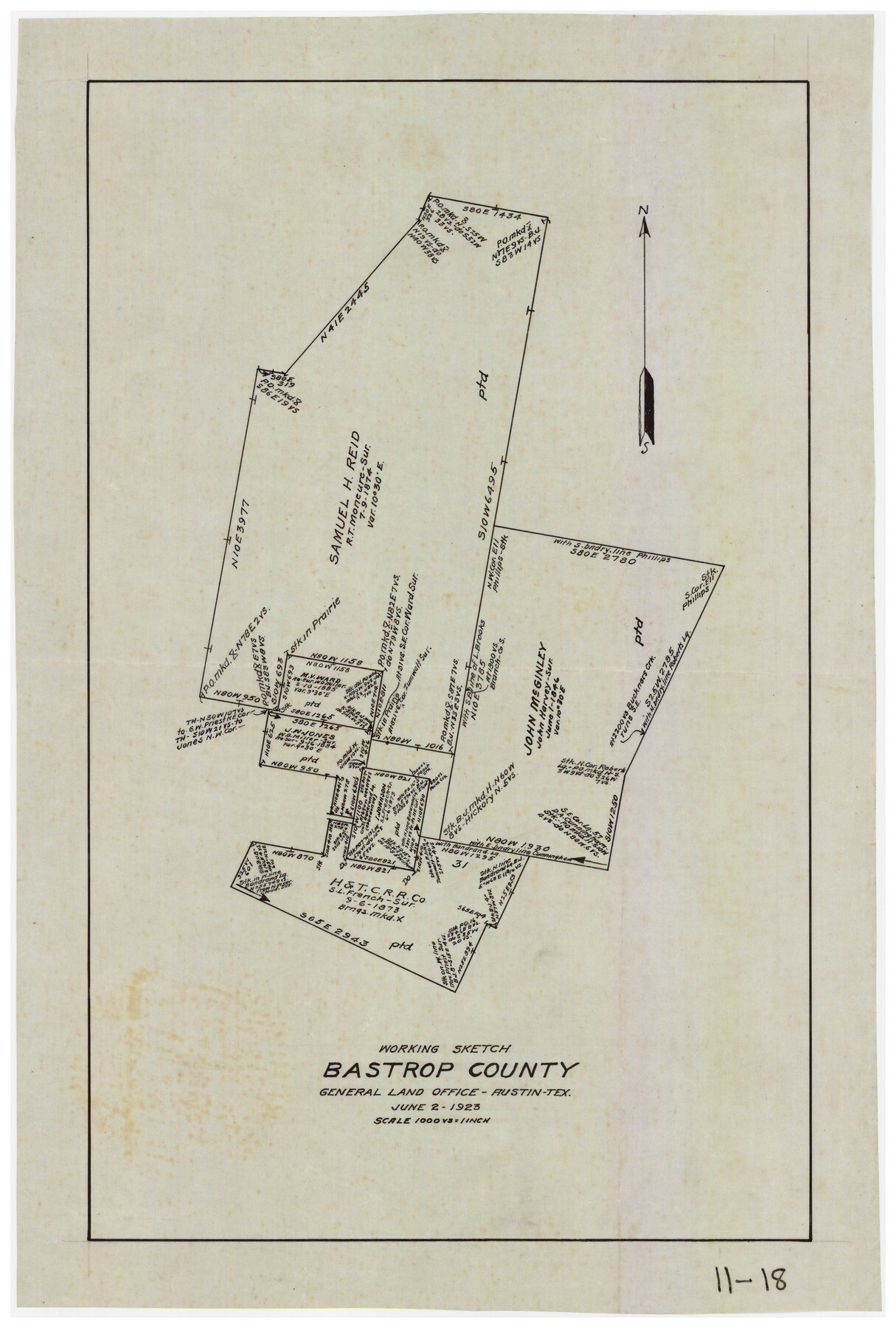
Working Sketch Bastrop County
11-18
-
Map/Doc
90207
-
Collection
Twichell Survey Records
-
Object Dates
6/2/1923 (Creation Date)
-
People and Organizations
General Land Office (Publisher)
-
Counties
Bastrop
-
Height x Width
11.0 x 16.2 inches
27.9 x 41.2 cm
Part of: Twichell Survey Records
[Strip along North line of Glasscock County School Land]
![90556, [Strip along North line of Glasscock County School Land], Twichell Survey Records](https://historictexasmaps.com/wmedia_w700/maps/90556-1.tif.jpg)
Print $2.00
- Digital $50.00
[Strip along North line of Glasscock County School Land]
Size 4.3 x 6.5 inches
Map/Doc 90556
[Sketch showing Potter County Block 2] / [Sketch showing F. W. & D. C. Round House]
![91709, [Sketch showing Potter County Block 2] / [Sketch showing F. W. & D. C. Round House], Twichell Survey Records](https://historictexasmaps.com/wmedia_w700/maps/91709-1.tif.jpg)
Print $20.00
- Digital $50.00
[Sketch showing Potter County Block 2] / [Sketch showing F. W. & D. C. Round House]
Size 12.2 x 14.6 inches
Map/Doc 91709
[North line of T. & P. Block 31, Township 6N]
![90554, [North line of T. & P. Block 31, Township 6N], Twichell Survey Records](https://historictexasmaps.com/wmedia_w700/maps/90554-1.tif.jpg)
Print $2.00
- Digital $50.00
[North line of T. & P. Block 31, Township 6N]
Size 7.5 x 4.7 inches
Map/Doc 90554
[PSL Blocks Q, U, Y, Z, W]
![90436, [PSL Blocks Q, U, Y, Z, W], Twichell Survey Records](https://historictexasmaps.com/wmedia_w700/maps/90436-1.tif.jpg)
Print $20.00
- Digital $50.00
[PSL Blocks Q, U, Y, Z, W]
Size 6.6 x 21.7 inches
Map/Doc 90436
[Sketch showing counties along Texas-New Mexico border]
![91986, [Sketch showing counties along Texas-New Mexico border], Twichell Survey Records](https://historictexasmaps.com/wmedia_w700/maps/91986-1.tif.jpg)
Print $3.00
- Digital $50.00
[Sketch showing counties along Texas-New Mexico border]
Size 11.0 x 16.7 inches
Map/Doc 91986
[T. & P. "B" Blocks, Tsp. 1S, Tsp. 2S, Tsp. 3S. And Tsp. 4S]
![89774, [T. & P. "B" Blocks, Tsp. 1S, Tsp. 2S, Tsp. 3S. And Tsp. 4S], Twichell Survey Records](https://historictexasmaps.com/wmedia_w700/maps/89774-1.tif.jpg)
Print $40.00
- Digital $50.00
[T. & P. "B" Blocks, Tsp. 1S, Tsp. 2S, Tsp. 3S. And Tsp. 4S]
Size 56.1 x 43.3 inches
Map/Doc 89774
Sketch Showing Division Fence, Shelton- Matador, Oldham County

Print $20.00
- Digital $50.00
Sketch Showing Division Fence, Shelton- Matador, Oldham County
Size 20.4 x 18.6 inches
Map/Doc 91445
Map No. 2 - Surveys Corrected in 1882 as they appear on the ground

Print $20.00
- Digital $50.00
Map No. 2 - Surveys Corrected in 1882 as they appear on the ground
1882
Size 30.7 x 19.2 inches
Map/Doc 91925
[Sketch showing Blocks B-11, G and M-2 and 3, L, and 47, Sections 77-102]
![91733, [Sketch showing Blocks B-11, G and M-2 and 3, L, and 47, Sections 77-102], Twichell Survey Records](https://historictexasmaps.com/wmedia_w700/maps/91733-1.tif.jpg)
Print $20.00
- Digital $50.00
[Sketch showing Blocks B-11, G and M-2 and 3, L, and 47, Sections 77-102]
Size 25.4 x 18.8 inches
Map/Doc 91733
[Public School Land Blocks]
![93152, [Public School Land Blocks], Twichell Survey Records](https://historictexasmaps.com/wmedia_w700/maps/93152-1.tif.jpg)
Print $40.00
- Digital $50.00
[Public School Land Blocks]
Size 41.3 x 113.1 inches
Map/Doc 93152
Conway, Carson County, Texas

Print $20.00
- Digital $50.00
Conway, Carson County, Texas
Size 17.2 x 22.3 inches
Map/Doc 90227
[Texas Boundary Line]
![92077, [Texas Boundary Line], Twichell Survey Records](https://historictexasmaps.com/wmedia_w700/maps/92077-1.tif.jpg)
Print $20.00
- Digital $50.00
[Texas Boundary Line]
Size 21.2 x 12.0 inches
Map/Doc 92077
You may also like
Flight Mission No. CRC-3R, Frame 205, Chambers County

Print $20.00
- Digital $50.00
Flight Mission No. CRC-3R, Frame 205, Chambers County
1956
Size 18.6 x 22.3 inches
Map/Doc 84860
Bexar County Rolled Sketch 4A

Print $20.00
- Digital $50.00
Bexar County Rolled Sketch 4A
1982
Size 24.4 x 36.7 inches
Map/Doc 5138
Andrews County Sketch File 13

Print $12.00
- Digital $50.00
Andrews County Sketch File 13
1979
Size 14.2 x 8.7 inches
Map/Doc 12863
[Oil and Gas Fields in West Texas]
![89884, [Oil and Gas Fields in West Texas], Twichell Survey Records](https://historictexasmaps.com/wmedia_w700/maps/89884-1.tif.jpg)
Print $40.00
- Digital $50.00
[Oil and Gas Fields in West Texas]
Size 38.5 x 59.2 inches
Map/Doc 89884
Flight Mission No. DIX-5P, Frame 141, Aransas County

Print $20.00
- Digital $50.00
Flight Mission No. DIX-5P, Frame 141, Aransas County
1956
Size 17.8 x 18.4 inches
Map/Doc 83802
Colorado County Working Sketch 29

Print $20.00
- Digital $50.00
Colorado County Working Sketch 29
1980
Size 15.4 x 12.4 inches
Map/Doc 68129
Map B [showing surveys along river and in vicinity of Archer County School Land League 3]
![89752, Map B [showing surveys along river and in vicinity of Archer County School Land League 3], Twichell Survey Records](https://historictexasmaps.com/wmedia_w700/maps/89752-1.tif.jpg)
Print $20.00
- Digital $50.00
Map B [showing surveys along river and in vicinity of Archer County School Land League 3]
Size 42.7 x 38.0 inches
Map/Doc 89752
Map of the Fort Worth and Denver City Railway

Print $40.00
- Digital $50.00
Map of the Fort Worth and Denver City Railway
1873
Size 31.6 x 90.3 inches
Map/Doc 64778
Midland County Working Sketch 7

Print $20.00
- Digital $50.00
Midland County Working Sketch 7
1950
Size 34.6 x 28.3 inches
Map/Doc 70987
G No. 2 - Reconnaissance of Channel No. IV Cedar-Keys, Florida

Print $20.00
- Digital $50.00
G No. 2 - Reconnaissance of Channel No. IV Cedar-Keys, Florida
1852
Size 10.8 x 12.6 inches
Map/Doc 97220
Map of Cameron County Drainage District Number One

Print $20.00
- Digital $50.00
Map of Cameron County Drainage District Number One
1929
Size 46.6 x 31.0 inches
Map/Doc 94245
Parker County Working Sketch 25

Print $20.00
- Digital $50.00
Parker County Working Sketch 25
2008
Map/Doc 88836