![90873, [Northwest corner of the County], Twichell Survey Records](https://historictexasmaps.com/wmedia_w1800h1800/maps/90873-2.tif.jpg)
[Northwest corner of the County]
85-48
-
Map/Doc
90873
-
Collection
Twichell Survey Records
-
Object Dates
2/7/1903 (Creation Date)
-
People and Organizations
C.W. Holt (Surveyor/Engineer)
-
Counties
Garza Crosby Lubbock Lynn
-
Height x Width
19.1 x 21.5 inches
48.5 x 54.6 cm
Part of: Twichell Survey Records
[Pablo Montoya Grant]
![93160, [Pablo Montoya Grant], Twichell Survey Records](https://historictexasmaps.com/wmedia_w700/maps/93160-1.tif.jpg)
Print $40.00
- Digital $50.00
[Pablo Montoya Grant]
Size 50.1 x 52.3 inches
Map/Doc 93160
Section C Tech Memorial Park, Inc.

Print $2.00
- Digital $50.00
Section C Tech Memorial Park, Inc.
Size 8.1 x 10.5 inches
Map/Doc 92351
[Surveys along the Red River and Capitol Lands]
![90738, [Surveys along the Red River and Capitol Lands], Twichell Survey Records](https://historictexasmaps.com/wmedia_w700/maps/90738-1.tif.jpg)
Print $20.00
- Digital $50.00
[Surveys along the Red River and Capitol Lands]
Size 24.8 x 39.7 inches
Map/Doc 90738
M. C. Lindsey's Subdivision of Block 20 College Addition to Lamesa, Texas

Print $20.00
- Digital $50.00
M. C. Lindsey's Subdivision of Block 20 College Addition to Lamesa, Texas
1953
Size 9.6 x 18.2 inches
Map/Doc 92589
Western Cotton Oil Co. Property Lamb County, Texas

Print $20.00
- Digital $50.00
Western Cotton Oil Co. Property Lamb County, Texas
1951
Size 20.9 x 16.9 inches
Map/Doc 92166
[Public School Land Blocks B1 and B7]
![91974, [Public School Land Blocks B1 and B7], Twichell Survey Records](https://historictexasmaps.com/wmedia_w700/maps/91974-1.tif.jpg)
Print $20.00
- Digital $50.00
[Public School Land Blocks B1 and B7]
Size 22.9 x 14.8 inches
Map/Doc 91974
[Blocks K3-K8, K11]
![90507, [Blocks K3-K8, K11], Twichell Survey Records](https://historictexasmaps.com/wmedia_w700/maps/90507-1.tif.jpg)
Print $20.00
- Digital $50.00
[Blocks K3-K8, K11]
1887
Size 13.2 x 14.6 inches
Map/Doc 90507
Sketch of the Giles Connell Ranch in Ector and Crane Counties

Print $20.00
- Digital $50.00
Sketch of the Giles Connell Ranch in Ector and Crane Counties
1918
Size 12.8 x 19.6 inches
Map/Doc 90303
Working Sketch in Hutchinson County

Print $20.00
- Digital $50.00
Working Sketch in Hutchinson County
1932
Size 18.4 x 27.0 inches
Map/Doc 91164
[Sketch showing Blocks B-11, O-18, P and Mc in case of Laneer vs. Bivens]
![91726, [Sketch showing Blocks B-11, O-18, P and Mc in case of Laneer vs. Bivens], Twichell Survey Records](https://historictexasmaps.com/wmedia_w700/maps/91726-1.tif.jpg)
Print $20.00
- Digital $50.00
[Sketch showing Blocks B-11, O-18, P and Mc in case of Laneer vs. Bivens]
Size 21.2 x 18.6 inches
Map/Doc 91726

[Sections Q, L Tech Memorial Park]
![92303, [Sections Q, L Tech Memorial Park], Twichell Survey Records](https://historictexasmaps.com/wmedia_w700/maps/92303-1.tif.jpg)
Print $20.00
- Digital $50.00
[Sections Q, L Tech Memorial Park]
1956
Size 13.0 x 17.8 inches
Map/Doc 92303
You may also like
Hill County Sketch File 24a

Print $40.00
- Digital $50.00
Hill County Sketch File 24a
Size 13.2 x 14.3 inches
Map/Doc 26518
Brewster County Rolled Sketch 103

Print $40.00
- Digital $50.00
Brewster County Rolled Sketch 103
1955
Size 51.8 x 27.9 inches
Map/Doc 5256
Half-circle Protractor with Arm and Vernier

Half-circle Protractor with Arm and Vernier
Size 0.8 x 15.0 inches
Map/Doc 97309
Robertson County Working Sketch 8

Print $20.00
- Digital $50.00
Robertson County Working Sketch 8
1983
Size 36.7 x 38.7 inches
Map/Doc 63581
Gregg County Working Sketch 11a

Print $20.00
- Digital $50.00
Gregg County Working Sketch 11a
1940
Size 26.2 x 32.9 inches
Map/Doc 63277
Wharton County Sketch File 21

Print $40.00
- Digital $50.00
Wharton County Sketch File 21
1911
Size 14.8 x 13.0 inches
Map/Doc 39986
Railroad map of the state of Texas / compiled and engraved expressly for the American railroad manual.

Print $20.00
Railroad map of the state of Texas / compiled and engraved expressly for the American railroad manual.
1873
Size 13.4 x 9.5 inches
Map/Doc 93599
Dawson County Rolled Sketch 10

Print $20.00
- Digital $50.00
Dawson County Rolled Sketch 10
1954
Size 44.5 x 37.9 inches
Map/Doc 8774
Flight Mission No. CGI-3N, Frame 74, Cameron County

Print $20.00
- Digital $50.00
Flight Mission No. CGI-3N, Frame 74, Cameron County
1954
Size 18.7 x 22.2 inches
Map/Doc 84568
[Skeleton Sketch of G. C. & S. F. Block 194 and sections 60-65, I. & G. N. Block 1]
![93187, [Skeleton Sketch of G. C. & S. F. Block 194 and sections 60-65, I. & G. N. Block 1], Twichell Survey Records](https://historictexasmaps.com/wmedia_w700/maps/93187-1.tif.jpg)
Print $40.00
- Digital $50.00
[Skeleton Sketch of G. C. & S. F. Block 194 and sections 60-65, I. & G. N. Block 1]
Size 74.5 x 43.4 inches
Map/Doc 93187
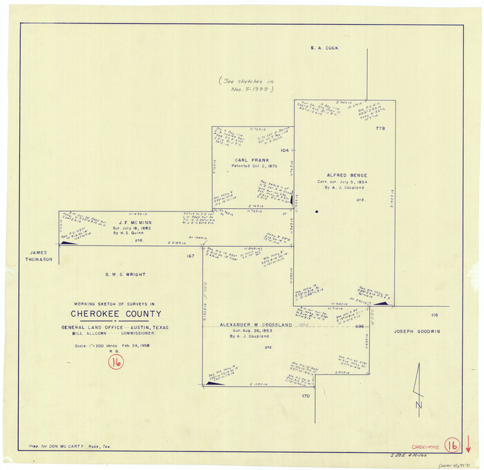
Cherokee County Working Sketch 16
Print $20.00
- Digital $50.00
Cherokee County Working Sketch 16
1958
Size 21.9 x 22.5 inches
Map/Doc 67971
Lee County Sketch File 5

Print $40.00
- Digital $50.00
Lee County Sketch File 5
Size 12.2 x 15.8 inches
Map/Doc 29686