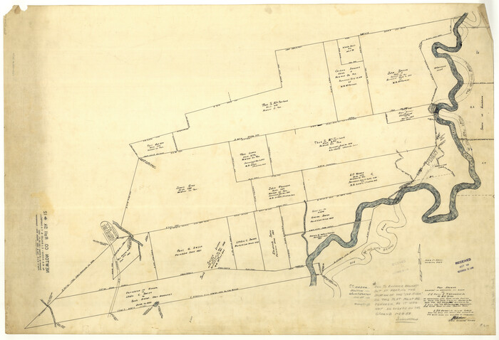
[Texas and Pacific Blocks 56-62, Townships 1-3]
55-5
- 
                          Map/Doc
90501
 - 
                            Collection
Twichell Survey Records
 - 
                            Object Dates
10/1885 (Creation Date)
 - 
                            People and Organizations
Paul McCombs (Surveyor/Engineer)
 - 
                            Counties
Culberson Loving
 - 
                            Height x Width
28.4 x 15.9 inches
72.1 x 40.4 cm
 
Part of: Twichell Survey Records
            [Sketch showing Blocks B5, B6 and G.&M. Block 5 north of Capitol Land]


                                            Print $20.00                    
                                             -                         Digital $50.00                                    
                [Sketch showing Blocks B5, B6 and G.&M. Block 5 north of Capitol Land]
Size 20.7 x 38.2 inches
                                Map/Doc 92990
            
            [Subdivision Plat of 80 acres]


                                            Print $2.00                    
                                             -                         Digital $50.00                                    
                [Subdivision Plat of 80 acres]
Size 11.7 x 6.2 inches
                                Map/Doc 93075
            
            Map of S. E. Pecos County with a part of Crockett County, Texas


                                            Print $40.00                    
                                             -                         Digital $50.00                                    
                Map of S. E. Pecos County with a part of Crockett County, Texas
1927
Size 42.2 x 51.6 inches
                                Map/Doc 89804
            
            Plat Showing Part of Block Y, W. D. and F. W. Johnson Subdivision Number 2; and Part of Block W, Edward K. Warren Subdivision Number 1


                                            Print $20.00                    
                                             -                         Digital $50.00                                    
                Plat Showing Part of Block Y, W. D. and F. W. Johnson Subdivision Number 2; and Part of Block W, Edward K. Warren Subdivision Number 1
1954
Size 23.3 x 17.4 inches
                                Map/Doc 92502
            
            Bravo Deed, Instrument 24, Tract A and Tract B


                                            Print $20.00                    
                                             -                         Digital $50.00                                    
                Bravo Deed, Instrument 24, Tract A and Tract B
Size 33.4 x 14.3 inches
                                Map/Doc 91434
            
            [Central Part of County]


                                            Print $40.00                    
                                             -                         Digital $50.00                                    
                [Central Part of County]
Size 63.1 x 34.7 inches
                                Map/Doc 89959
            
            [North line of Sherman, Hansford, Ochiltree and Lipscomb Counties]


                                            Print $40.00                    
                                             -                         Digital $50.00                                    
                [North line of Sherman, Hansford, Ochiltree and Lipscomb Counties]
Size 127.0 x 14.3 inches
                                Map/Doc 93189
            
            Sudan Cemetery Sudan, Texas


                                            Print $20.00                    
                                             -                         Digital $50.00                                    
                Sudan Cemetery Sudan, Texas
1925
Size 24.1 x 28.2 inches
                                Map/Doc 92403
            
            [Reynolds Cattle Company Lands]


                                            Print $20.00                    
                                             -                         Digital $50.00                                    
                [Reynolds Cattle Company Lands]
1908
Size 13.1 x 31.5 inches
                                Map/Doc 90767
            
            [Northeast 1/4 of County Map showing Durrell's Tie Line]


                                            Print $20.00                    
                                             -                         Digital $50.00                                    
                [Northeast 1/4 of County Map showing Durrell's Tie Line]
Size 24.1 x 18.7 inches
                                Map/Doc 91619
            
            [Notes and map showing Public School Land Block K between Yoakum and Terry Counties]


                                            Print $2.00                    
                                             -                         Digital $50.00                                    
                [Notes and map showing Public School Land Block K between Yoakum and Terry Counties]
Size 8.3 x 5.7 inches
                                Map/Doc 92010
            
            Map Showing Block HG and Connecting Surveys


                                            Print $2.00                    
                                             -                         Digital $50.00                                    
                Map Showing Block HG and Connecting Surveys
1907
Size 9.2 x 13.7 inches
                                Map/Doc 90681
            You may also like
            Map of Maverick County, Texas


                                            Print $20.00                    
                                             -                         Digital $50.00                                    
                Map of Maverick County, Texas
1879
Size 33.0 x 23.0 inches
                                Map/Doc 718
            
            Carson County Boundary File 5c


                                            Print $10.00                    
                                             -                         Digital $50.00                                    
                Carson County Boundary File 5c
Size 14.2 x 8.7 inches
                                Map/Doc 51146
            
            W. D. Twichell's Preliminary Report Showing R. S. Hunnicutt's Reconnoissance Survey in Parmer County, Texas November 6th to 19th, 1915


                                            Print $20.00                    
                                             -                         Digital $50.00                                    
                W. D. Twichell's Preliminary Report Showing R. S. Hunnicutt's Reconnoissance Survey in Parmer County, Texas November 6th to 19th, 1915
1915
Size 45.1 x 42.8 inches
                                Map/Doc 89803
            
            [Survey 321, Double Lakes Area, Northwest of Tohoka]


                                            Print $20.00                    
                                             -                         Digital $50.00                                    
                [Survey 321, Double Lakes Area, Northwest of Tohoka]
Size 26.9 x 19.5 inches
                                Map/Doc 91299
            
            Wichita County Working Sketch 3


                                            Print $20.00                    
                                             -                         Digital $50.00                                    
                Wichita County Working Sketch 3
1913
Size 22.2 x 15.6 inches
                                Map/Doc 72512
            
            Limestone County Working Sketch 18


                                            Print $20.00                    
                                             -                         Digital $50.00                                    
                Limestone County Working Sketch 18
1962
Size 45.5 x 38.7 inches
                                Map/Doc 70568
            
            Marion County Working Sketch 3


                                            Print $20.00                    
                                             -                         Digital $50.00                                    
                Marion County Working Sketch 3
Size 34.9 x 30.0 inches
                                Map/Doc 70778
            
            Kaufman County Sketch File 14


                                            Print $4.00                    
                                             -                         Digital $50.00                                    
                Kaufman County Sketch File 14
Size 10.1 x 8.1 inches
                                Map/Doc 28649
            
            Upton County Sketch File 19


                                            Print $20.00                    
                                             -                         Digital $50.00                                    
                Upton County Sketch File 19
1927
Size 21.2 x 21.4 inches
                                Map/Doc 12515
            
            Brewster County Rolled Sketch 114


                                            Print $20.00                    
                                             -                         Digital $50.00                                    
                Brewster County Rolled Sketch 114
1964
Size 11.1 x 18.4 inches
                                Map/Doc 5270
            
            Polk County Sketch File 24


                                            Print $20.00                    
                                             -                         Digital $50.00                                    
                Polk County Sketch File 24
Size 14.3 x 30.8 inches
                                Map/Doc 12193
            
            [Abstract Numbering Register - Kaufman through Reagan]


            [Abstract Numbering Register - Kaufman through Reagan]
Map/Doc 82967