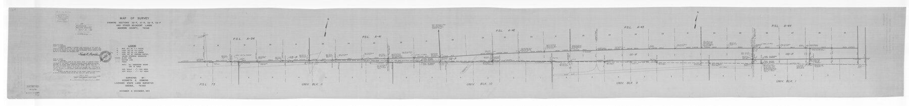
Andrews County Rolled Sketch 33
Map of survey showing sections 110-P, 111-P, 112-P, 113-P and other adjacent lands
-
Map/Doc
9003
-
Collection
General Map Collection
-
Object Dates
1953 (Survey Date)
1954/4/12 (File Date)
1953 (Survey Date)
-
People and Organizations
Kenneth E. Esmond (Surveyor/Engineer)
-
Counties
Andrews
-
Subjects
Surveying Rolled Sketch
-
Height x Width
131.2 x 22.0 inches
333.2 x 55.9 cm
-
Medium
linen, manuscript
-
Comments
Relating to SF-15635 and SF-15636.
Part of: General Map Collection
Parker County Sketch File 10

Print $40.00
- Digital $50.00
Parker County Sketch File 10
Size 43.5 x 37.8 inches
Map/Doc 10567
[Map of Hunt County]
![3691, [Map of Hunt County], General Map Collection](https://historictexasmaps.com/wmedia_w700/maps/3691-1.tif.jpg)
Print $20.00
- Digital $50.00
[Map of Hunt County]
1851
Size 21.6 x 19.1 inches
Map/Doc 3691
Cass County Working Sketch 33

Print $20.00
- Digital $50.00
Cass County Working Sketch 33
1982
Size 27.4 x 26.6 inches
Map/Doc 67936
Liberty County Working Sketch 74

Print $20.00
- Digital $50.00
Liberty County Working Sketch 74
1979
Size 38.8 x 35.4 inches
Map/Doc 70534
Crosby County Working Sketch 5

Print $20.00
- Digital $50.00
Crosby County Working Sketch 5
1911
Size 23.3 x 16.7 inches
Map/Doc 68439
Polk County Sketch File 35

Print $8.00
- Digital $50.00
Polk County Sketch File 35
1891
Size 14.2 x 8.7 inches
Map/Doc 34232
Atascosa County Rolled Sketch 22

Print $40.00
- Digital $50.00
Atascosa County Rolled Sketch 22
1917
Size 57.5 x 26.5 inches
Map/Doc 8921
Pecos County Working Sketch 124

Print $40.00
- Digital $50.00
Pecos County Working Sketch 124
1974
Size 57.9 x 38.2 inches
Map/Doc 71597
Real County Working Sketch 24

Print $20.00
- Digital $50.00
Real County Working Sketch 24
1946
Size 17.4 x 22.5 inches
Map/Doc 71916
Stonewall County Sketch File 26

Print $20.00
- Digital $50.00
Stonewall County Sketch File 26
1953
Size 35.7 x 36.8 inches
Map/Doc 10376
Maverick County Working Sketch 5

Print $40.00
- Digital $50.00
Maverick County Working Sketch 5
1944
Size 55.4 x 43.0 inches
Map/Doc 70897
Trinity River, Levee Improvements, District Widths of Floodways

Print $20.00
- Digital $50.00
Trinity River, Levee Improvements, District Widths of Floodways
1920
Size 25.0 x 18.6 inches
Map/Doc 65252
You may also like
[Subdivision of Crockett County School Land Lgs. 214-217]
![90106, [Subdivision of Crockett County School Land Lgs. 214-217], Twichell Survey Records](https://historictexasmaps.com/wmedia_w700/maps/90106-1.tif.jpg)
Print $2.00
- Digital $50.00
[Subdivision of Crockett County School Land Lgs. 214-217]
Size 12.4 x 8.5 inches
Map/Doc 90106
A Geographically Correct Map of the State of Texas

Print $20.00
- Digital $50.00
A Geographically Correct Map of the State of Texas
1876
Size 20.4 x 21.9 inches
Map/Doc 95362
Brazos River, Koy Bridge Sheet/Mill Creek

Print $20.00
- Digital $50.00
Brazos River, Koy Bridge Sheet/Mill Creek
1933
Size 44.0 x 27.3 inches
Map/Doc 65290
Montague County Sketch File 6

Print $4.00
- Digital $50.00
Montague County Sketch File 6
1856
Size 8.0 x 8.4 inches
Map/Doc 31717
Castro County Rolled Sketch 8

Print $20.00
- Digital $50.00
Castro County Rolled Sketch 8
Size 34.1 x 28.8 inches
Map/Doc 5418
Wharton County Sketch File 23

Print $20.00
- Digital $50.00
Wharton County Sketch File 23
Size 19.3 x 19.9 inches
Map/Doc 12667
Aransas County Sketch File 21

Print $2.00
- Digital $50.00
Aransas County Sketch File 21
Size 8.0 x 8.9 inches
Map/Doc 13157
Jefferson County Rolled Sketch 31

Print $425.00
- Digital $50.00
Jefferson County Rolled Sketch 31
1955
Size 10.1 x 15.3 inches
Map/Doc 46323
[Missouri, Kansas & Texas Line Map through Bastrop County]
![64033, [Missouri, Kansas & Texas Line Map through Bastrop County], General Map Collection](https://historictexasmaps.com/wmedia_w700/maps/64033.tif.jpg)
Print $40.00
- Digital $50.00
[Missouri, Kansas & Texas Line Map through Bastrop County]
1916
Size 25.2 x 68.9 inches
Map/Doc 64033
Amistad International Reservoir on Rio Grande 66

Print $20.00
- Digital $50.00
Amistad International Reservoir on Rio Grande 66
1949
Size 28.5 x 39.6 inches
Map/Doc 73351
Newton County Working Sketch 7

Print $20.00
- Digital $50.00
Newton County Working Sketch 7
1936
Size 32.3 x 37.0 inches
Map/Doc 71253
University Land Loving-Ward-Winkler Counties

Print $20.00
- Digital $50.00
University Land Loving-Ward-Winkler Counties
1931
Size 24.7 x 33.2 inches
Map/Doc 2448