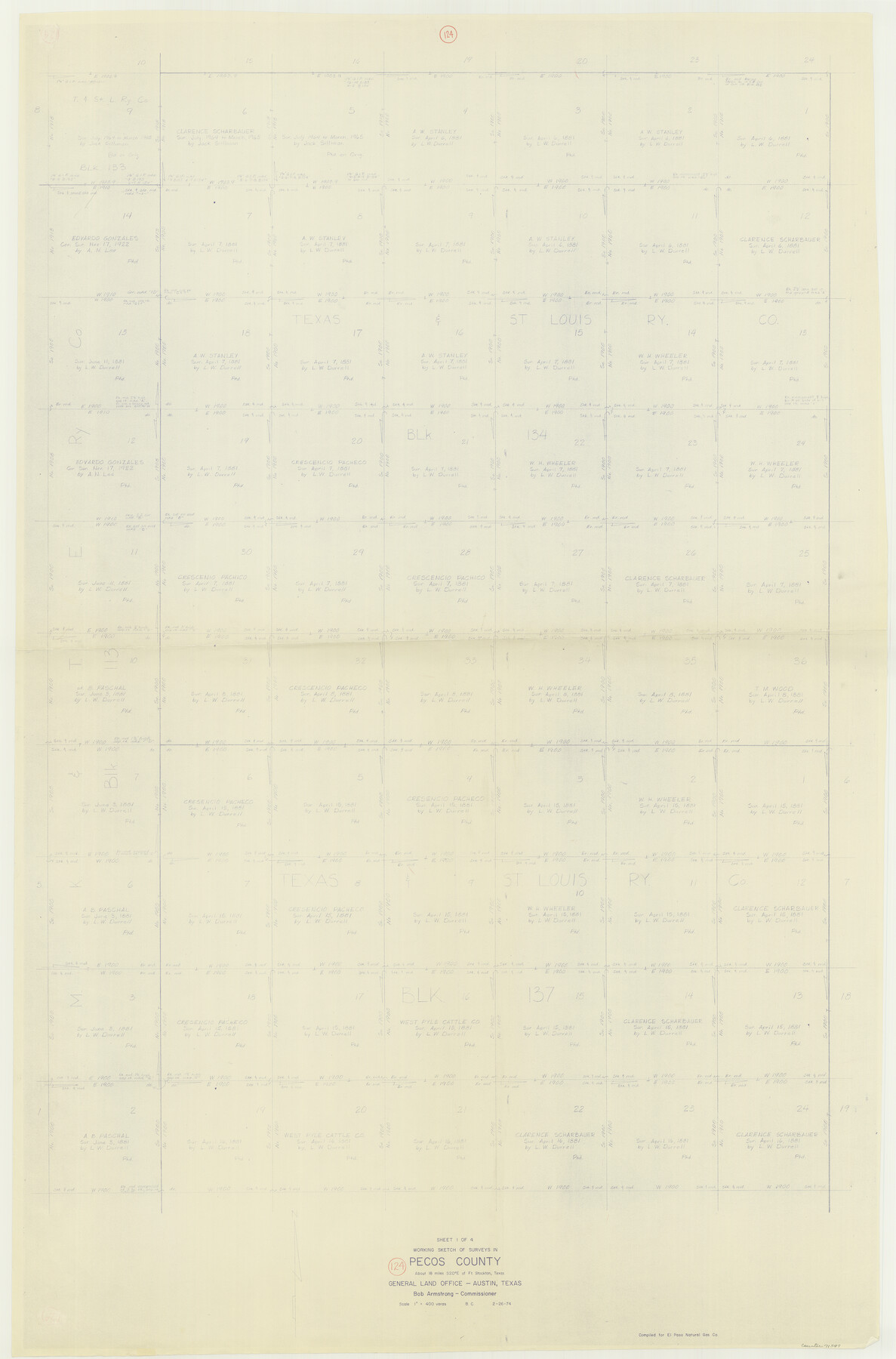
Pecos County Working Sketch 124
- 
                          Map/Doc71597
- 
                            CollectionGeneral Map Collection
- 
                            Object Dates2/26/1974 (Creation Date)
- 
                            People and OrganizationsBeverly Christian (Draftsman)
- 
                            CountiesPecos
- 
                            SubjectsSurveying Working Sketch
- 
                            Height x Width57.9 x 38.2 inches147.1 x 97.0 cm
- 
                            Scale1" = 400 varas
Part of: General Map Collection
            Rains County Sketch File 10


                                            Print $20.00                    
                                             -                         Digital $50.00                                    
                Rains County Sketch File 10
Size 20.9 x 15.7 inches
                                Map/Doc 12203
            
            Hardin County Sketch File 14


                                            Print $4.00                    
                                             -                         Digital $50.00                                    
                Hardin County Sketch File 14
1866
Size 13.0 x 8.0 inches
                                Map/Doc 25120
            
            [Sketch for Mineral Application 24072, San Jacinto River]
            
                                    ![65588, [Sketch for Mineral Application 24072, San Jacinto River], General Map Collection](https://historictexasmaps.com/wmedia_w700/maps/65588.tif.jpg) 


    ![65588, [Sketch for Mineral Application 24072, San Jacinto River], General Map Collection](https://historictexasmaps.com/wmedia_w700/maps/65588.tif.jpg) 
                                
            
                                            Print $20.00                    
                                             -                         Digital $50.00                                    
                [Sketch for Mineral Application 24072, San Jacinto River]
1929
Size 19.6 x 13.7 inches
                                Map/Doc 65588
            
            Flight Mission No. CRE-2R, Frame 152, Jackson County


                                            Print $20.00                    
                                             -                         Digital $50.00                                    
                Flight Mission No. CRE-2R, Frame 152, Jackson County
1956
Size 16.3 x 16.1 inches
                                Map/Doc 85363
            
            Motley County Sketch File 9a (N)


                                            Print $4.00                    
                                             -                         Digital $50.00                                    
                Motley County Sketch File 9a (N)
1885
Size 14.2 x 8.6 inches
                                Map/Doc 32024
            
            Flight Mission No. CRK-5P, Frame 130, Refugio County


                                            Print $20.00                    
                                             -                         Digital $50.00                                    
                Flight Mission No. CRK-5P, Frame 130, Refugio County
1956
Size 18.6 x 22.5 inches
                                Map/Doc 86933
            
            South Sulphur River, Klondike Sheet


                                            Print $20.00                    
                                             -                         Digital $50.00                                    
                South Sulphur River, Klondike Sheet
1925
Size 18.2 x 19.9 inches
                                Map/Doc 78332
            
            [Maps of surveys in Reeves & Culberson Cos]
            
                                    ![61141, [Maps of surveys in Reeves & Culberson Cos], General Map Collection](https://historictexasmaps.com/wmedia_w700/maps/61141.tif.jpg) 


    ![61141, [Maps of surveys in Reeves & Culberson Cos], General Map Collection](https://historictexasmaps.com/wmedia_w700/maps/61141.tif.jpg) 
                                
            
                                            Print $20.00                    
                                             -                         Digital $50.00                                    
                [Maps of surveys in Reeves & Culberson Cos]
1937
Size 30.7 x 24.9 inches
                                Map/Doc 61141
            
            Flight Mission No. BRA-8M, Frame 71, Jefferson County


                                            Print $20.00                    
                                             -                         Digital $50.00                                    
                Flight Mission No. BRA-8M, Frame 71, Jefferson County
1953
Size 18.7 x 22.3 inches
                                Map/Doc 85591
            
            Bastrop County Rolled Sketch 5


                                            Print $20.00                    
                                             -                         Digital $50.00                                    
                Bastrop County Rolled Sketch 5
2013
Size 24.9 x 36.9 inches
                                Map/Doc 93715
            
            Padre Island National Seashore, Texas - Dependent Resurvey


                                            Print $4.00                    
                                             -                         Digital $50.00                                    
                Padre Island National Seashore, Texas - Dependent Resurvey
2001
Size 18.4 x 24.2 inches
                                Map/Doc 60543
            You may also like
            Flight Mission No. DAG-23K, Frame 180, Matagorda County


                                            Print $20.00                    
                                             -                         Digital $50.00                                    
                Flight Mission No. DAG-23K, Frame 180, Matagorda County
1953
Size 18.4 x 16.0 inches
                                Map/Doc 86515
            
            Ellis County Boundary File 2


                                            Print $12.00                    
                                             -                         Digital $50.00                                    
                Ellis County Boundary File 2
Size 10.7 x 8.3 inches
                                Map/Doc 52944
            
            Wharton County Working Sketch 5


                                            Print $20.00                    
                                             -                         Digital $50.00                                    
                Wharton County Working Sketch 5
Size 20.2 x 15.6 inches
                                Map/Doc 72469
            
            Lipscomb County Boundary File 5


                                            Print $4.00                    
                                             -                         Digital $50.00                                    
                Lipscomb County Boundary File 5
Size 5.5 x 8.6 inches
                                Map/Doc 56327
            
            Jefferson County Aerial Photograph Index Sheet 5


                                            Print $20.00                    
                                             -                         Digital $50.00                                    
                Jefferson County Aerial Photograph Index Sheet 5
1953
Size 23.3 x 16.9 inches
                                Map/Doc 83709
            
            Sectional Map No. 4 of the lands and of the lines of the Texas & Pacific R'Y. Co. in El Paso and part of Presidio Co's.


                                            Print $20.00                    
                                             -                         Digital $50.00                                    
                Sectional Map No. 4 of the lands and of the lines of the Texas & Pacific R'Y. Co. in El Paso and part of Presidio Co's.
1885
Size 22.3 x 17.0 inches
                                Map/Doc 2304
            
            Webb County Sketch File 9c


                                            Print $20.00                    
                                             -                         Digital $50.00                                    
                Webb County Sketch File 9c
1930
Size 18.7 x 22.1 inches
                                Map/Doc 12621
            
            Ochiltree County Working Sketch 2


                                            Print $20.00                    
                                             -                         Digital $50.00                                    
                Ochiltree County Working Sketch 2
1959
Size 23.9 x 20.8 inches
                                Map/Doc 71315
            
            Jefferson County Rolled Sketch 58


                                            Print $40.00                    
                                             -                         Digital $50.00                                    
                Jefferson County Rolled Sketch 58
1897
Size 21.4 x 60.3 inches
                                Map/Doc 9312
            
            Freestone County Working Sketch 18


                                            Print $20.00                    
                                             -                         Digital $50.00                                    
                Freestone County Working Sketch 18
1980
Size 43.3 x 46.9 inches
                                Map/Doc 69260
            
            Flight Mission No. DCL-7C, Frame 28, Kenedy County


                                            Print $20.00                    
                                             -                         Digital $50.00                                    
                Flight Mission No. DCL-7C, Frame 28, Kenedy County
1943
Size 15.4 x 15.4 inches
                                Map/Doc 86020
            
            San Patricio County Sketch File 32


                                            Print $20.00                    
                                             -                         Digital $50.00                                    
                San Patricio County Sketch File 32
Size 13.7 x 30.3 inches
                                Map/Doc 12287
             
                        