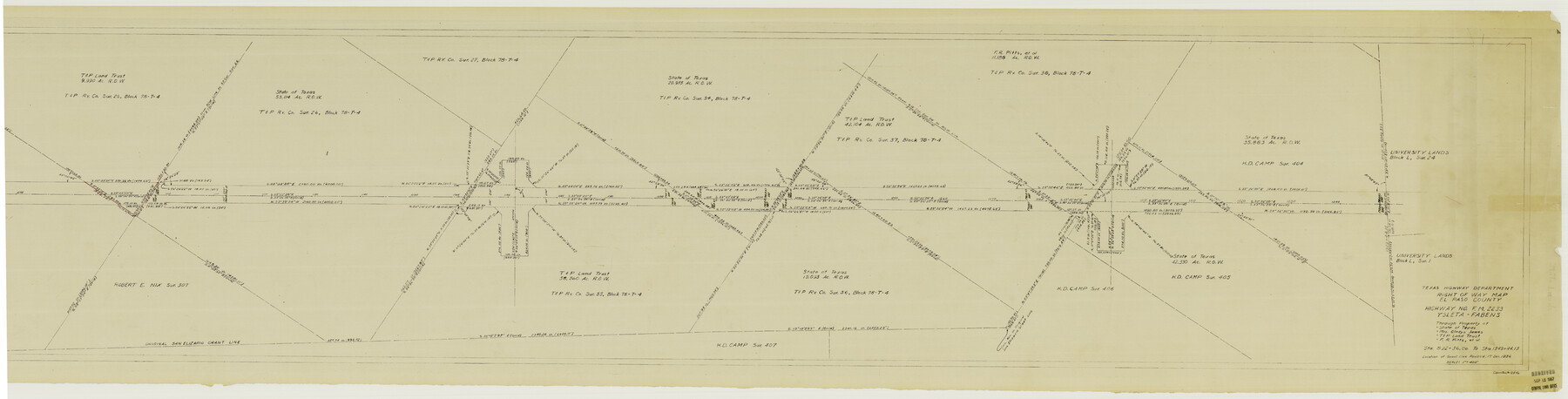
El Paso County Rolled Sketch 50
Right of Way Map, El Paso County, Highway No. FM. 2233, Ysleta-Fabens through property of State of Texas, Mrs. Gladys James, T&P Land Trust, F.R. Pitts, et al, Sta. 892+36.06 to Sta. 1349+44.13
-
Map/Doc
8876
-
Collection
General Map Collection
-
Object Dates
12/17/1956 (Creation Date)
-
Counties
El Paso
-
Subjects
Surveying Rolled Sketch
-
Height x Width
20.7 x 80.1 inches
52.6 x 203.5 cm
-
Medium
blueprint/diazo
-
Scale
1" = 400 feet
-
Comments
For another two segments of this map see 5835 and 76430.
Related maps
El Paso County Rolled Sketch 50

Print $20.00
- Digital $50.00
El Paso County Rolled Sketch 50
1956
Size 18.9 x 26.7 inches
Map/Doc 5835
El Paso County Rolled Sketch 50

Print $40.00
- Digital $50.00
El Paso County Rolled Sketch 50
Size 19.7 x 76.0 inches
Map/Doc 76430
Part of: General Map Collection
Nautical Chart 892-SC - Intracoastal Waterway - Carlos Bay to Redfish Bay including Copano Bay, Texas

Print $40.00
- Digital $50.00
Nautical Chart 892-SC - Intracoastal Waterway - Carlos Bay to Redfish Bay including Copano Bay, Texas
1972
Size 16.8 x 51.8 inches
Map/Doc 73440
Wise County Working Sketch 24

Print $40.00
- Digital $50.00
Wise County Working Sketch 24
1983
Size 37.1 x 58.2 inches
Map/Doc 72638
Jefferson County NRC Article 33.136 Sketch 14

Print $164.00
- Digital $50.00
Jefferson County NRC Article 33.136 Sketch 14
2021
Map/Doc 96645
Clay County Sketch File 40

Print $12.00
- Digital $50.00
Clay County Sketch File 40
Size 11.3 x 8.5 inches
Map/Doc 18476
Live Oak County Working Sketch 30

Print $20.00
- Digital $50.00
Live Oak County Working Sketch 30
1988
Size 19.0 x 25.9 inches
Map/Doc 70615
[Folder for] Nautical Chart 11305: Texas Intracoastal Waterway, Laguna Madre, Rincon de San Jose to Chubby Island
![75913, [Folder for] Nautical Chart 11305: Texas Intracoastal Waterway, Laguna Madre, Rincon de San Jose to Chubby Island, General Map Collection](https://historictexasmaps.com/wmedia_w700/maps/75913-1.tif.jpg)
Print $20.00
- Digital $50.00
[Folder for] Nautical Chart 11305: Texas Intracoastal Waterway, Laguna Madre, Rincon de San Jose to Chubby Island
1976
Size 16.0 x 19.0 inches
Map/Doc 75913
Montgomery County Sketch File 7

Print $35.00
- Digital $50.00
Montgomery County Sketch File 7
1861
Size 8.8 x 7.8 inches
Map/Doc 31785
Trinity County Working Sketch 6

Print $20.00
- Digital $50.00
Trinity County Working Sketch 6
1920
Size 19.6 x 14.6 inches
Map/Doc 69454
Potter County Rolled Sketch 10

Print $20.00
- Digital $50.00
Potter County Rolled Sketch 10
1963
Size 31.8 x 43.3 inches
Map/Doc 7323
Map of Hill County

Print $20.00
- Digital $50.00
Map of Hill County
1862
Size 22.1 x 24.7 inches
Map/Doc 3671
Flight Mission No. BRA-9M, Frame 59, Jefferson County

Print $20.00
- Digital $50.00
Flight Mission No. BRA-9M, Frame 59, Jefferson County
1953
Size 18.6 x 22.4 inches
Map/Doc 85642
Pecos County Working Sketch 19

Print $20.00
- Digital $50.00
Pecos County Working Sketch 19
1917
Size 21.0 x 14.6 inches
Map/Doc 71489
You may also like
[Surveying Sketch of M. Farley, R. Word, S. S. Hervey, et al in Kleberg County, Texas]
![10783, [Surveying Sketch of M. Farley, R. Word, S. S. Hervey, et al in Kleberg County, Texas], Maddox Collection](https://historictexasmaps.com/wmedia_w700/maps/10783.tif.jpg)
Print $20.00
- Digital $50.00
[Surveying Sketch of M. Farley, R. Word, S. S. Hervey, et al in Kleberg County, Texas]
Size 23.2 x 40.6 inches
Map/Doc 10783
Working Sketch Dickens and Kent Counties

Print $20.00
- Digital $50.00
Working Sketch Dickens and Kent Counties
1904
Size 16.3 x 20.7 inches
Map/Doc 90862
Flight Mission No. DAG-21K, Frame 98, Matagorda County

Print $20.00
- Digital $50.00
Flight Mission No. DAG-21K, Frame 98, Matagorda County
1952
Size 18.5 x 22.3 inches
Map/Doc 86427

Harris County Boundary File 39 (17)

Print $4.00
- Digital $50.00
Harris County Boundary File 39 (17)
Size 10.0 x 8.1 inches
Map/Doc 54357
Sketch H No. V Showing the observed and computed Tidal Curves at Cat Island, Mississippi Sound in 1848 & 1849

Print $20.00
- Digital $50.00
Sketch H No. V Showing the observed and computed Tidal Curves at Cat Island, Mississippi Sound in 1848 & 1849
1852
Size 12.3 x 19.5 inches
Map/Doc 97226
[Drawings of individual counties for Pressler and Langermann's 1879 Map of Texas]
![[Drawings of individual counties for Pressler and Langermann's 1879 Map of Texas]](https://historictexasmaps.com/wmedia_w700/maps/4863.tif.jpg)
Print $20.00
- Digital $50.00
[Drawings of individual counties for Pressler and Langermann's 1879 Map of Texas]
1878
Size 38.8 x 26.8 inches
Map/Doc 4863
[William Steele Survey near Copano Bay]
![60284, [William Steele Survey near Copano Bay], General Map Collection](https://historictexasmaps.com/wmedia_w700/maps/60284-1.tif.jpg)
Print $3.00
- Digital $50.00
[William Steele Survey near Copano Bay]
1927
Size 15.5 x 9.5 inches
Map/Doc 60284
Martin County Rolled Sketch 9

Print $20.00
- Digital $50.00
Martin County Rolled Sketch 9
1990
Size 17.3 x 11.4 inches
Map/Doc 6669
Coast Chart No. 212 - From Latitude 26° 33' to the Rio Grande Texas

Print $20.00
- Digital $50.00
Coast Chart No. 212 - From Latitude 26° 33' to the Rio Grande Texas
1886
Size 27.7 x 18.3 inches
Map/Doc 72828
Bosque County

Print $40.00
- Digital $50.00
Bosque County
1945
Size 48.3 x 38.0 inches
Map/Doc 73083
Houston, Texas (Looking South)

Print $20.00
Houston, Texas (Looking South)
1891
Size 25.3 x 41.1 inches
Map/Doc 89094