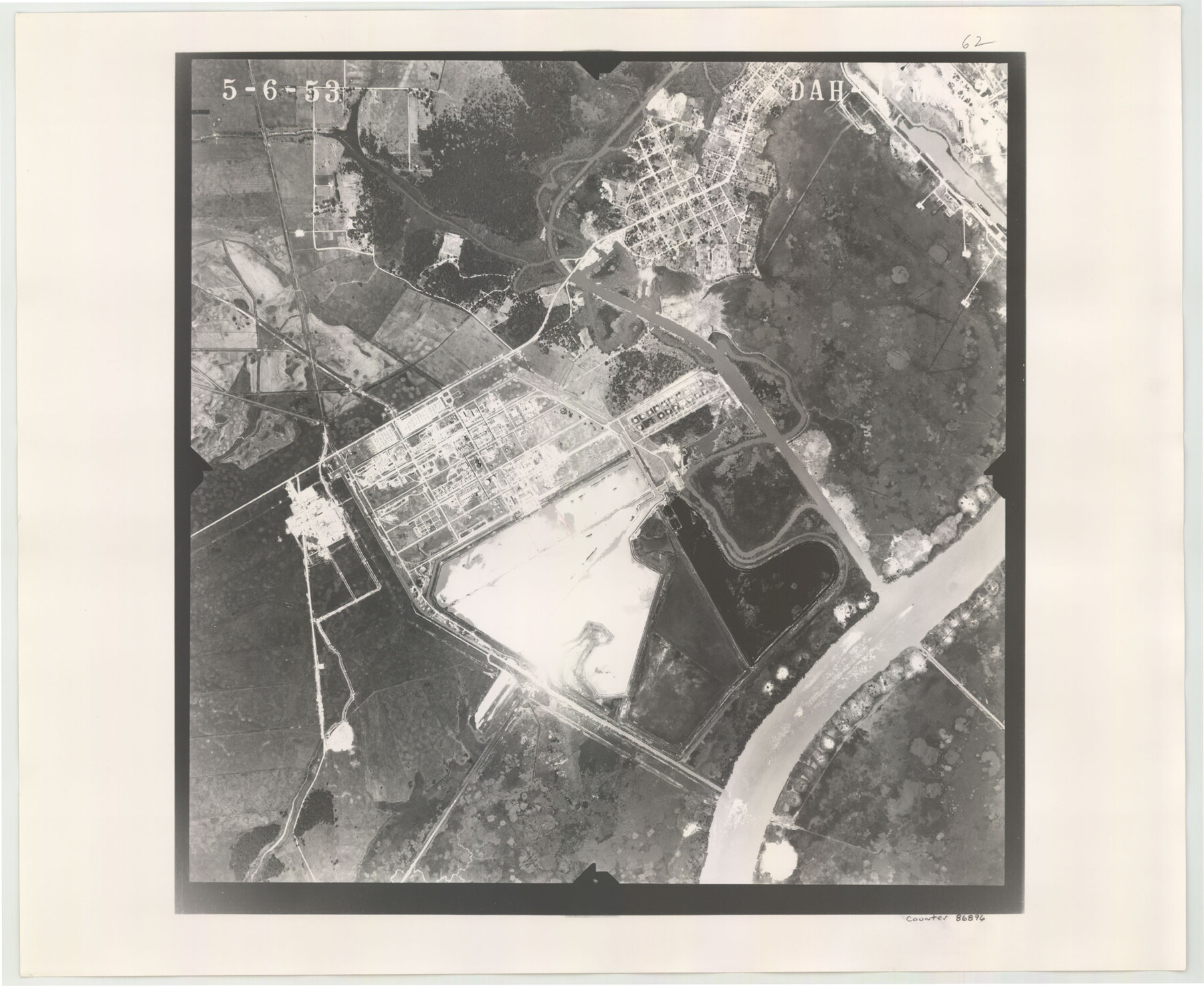
Flight Mission No. DAH-17M, Frame 62, Orange County
DAH-17M-62
-
Map/Doc
86896
-
Collection
General Map Collection
-
Object Dates
1953/5/6 (Creation Date)
-
People and Organizations
U. S. Department of Agriculture (Publisher)
-
Counties
Orange
-
Subjects
Aerial Photograph
-
Height x Width
18.5 x 22.6 inches
47.0 x 57.4 cm
-
Comments
Flown by Jack Ammann Photogrammetric Engineers of San Antonio, Texas.
Part of: General Map Collection
Flight Mission No. DCL-7C, Frame 114, Kenedy County

Print $20.00
- Digital $50.00
Flight Mission No. DCL-7C, Frame 114, Kenedy County
1943
Size 18.6 x 22.2 inches
Map/Doc 86079
Flight Mission No. BRA-6M, Frame 87, Jefferson County

Print $20.00
- Digital $50.00
Flight Mission No. BRA-6M, Frame 87, Jefferson County
1953
Size 18.5 x 22.3 inches
Map/Doc 85430
Edwards County Working Sketch 106

Print $20.00
- Digital $50.00
Edwards County Working Sketch 106
1972
Size 32.3 x 26.5 inches
Map/Doc 68982
Lipscomb County Boundary File 7

Print $4.00
- Digital $50.00
Lipscomb County Boundary File 7
Size 6.6 x 8.1 inches
Map/Doc 56331
San Augustine County Sketch File 22

Print $4.00
San Augustine County Sketch File 22
Size 12.8 x 8.4 inches
Map/Doc 35687
Hays County Sketch File 36

Print $4.00
- Digital $50.00
Hays County Sketch File 36
Size 11.0 x 8.5 inches
Map/Doc 96639
Edwards County Boundary File 29

Print $22.00
- Digital $50.00
Edwards County Boundary File 29
Size 15.4 x 31.0 inches
Map/Doc 65502
Flight Mission No. DCL-6C, Frame 67, Kenedy County

Print $20.00
- Digital $50.00
Flight Mission No. DCL-6C, Frame 67, Kenedy County
1943
Size 18.6 x 22.2 inches
Map/Doc 85909
San Patricio County Sketch File 5a

Print $4.00
- Digital $50.00
San Patricio County Sketch File 5a
Size 5.5 x 8.6 inches
Map/Doc 36033
Galveston County NRC Article 33.136 Sketch 7

Print $20.00
- Digital $50.00
Galveston County NRC Article 33.136 Sketch 7
2001
Size 23.7 x 37.2 inches
Map/Doc 61589

Runnels County Sketch File 32

Print $4.00
Runnels County Sketch File 32
1950
Size 23.6 x 22.6 inches
Map/Doc 12263
You may also like
[T. & G. Ry. Main Line, Texas, Right of Way Map, Center to Gary]
![64569, [T. & G. Ry. Main Line, Texas, Right of Way Map, Center to Gary], General Map Collection](https://historictexasmaps.com/wmedia_w700/maps/64569.tif.jpg)
Print $40.00
- Digital $50.00
[T. & G. Ry. Main Line, Texas, Right of Way Map, Center to Gary]
1917
Size 31.5 x 76.7 inches
Map/Doc 64569
Glasscock County

Print $20.00
- Digital $50.00
Glasscock County
1933
Size 47.0 x 39.2 inches
Map/Doc 1839
Van Zandt County Sketch File A45

Print $40.00
- Digital $50.00
Van Zandt County Sketch File A45
Size 14.2 x 13.7 inches
Map/Doc 39501
Jim Wells County Working Sketch 13

Print $20.00
- Digital $50.00
Jim Wells County Working Sketch 13
1980
Size 36.7 x 26.3 inches
Map/Doc 66611
Brewster County Rolled Sketch 130

Print $20.00
- Digital $50.00
Brewster County Rolled Sketch 130
1978
Size 18.4 x 24.6 inches
Map/Doc 5302
Kinney County Sketch File 37

Print $20.00
- Digital $50.00
Kinney County Sketch File 37
Size 19.0 x 23.4 inches
Map/Doc 11950
Wichita County Rolled Sketch 18

Print $20.00
- Digital $50.00
Wichita County Rolled Sketch 18
1924
Size 30.0 x 40.5 inches
Map/Doc 8253
Chambers County Working Sketch 21

Print $20.00
- Digital $50.00
Chambers County Working Sketch 21
1974
Size 44.1 x 34.8 inches
Map/Doc 68004
Terry County Rolled Sketch 5

Print $40.00
- Digital $50.00
Terry County Rolled Sketch 5
Size 56.8 x 38.1 inches
Map/Doc 9995
Knox County Working Sketch 19

Print $20.00
- Digital $50.00
Knox County Working Sketch 19
1992
Size 25.0 x 35.6 inches
Map/Doc 70261
Flight Mission No. BRA-7M, Frame 192, Jefferson County

Print $20.00
- Digital $50.00
Flight Mission No. BRA-7M, Frame 192, Jefferson County
1953
Size 18.5 x 22.4 inches
Map/Doc 85560
Hartley County Boundary File 4a

Print $38.00
- Digital $50.00
Hartley County Boundary File 4a
Size 14.2 x 9.0 inches
Map/Doc 54505