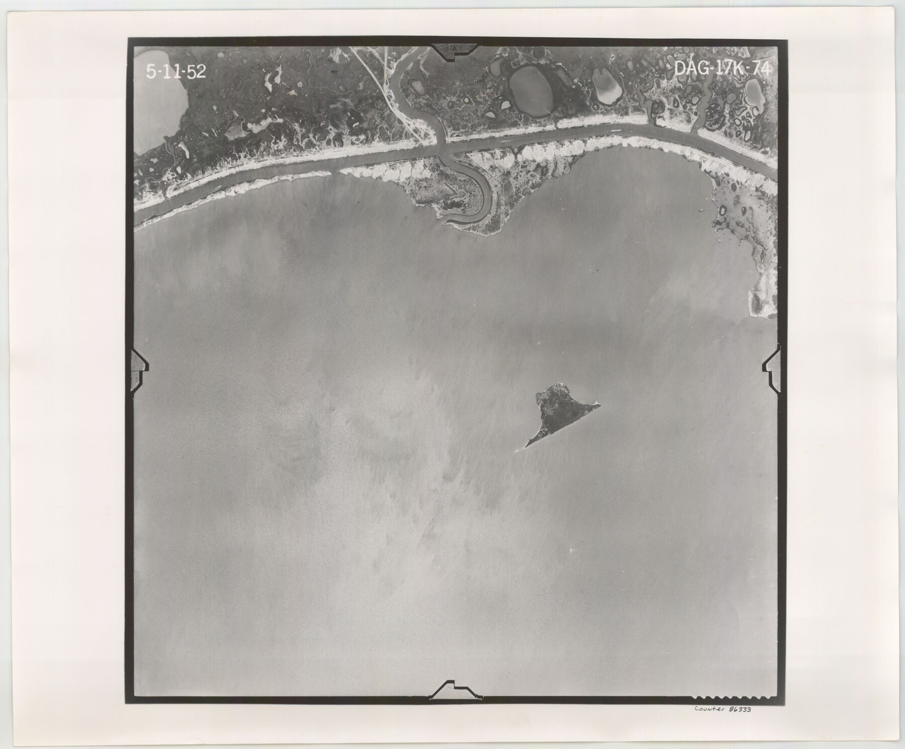
Flight Mission No. DAG-17K, Frame 74, Matagorda County
DAG-17K-74
-
Map/Doc
86333
-
Collection
General Map Collection
-
Object Dates
1952/5/11 (Creation Date)
-
People and Organizations
U. S. Department of Agriculture (Publisher)
-
Counties
Matagorda
-
Subjects
Aerial Photograph
-
Height x Width
18.5 x 22.3 inches
47.0 x 56.6 cm
-
Comments
Flown by Aero Exploration Company of Tulsa, Oklahoma.
Part of: General Map Collection
Texas Intracoastal Waterway - Laguna Madre - Dagger Hill to Potrero Grande

Print $20.00
- Digital $50.00
Texas Intracoastal Waterway - Laguna Madre - Dagger Hill to Potrero Grande
1956
Size 38.6 x 27.2 inches
Map/Doc 73509
Hammond's continental map of the United States

Digital $50.00
Hammond's continental map of the United States
1940
Size 33.2 x 50.2 inches
Map/Doc 3118
Houston County Sketch File 1a

Print $4.00
- Digital $50.00
Houston County Sketch File 1a
Size 9.2 x 7.8 inches
Map/Doc 26742
Freestone County Working Sketch 26

Print $20.00
- Digital $50.00
Freestone County Working Sketch 26
1907
Size 27.7 x 30.3 inches
Map/Doc 69268
Duval County Sketch File 66

Print $12.00
- Digital $50.00
Duval County Sketch File 66
1944
Size 14.5 x 8.8 inches
Map/Doc 21444
Oldham County

Print $40.00
- Digital $50.00
Oldham County
1925
Size 41.5 x 53.2 inches
Map/Doc 95604
Township No. 2 South Range No. 23 West of the Indian Meridian

Print $20.00
- Digital $50.00
Township No. 2 South Range No. 23 West of the Indian Meridian
1875
Size 19.3 x 24.4 inches
Map/Doc 75175
Pecos County Working Sketch 84

Print $20.00
- Digital $50.00
Pecos County Working Sketch 84
1961
Size 26.1 x 23.0 inches
Map/Doc 71556
Anderson County Rolled Sketch 13

Print $20.00
- Digital $50.00
Anderson County Rolled Sketch 13
1964
Size 19.8 x 32.2 inches
Map/Doc 77158
Stonewall County Working Sketch 25

Print $20.00
- Digital $50.00
Stonewall County Working Sketch 25
1973
Size 29.5 x 23.4 inches
Map/Doc 62332
Flight Mission No. DCL-7C, Frame 47, Kenedy County

Print $20.00
- Digital $50.00
Flight Mission No. DCL-7C, Frame 47, Kenedy County
1943
Size 15.3 x 15.3 inches
Map/Doc 86035
DeWitt County Sketch File 6

Print $24.00
- Digital $50.00
DeWitt County Sketch File 6
1872
Size 9.8 x 8.5 inches
Map/Doc 20805
You may also like
Jones County Working Sketch 6

Print $20.00
- Digital $50.00
Jones County Working Sketch 6
1951
Size 36.2 x 20.6 inches
Map/Doc 66644
Flight Mission No. BQR-9K, Frame 6, Brazoria County

Print $20.00
- Digital $50.00
Flight Mission No. BQR-9K, Frame 6, Brazoria County
1952
Size 18.7 x 22.4 inches
Map/Doc 84035
Flight Mission No. DAG-21K, Frame 125, Matagorda County

Print $20.00
- Digital $50.00
Flight Mission No. DAG-21K, Frame 125, Matagorda County
1952
Size 18.5 x 22.4 inches
Map/Doc 86451
Harrison County Boundary File 41 (10)

Print $10.00
- Digital $50.00
Harrison County Boundary File 41 (10)
Size 7.1 x 3.4 inches
Map/Doc 54418
Travis County Working Sketch 58

Print $20.00
- Digital $50.00
Travis County Working Sketch 58
1946
Size 36.4 x 43.0 inches
Map/Doc 69442
Freestone County Working Sketch 7

Print $20.00
- Digital $50.00
Freestone County Working Sketch 7
1951
Size 32.8 x 24.4 inches
Map/Doc 69249
General Highway Map, Kendall County, Texas

Print $20.00
General Highway Map, Kendall County, Texas
1961
Size 18.3 x 24.6 inches
Map/Doc 79549
East Part of Liberty Co.

Print $20.00
- Digital $50.00
East Part of Liberty Co.
1977
Size 41.0 x 30.9 inches
Map/Doc 77352
Reagan County Sketch File 10

Print $40.00
- Digital $50.00
Reagan County Sketch File 10
1928
Size 13.7 x 14.2 inches
Map/Doc 34989
[Sketch of area in dispute between Archibald Smith and Cyrena McReara Surveys]
![91923, [Sketch of area in dispute between Archibald Smith and Cyrena McReara Surveys], Twichell Survey Records](https://historictexasmaps.com/wmedia_w700/maps/91923-1.tif.jpg)
Print $20.00
- Digital $50.00
[Sketch of area in dispute between Archibald Smith and Cyrena McReara Surveys]
Size 27.8 x 31.9 inches
Map/Doc 91923
Hopkins County Boundary File 3b

Print $4.00
- Digital $50.00
Hopkins County Boundary File 3b
Size 12.7 x 8.3 inches
Map/Doc 55084
Map of Armstrong County

Print $20.00
- Digital $50.00
Map of Armstrong County
1886
Size 23.0 x 18.6 inches
Map/Doc 3244