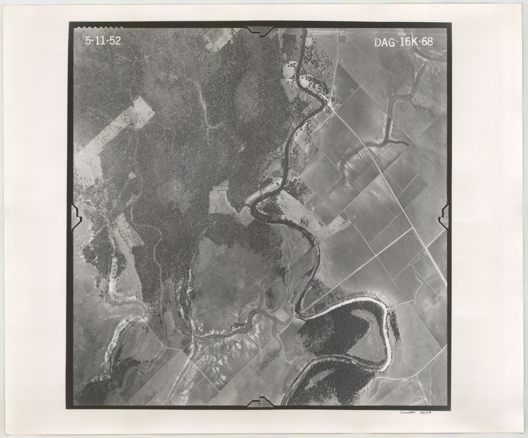
Flight Mission No. DAG-16K, Frame 68, Matagorda County
DAG-16K-68
-
Map/Doc
86314
-
Collection
General Map Collection
-
Object Dates
1952/5/11 (Creation Date)
-
People and Organizations
U. S. Department of Agriculture (Publisher)
-
Counties
Matagorda
-
Subjects
Aerial Photograph
-
Height x Width
18.5 x 22.3 inches
47.0 x 56.6 cm
-
Comments
Flown by Aero Exploration Company of Tulsa, Oklahoma.
Part of: General Map Collection
Shores of Laguna Madre, Texas from Triangulation Station Griffins to Triangulation Station Camp No. 2

Print $40.00
- Digital $50.00
Shores of Laguna Madre, Texas from Triangulation Station Griffins to Triangulation Station Camp No. 2
1882
Size 33.2 x 54.3 inches
Map/Doc 73483

Bowie County Sketch File 7

Print $40.00
- Digital $50.00
Bowie County Sketch File 7
1927
Size 18.0 x 35.5 inches
Map/Doc 10943
Moore County Working Sketch 9

Print $20.00
- Digital $50.00
Moore County Working Sketch 9
1950
Size 38.5 x 31.8 inches
Map/Doc 71191
Map of Potter County

Print $20.00
- Digital $50.00
Map of Potter County
1895
Size 27.0 x 21.1 inches
Map/Doc 3966
Navigation Maps of Gulf Intracoastal Waterway, Port Arthur to Brownsville, Texas

Print $4.00
- Digital $50.00
Navigation Maps of Gulf Intracoastal Waterway, Port Arthur to Brownsville, Texas
1951
Size 16.8 x 21.6 inches
Map/Doc 65419
Glasscock County Working Sketch 15

Print $40.00
- Digital $50.00
Glasscock County Working Sketch 15
1984
Size 65.6 x 42.1 inches
Map/Doc 63188
Tom Green County Working Sketch 11

Print $20.00
- Digital $50.00
Tom Green County Working Sketch 11
1968
Size 33.9 x 39.2 inches
Map/Doc 69380
Texas Gulf Coast, from the Sabine River to the Rio Grande as Subdivided for Mineral Development; Matagorda, Calhoun and Aransas Counties

Print $40.00
- Digital $50.00
Texas Gulf Coast, from the Sabine River to the Rio Grande as Subdivided for Mineral Development; Matagorda, Calhoun and Aransas Counties
1976
Size 43.0 x 90.9 inches
Map/Doc 1939
Gulf Intracoastal Waterway, Tex. - Aransas Bay to Corpus Christi Bay - Modified Route of Main Channel/Dredging

Print $20.00
- Digital $50.00
Gulf Intracoastal Waterway, Tex. - Aransas Bay to Corpus Christi Bay - Modified Route of Main Channel/Dredging
1958
Size 30.8 x 42.8 inches
Map/Doc 61896
Travis County Boundary File 29

Print $4.00
- Digital $50.00
Travis County Boundary File 29
Size 13.2 x 8.4 inches
Map/Doc 59467
Anderson County Working Sketch 31

Print $20.00
- Digital $50.00
Anderson County Working Sketch 31
1966
Size 18.3 x 23.2 inches
Map/Doc 67031
You may also like
Comanche County Working Sketch 25

Print $20.00
- Digital $50.00
Comanche County Working Sketch 25
1976
Size 34.8 x 31.9 inches
Map/Doc 68159
Pecos County Working Sketch 124

Print $40.00
- Digital $50.00
Pecos County Working Sketch 124
1974
Size 57.9 x 38.2 inches
Map/Doc 71597
San Angelo/Big Spring, Texas Street Map "A Traveler's Best Friend"

San Angelo/Big Spring, Texas Street Map "A Traveler's Best Friend"
Size 37.5 x 24.9 inches
Map/Doc 94399
Loving County Working Sketch 2

Print $20.00
- Digital $50.00
Loving County Working Sketch 2
1937
Size 33.9 x 42.5 inches
Map/Doc 70634
[F. W. & D. C. Ry. Co. Alignment and Right of Way Map, Clay County]
![64736, [F. W. & D. C. Ry. Co. Alignment and Right of Way Map, Clay County], General Map Collection](https://historictexasmaps.com/wmedia_w700/maps/64736-GC.tif.jpg)
Print $20.00
- Digital $50.00
[F. W. & D. C. Ry. Co. Alignment and Right of Way Map, Clay County]
1927
Size 18.6 x 11.7 inches
Map/Doc 64736
[Surveys Along Canadian River]
![92359, [Surveys Along Canadian River], Twichell Survey Records](https://historictexasmaps.com/wmedia_w700/maps/92359-1.tif.jpg)
Print $20.00
- Digital $50.00
[Surveys Along Canadian River]
Size 42.9 x 27.0 inches
Map/Doc 92359
Flight Mission No. CRC-2R, Frame 132, Chambers County

Print $20.00
- Digital $50.00
Flight Mission No. CRC-2R, Frame 132, Chambers County
1956
Size 18.6 x 22.3 inches
Map/Doc 84748
Dimmit County Rolled Sketch 17

Print $20.00
- Digital $50.00
Dimmit County Rolled Sketch 17
1974
Size 34.9 x 19.3 inches
Map/Doc 5724
Hunt County Sketch File 16b

Print $6.00
- Digital $50.00
Hunt County Sketch File 16b
Size 6.7 x 7.4 inches
Map/Doc 27111
Polk County Working Sketch 16

Print $20.00
- Digital $50.00
Polk County Working Sketch 16
1947
Size 45.7 x 27.3 inches
Map/Doc 71631
Walker County

Print $20.00
- Digital $50.00
Walker County
1944
Size 45.7 x 38.4 inches
Map/Doc 73314
[Blocks GM, and D3 and Vicinity in Motley and Floyd Counties]
![91502, [Blocks GM, and D3 and Vicinity in Motley and Floyd Counties], Twichell Survey Records](https://historictexasmaps.com/wmedia_w700/maps/91502-1.tif.jpg)
Print $20.00
- Digital $50.00
[Blocks GM, and D3 and Vicinity in Motley and Floyd Counties]
1904
Size 23.8 x 17.4 inches
Map/Doc 91502