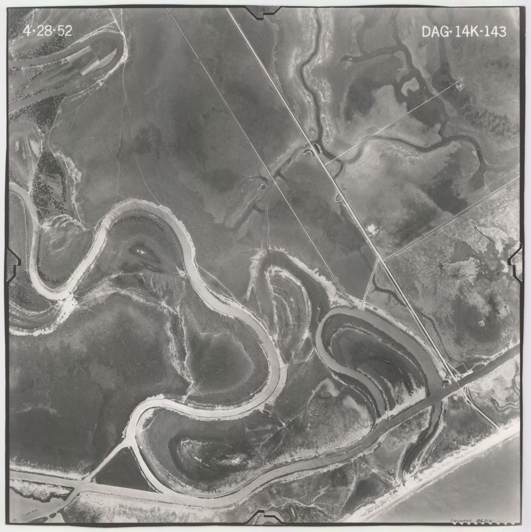
Flight Mission No. DAG-14K, Frame 143, Matagorda County
DAG-14K-143
-
Map/Doc
86310
-
Collection
General Map Collection
-
Object Dates
1952/4/28 (Creation Date)
-
People and Organizations
U. S. Department of Agriculture (Publisher)
-
Counties
Matagorda
-
Subjects
Aerial Photograph
-
Height x Width
16.4 x 16.4 inches
41.7 x 41.7 cm
-
Comments
Flown by Aero Exploration Company of Tulsa, Oklahoma.
Part of: General Map Collection
Freestone County Working Sketch 32

Print $20.00
- Digital $50.00
Freestone County Working Sketch 32
1997
Size 46.5 x 34.0 inches
Map/Doc 69274
Brazoria County Rolled Sketch 30

Print $20.00
- Digital $50.00
Brazoria County Rolled Sketch 30
1940
Size 17.8 x 22.9 inches
Map/Doc 5168
Palo Pinto County Rolled Sketch 12

Print $20.00
- Digital $50.00
Palo Pinto County Rolled Sketch 12
1984
Size 32.2 x 28.9 inches
Map/Doc 7192
Hamilton County Working Sketch 32

Print $20.00
- Digital $50.00
Hamilton County Working Sketch 32
1993
Size 26.3 x 34.3 inches
Map/Doc 63370

Reagan County Working Sketch 18

Print $20.00
- Digital $50.00
Reagan County Working Sketch 18
1954
Size 23.6 x 42.9 inches
Map/Doc 71860
Hartley County Sketch File 3

Print $20.00
- Digital $50.00
Hartley County Sketch File 3
1883
Size 26.8 x 38.4 inches
Map/Doc 10489
Flight Mission No. DIX-6P, Frame 182, Aransas County

Print $20.00
- Digital $50.00
Flight Mission No. DIX-6P, Frame 182, Aransas County
1956
Size 19.1 x 22.8 inches
Map/Doc 83844
Hidalgo County Working Sketch 1

Print $20.00
- Digital $50.00
Hidalgo County Working Sketch 1
1939
Size 24.8 x 21.4 inches
Map/Doc 66178
Eastland County Working Sketch 44

Print $20.00
- Digital $50.00
Eastland County Working Sketch 44
1979
Size 28.8 x 23.5 inches
Map/Doc 68825
Flight Mission No. DCL-7C, Frame 78, Kenedy County

Print $20.00
- Digital $50.00
Flight Mission No. DCL-7C, Frame 78, Kenedy County
1943
Size 15.3 x 15.2 inches
Map/Doc 86064
Montgomery County Boundary File 2

Print $6.00
- Digital $50.00
Montgomery County Boundary File 2
Size 17.1 x 11.4 inches
Map/Doc 57448
You may also like
Edwards County Sketch File 1

Print $10.00
- Digital $50.00
Edwards County Sketch File 1
Size 9.2 x 7.0 inches
Map/Doc 21672
Flight Mission No. DQO-7K, Frame 109, Galveston County

Print $20.00
- Digital $50.00
Flight Mission No. DQO-7K, Frame 109, Galveston County
1952
Size 18.7 x 22.4 inches
Map/Doc 85124
Gregg County Sketch File 12

Print $20.00
- Digital $50.00
Gregg County Sketch File 12
Size 17.3 x 24.1 inches
Map/Doc 11589
General Highway Map, Rains County, Wood County, Texas

Print $20.00
General Highway Map, Rains County, Wood County, Texas
1939
Size 18.2 x 24.8 inches
Map/Doc 79223
Harris County Working Sketch 3

Print $20.00
- Digital $50.00
Harris County Working Sketch 3
Size 14.7 x 22.4 inches
Map/Doc 65895
Flight Mission No. BRE-2P, Frame 67, Nueces County

Print $20.00
- Digital $50.00
Flight Mission No. BRE-2P, Frame 67, Nueces County
1956
Size 18.5 x 22.3 inches
Map/Doc 86762
Falls County Working Sketch 2

Print $20.00
- Digital $50.00
Falls County Working Sketch 2
1922
Size 19.0 x 30.0 inches
Map/Doc 69177
General Highway Map, Wilson County, Texas

Print $20.00
General Highway Map, Wilson County, Texas
1940
Size 18.2 x 24.8 inches
Map/Doc 79282
Duval County Working Sketch 29

Print $20.00
- Digital $50.00
Duval County Working Sketch 29
1948
Size 28.9 x 31.5 inches
Map/Doc 68753
Gulf Oil Corp. Fishgide - Port O'Connor

Gulf Oil Corp. Fishgide - Port O'Connor
1960
Size 12.0 x 22.0 inches
Map/Doc 75982
Flight Mission No. CUG-3P, Frame 90, Kleberg County

Print $20.00
- Digital $50.00
Flight Mission No. CUG-3P, Frame 90, Kleberg County
1956
Size 18.6 x 22.3 inches
Map/Doc 86260
Marion County Rolled Sketch F

Print $40.00
- Digital $50.00
Marion County Rolled Sketch F
1937
Size 43.5 x 67.1 inches
Map/Doc 9487