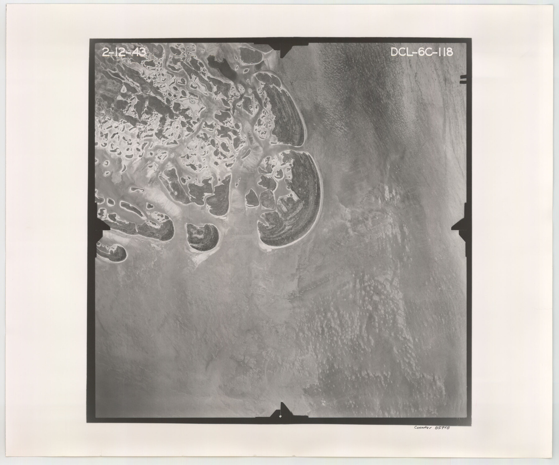
Flight Mission No. DCL-6C, Frame 118, Kenedy County
DCL-6C-118
-
Map/Doc
85948
-
Collection
General Map Collection
-
Object Dates
1943/2/12 (Creation Date)
-
People and Organizations
U. S. Department of Agriculture (Publisher)
-
Counties
Kenedy
-
Subjects
Aerial Photograph
-
Height x Width
18.6 x 22.4 inches
47.2 x 56.9 cm
-
Comments
Flown by Aerial Surveys of Pittsburgh, Inc. of Pittsburgh, Pennsylvania.
Part of: General Map Collection
Right of Way and Track Map Houston & Texas Central R.R. operated by the T. and N. O. R.R. Co., Fort Worth Branch

Print $40.00
- Digital $50.00
Right of Way and Track Map Houston & Texas Central R.R. operated by the T. and N. O. R.R. Co., Fort Worth Branch
1918
Size 31.4 x 58.5 inches
Map/Doc 64544
[Sketch for Mineral Application 35981 - Liberty County, John Mecom]
![65617, [Sketch for Mineral Application 35981 - Liberty County, John Mecom], General Map Collection](https://historictexasmaps.com/wmedia_w700/maps/65617.tif.jpg)
Print $20.00
- Digital $50.00
[Sketch for Mineral Application 35981 - Liberty County, John Mecom]
1941
Size 30.2 x 26.5 inches
Map/Doc 65617
Wilson County Sketch File 1

Print $6.00
- Digital $50.00
Wilson County Sketch File 1
1858
Size 10.4 x 7.5 inches
Map/Doc 40396
Brazoria County NRC Article 33.136 Sketch 6

Print $22.00
- Digital $50.00
Brazoria County NRC Article 33.136 Sketch 6
2004
Size 24.6 x 35.2 inches
Map/Doc 82904
Smith County Rolled Sketch 2

Print $20.00
- Digital $50.00
Smith County Rolled Sketch 2
Size 36.2 x 34.6 inches
Map/Doc 76010
San Luis Pass to East Matagorda Bay

Print $20.00
- Digital $50.00
San Luis Pass to East Matagorda Bay
1964
Size 34.7 x 46.6 inches
Map/Doc 69964
Fort Bend County State Real Property Sketch 14

Print $40.00
- Digital $50.00
Fort Bend County State Real Property Sketch 14
1985
Size 36.7 x 35.6 inches
Map/Doc 61688
Comanche County Working Sketch 19

Print $20.00
- Digital $50.00
Comanche County Working Sketch 19
1973
Size 28.9 x 40.3 inches
Map/Doc 68153
University Land Field Notes for Blocks K, L, M, and N in Hudspeth County

University Land Field Notes for Blocks K, L, M, and N in Hudspeth County
Map/Doc 81713
Lake Corpus Christi and a city map of Mathis, Texas [Verso]
![94171, Lake Corpus Christi and a city map of Mathis, Texas [Verso], General Map Collection](https://historictexasmaps.com/wmedia_w700/maps/94171.tif.jpg)
Lake Corpus Christi and a city map of Mathis, Texas [Verso]
1984
Size 29.3 x 22.9 inches
Map/Doc 94171
Kimble County Working Sketch 84

Print $20.00
- Digital $50.00
Kimble County Working Sketch 84
1972
Size 32.5 x 30.7 inches
Map/Doc 70152
Tarrant County State Real Property Sketch 3

Print $20.00
- Digital $50.00
Tarrant County State Real Property Sketch 3
2018
Size 35.1 x 23.8 inches
Map/Doc 95402
You may also like
Flight Mission No. BQY-4M, Frame 67, Harris County

Print $20.00
- Digital $50.00
Flight Mission No. BQY-4M, Frame 67, Harris County
1953
Size 18.7 x 22.4 inches
Map/Doc 85276
Rusk County Working Sketch 29a

Print $20.00
- Digital $50.00
Rusk County Working Sketch 29a
1933
Size 18.1 x 25.8 inches
Map/Doc 63665
Flight Mission No. CLL-1N, Frame 193, Willacy County

Print $20.00
- Digital $50.00
Flight Mission No. CLL-1N, Frame 193, Willacy County
1954
Size 18.4 x 22.2 inches
Map/Doc 87063
Flight Mission No. BRA-16M, Frame 168, Jefferson County

Print $20.00
- Digital $50.00
Flight Mission No. BRA-16M, Frame 168, Jefferson County
1953
Size 18.7 x 22.5 inches
Map/Doc 85766
Swisher County

Print $20.00
- Digital $50.00
Swisher County
1941
Size 45.2 x 38.0 inches
Map/Doc 63055
Bee County Sketch File 13

Print $4.00
- Digital $50.00
Bee County Sketch File 13
1876
Size 12.6 x 8.1 inches
Map/Doc 14295
Topographical Map of the City of Austin

Print $20.00
- Digital $50.00
Topographical Map of the City of Austin
1887
Size 43.1 x 41.1 inches
Map/Doc 2189
Nueces County Rolled Sketch 100
Print $20.00
- Digital $50.00
Nueces County Rolled Sketch 100
1937
Size 30.5 x 35.1 inches
Map/Doc 9634
The Judicial District/County of Smith. Created, February 1, 1842

Print $20.00
The Judicial District/County of Smith. Created, February 1, 1842
2020
Size 19.6 x 21.7 inches
Map/Doc 96346
Flight Mission No. DQO-8K, Frame 21, Galveston County

Print $20.00
- Digital $50.00
Flight Mission No. DQO-8K, Frame 21, Galveston County
1952
Size 18.6 x 22.3 inches
Map/Doc 85144
Flight Mission No. DCL-7C, Frame 39, Kenedy County

Print $20.00
- Digital $50.00
Flight Mission No. DCL-7C, Frame 39, Kenedy County
1943
Size 15.3 x 15.3 inches
Map/Doc 86027
Brewster County Rolled Sketch 152

Print $20.00
- Digital $50.00
Brewster County Rolled Sketch 152
1996
Size 28.0 x 36.5 inches
Map/Doc 5319