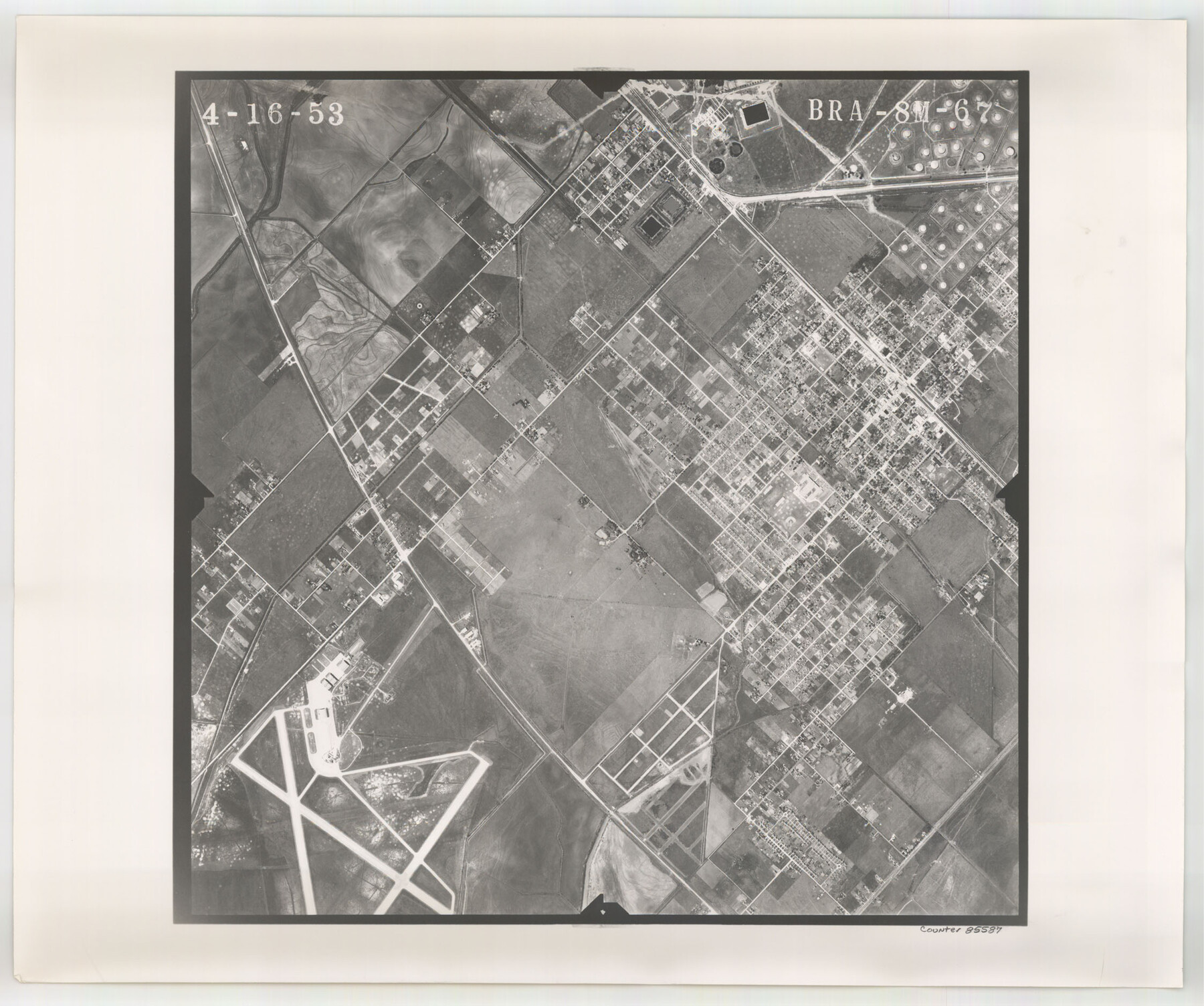
Flight Mission No. BRA-8M, Frame 67, Jefferson County
BRA-8M-67
-
Map/Doc
85587
-
Collection
General Map Collection
-
Object Dates
1953/4/16 (Creation Date)
-
People and Organizations
U. S. Department of Agriculture (Publisher)
-
Counties
Jefferson
-
Subjects
Aerial Photograph
-
Height x Width
18.8 x 22.5 inches
47.8 x 57.2 cm
-
Comments
Flown by Jack Ammann Photogrammetric Engineers of San Antonio, Texas.
Part of: General Map Collection
Shelby County Working Sketch 6

Print $20.00
- Digital $50.00
Shelby County Working Sketch 6
1941
Size 25.1 x 18.9 inches
Map/Doc 63859
Cherokee County Sketch File 7

Print $4.00
- Digital $50.00
Cherokee County Sketch File 7
Size 10.3 x 8.3 inches
Map/Doc 18128

Flight Mission No. CRC-3R, Frame 37, Chambers County

Print $20.00
- Digital $50.00
Flight Mission No. CRC-3R, Frame 37, Chambers County
1956
Size 18.6 x 22.4 inches
Map/Doc 84810

Edwards County Sketch File 43

Print $20.00
- Digital $50.00
Edwards County Sketch File 43
1947
Size 17.4 x 18.2 inches
Map/Doc 11441
Map of the Roman Empire to illustrate Ancient History, engraved for Olney's school atlas

Print $20.00
- Digital $50.00
Map of the Roman Empire to illustrate Ancient History, engraved for Olney's school atlas
1845
Size 12.1 x 19.0 inches
Map/Doc 93550
Red River County Working Sketch 14

Print $20.00
- Digital $50.00
Red River County Working Sketch 14
1952
Size 37.8 x 22.9 inches
Map/Doc 71997
Coleman County Boundary File 17 (1)

Print $52.00
- Digital $50.00
Coleman County Boundary File 17 (1)
Size 7.7 x 3.9 inches
Map/Doc 51628
Hays County Working Sketch 18

Print $20.00
- Digital $50.00
Hays County Working Sketch 18
1978
Size 33.4 x 32.0 inches
Map/Doc 66092
Flight Mission No. DAG-23K, Frame 173, Matagorda County

Print $20.00
- Digital $50.00
Flight Mission No. DAG-23K, Frame 173, Matagorda County
1953
Size 18.5 x 22.3 inches
Map/Doc 86511
Anderson County Sketch File 23

Print $10.00
- Digital $50.00
Anderson County Sketch File 23
1942
Size 11.2 x 8.7 inches
Map/Doc 12794
You may also like
[Blocks C, M and B, north of Morris County School Land]
![90488, [Blocks C, M and B, north of Morris County School Land], Twichell Survey Records](https://historictexasmaps.com/wmedia_w700/maps/90488-1.tif.jpg)
Print $20.00
- Digital $50.00
[Blocks C, M and B, north of Morris County School Land]
Size 20.0 x 15.0 inches
Map/Doc 90488
San Saba County Working Sketch 5

Print $20.00
- Digital $50.00
San Saba County Working Sketch 5
1945
Size 30.5 x 22.9 inches
Map/Doc 63793
Archer County Sketch File 8a

Print $8.00
- Digital $50.00
Archer County Sketch File 8a
Size 8.8 x 7.1 inches
Map/Doc 13639
General Highway Map, Harris County, Texas

Print $20.00
General Highway Map, Harris County, Texas
1939
Size 24.7 x 18.4 inches
Map/Doc 79115
Jefferson County

Print $20.00
- Digital $50.00
Jefferson County
1882
Size 22.8 x 20.0 inches
Map/Doc 3730
Irion County Rolled Sketch 11

Print $40.00
- Digital $50.00
Irion County Rolled Sketch 11
1945
Size 38.5 x 52.9 inches
Map/Doc 9252
Pecos County Working Sketch 102

Print $40.00
- Digital $50.00
Pecos County Working Sketch 102
1971
Size 36.9 x 52.7 inches
Map/Doc 71575
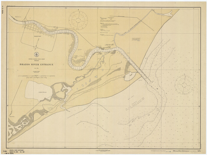
Brazos River Entrance
Print $20.00
- Digital $50.00
Brazos River Entrance
1925
Size 31.0 x 41.4 inches
Map/Doc 69974
Irion County Working Sketch 17

Print $20.00
- Digital $50.00
Irion County Working Sketch 17
1983
Size 37.4 x 41.6 inches
Map/Doc 66426

Howard County Sketch File 10

Print $20.00
- Digital $50.00
Howard County Sketch File 10
Size 22.5 x 22.0 inches
Map/Doc 11798
Stephens County Sketch File 15

Print $4.00
- Digital $50.00
Stephens County Sketch File 15
1890
Size 9.1 x 6.7 inches
Map/Doc 37068