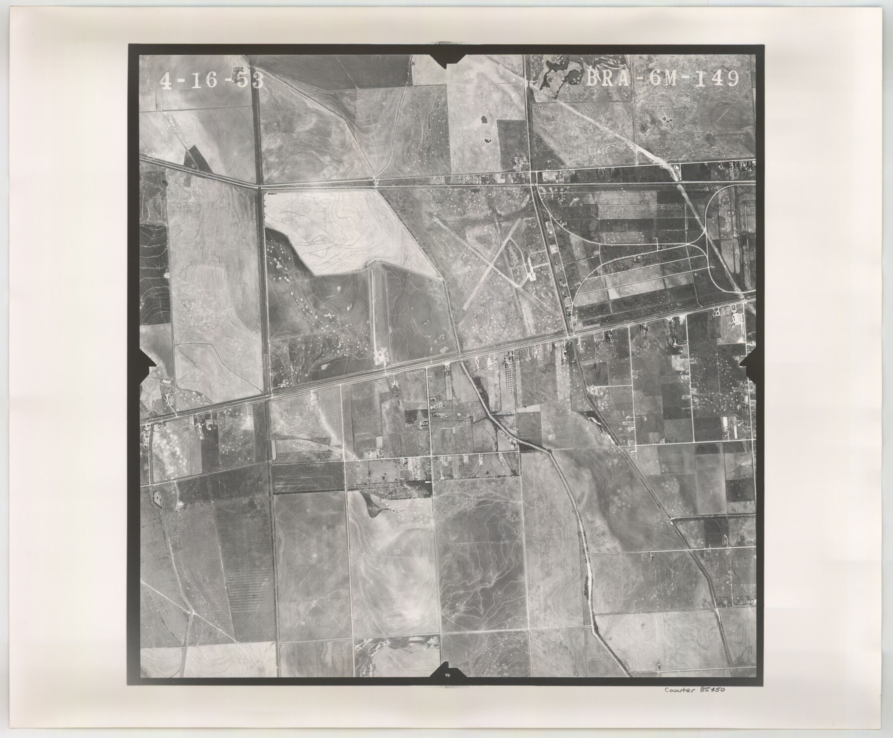
Flight Mission No. BRA-6M, Frame 149, Jefferson County
BRA-6M-149
-
Map/Doc
85450
-
Collection
General Map Collection
-
Object Dates
1953/4/16 (Creation Date)
-
People and Organizations
U. S. Department of Agriculture (Publisher)
-
Counties
Jefferson
-
Subjects
Aerial Photograph
-
Height x Width
18.5 x 22.3 inches
47.0 x 56.6 cm
-
Comments
Flown by Jack Ammann Photogrammetric Engineers of San Antonio, Texas.
Part of: General Map Collection
Nolan County Working Sketch 10

Print $40.00
- Digital $50.00
Nolan County Working Sketch 10
1971
Size 78.9 x 37.0 inches
Map/Doc 71301
Sutton County Rolled Sketch 54

Print $20.00
- Digital $50.00
Sutton County Rolled Sketch 54
Size 32.4 x 27.7 inches
Map/Doc 7894
Kleberg County, Cayo del Grullo

Print $20.00
- Digital $50.00
Kleberg County, Cayo del Grullo
1952
Size 32.6 x 29.0 inches
Map/Doc 73506
Flight Mission No. CUG-3P, Frame 39, Kleberg County

Print $20.00
- Digital $50.00
Flight Mission No. CUG-3P, Frame 39, Kleberg County
1956
Size 18.4 x 22.2 inches
Map/Doc 86244
Hardeman County Working Sketch 16

Print $20.00
- Digital $50.00
Hardeman County Working Sketch 16
1982
Size 35.7 x 45.1 inches
Map/Doc 63397
Corpus Christi Pass

Print $20.00
- Digital $50.00
Corpus Christi Pass
Size 46.2 x 41.4 inches
Map/Doc 78455
Maps of Gulf Intracoastal Waterway, Texas - Sabine River to the Rio Grande and connecting waterways including ship channels

Print $20.00
- Digital $50.00
Maps of Gulf Intracoastal Waterway, Texas - Sabine River to the Rio Grande and connecting waterways including ship channels
1966
Size 14.6 x 22.3 inches
Map/Doc 61957
Maps of Gulf Intracoastal Waterway, Texas - Sabine River to the Rio Grande and connecting waterways including ship channels

Print $20.00
- Digital $50.00
Maps of Gulf Intracoastal Waterway, Texas - Sabine River to the Rio Grande and connecting waterways including ship channels
1966
Size 14.5 x 22.1 inches
Map/Doc 61917
Topographical Map of the Rio Grande, Sheet No. 20

Print $20.00
- Digital $50.00
Topographical Map of the Rio Grande, Sheet No. 20
1912
Map/Doc 89544
Erath County Working Sketch 15

Print $20.00
- Digital $50.00
Erath County Working Sketch 15
1961
Size 19.8 x 15.4 inches
Map/Doc 69096
Sutton County Sketch File 18

Print $94.00
- Digital $50.00
Sutton County Sketch File 18
1893
Size 12.9 x 8.3 inches
Map/Doc 37410
Freestone County State Real Property Sketch 1

Print $20.00
- Digital $50.00
Freestone County State Real Property Sketch 1
1997
Size 24.3 x 35.2 inches
Map/Doc 80128
You may also like
Travis County Sketch File 15

Print $4.00
- Digital $50.00
Travis County Sketch File 15
Size 12.8 x 8.1 inches
Map/Doc 38310
Travis County Appraisal District Plat Map 1_1808

Print $20.00
- Digital $50.00
Travis County Appraisal District Plat Map 1_1808
Size 21.5 x 26.5 inches
Map/Doc 94214
Gregg County Rolled Sketch 13

Print $64.00
- Digital $50.00
Gregg County Rolled Sketch 13
1940
Size 10.5 x 15.5 inches
Map/Doc 45439
Camp County, Texas

Print $3.00
- Digital $50.00
Camp County, Texas
1879
Size 9.6 x 16.8 inches
Map/Doc 512
Bandera County Working Sketch 16d

Print $20.00
- Digital $50.00
Bandera County Working Sketch 16d
1941
Size 19.1 x 23.2 inches
Map/Doc 67612
Dinsmore & Company's New and Complete Map of the Railway System of the United States and Canada compiled from official sources, under the direction of the editor of the "American Railway Guide"

Print $20.00
- Digital $50.00
Dinsmore & Company's New and Complete Map of the Railway System of the United States and Canada compiled from official sources, under the direction of the editor of the "American Railway Guide"
1855
Size 16.3 x 20.4 inches
Map/Doc 95903
The Republic County of Rusk. February 1, 1845

Print $20.00
The Republic County of Rusk. February 1, 1845
2020
Size 19.1 x 21.7 inches
Map/Doc 96267
Nueces County Rolled Sketch 88

Print $20.00
- Digital $50.00
Nueces County Rolled Sketch 88
1983
Size 18.4 x 24.6 inches
Map/Doc 6990
Hutchinson County Sketch File 48

Print $38.00
- Digital $50.00
Hutchinson County Sketch File 48
1989
Size 11.2 x 8.8 inches
Map/Doc 27400
La Salle County Working Sketch 3

Print $20.00
- Digital $50.00
La Salle County Working Sketch 3
1914
Size 15.0 x 14.2 inches
Map/Doc 70304
Panola County Sketch File 1a

Print $4.00
- Digital $50.00
Panola County Sketch File 1a
1855
Size 12.7 x 7.9 inches
Map/Doc 33445
Lampasas County Sketch File 21

Print $14.00
- Digital $50.00
Lampasas County Sketch File 21
2001
Size 14.2 x 8.8 inches
Map/Doc 29436