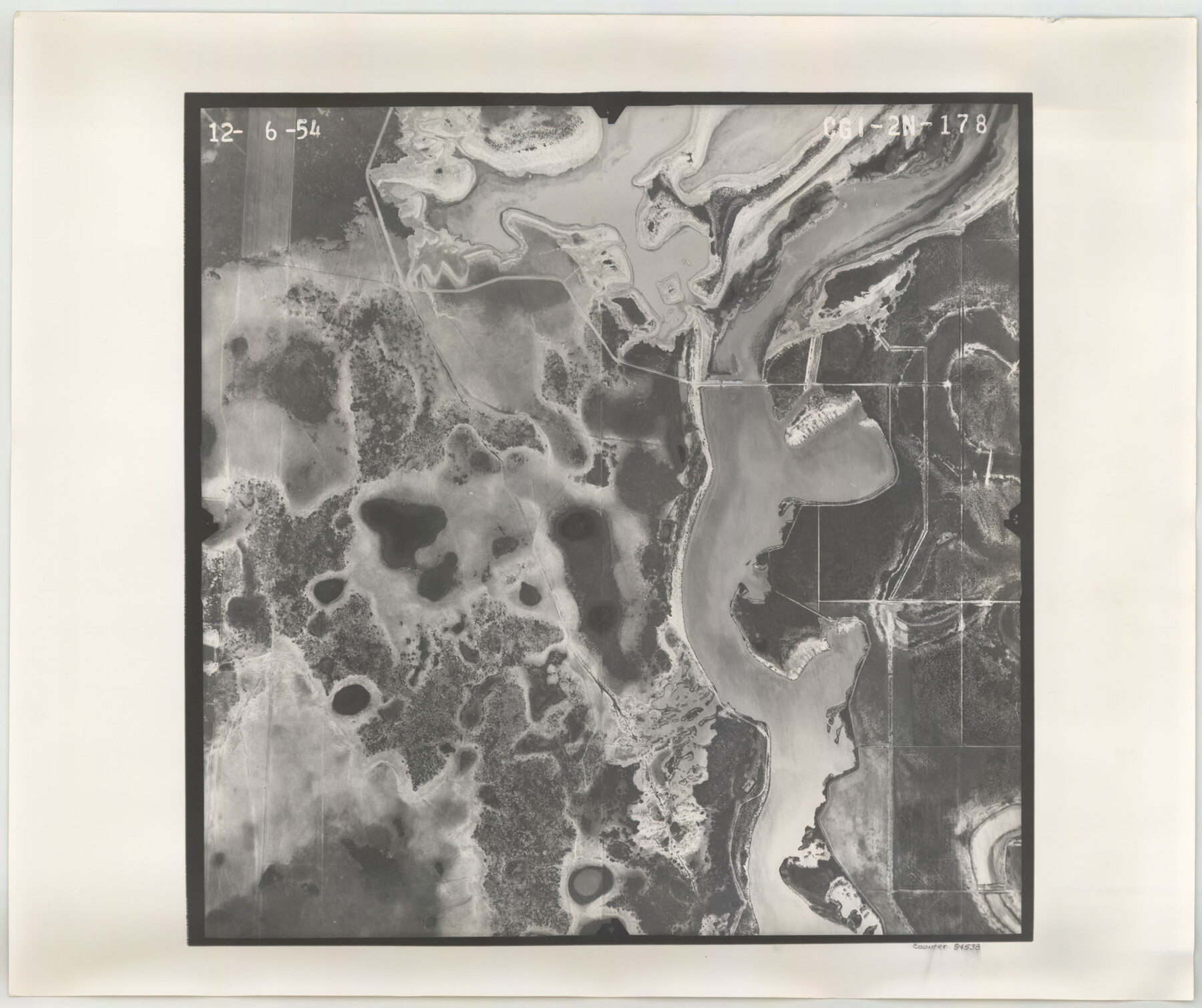
Flight Mission No. CGI-2N, Frame 178, Cameron County
CGI-2N-178
-
Map/Doc
84538
-
Collection
General Map Collection
-
Object Dates
1954/12/6 (Creation Date)
-
People and Organizations
U. S. Department of Agriculture (Publisher)
-
Counties
Cameron
-
Subjects
Aerial Photograph
-
Height x Width
18.5 x 22.1 inches
47.0 x 56.1 cm
-
Comments
Flown by Puckett Aerial Surveys, Inc. of Jackson, Mississippi.
Part of: General Map Collection
Houston County

Print $20.00
- Digital $50.00
Houston County
1868
Size 24.3 x 25.0 inches
Map/Doc 4568
Harris County Working Sketch 62

Print $20.00
- Digital $50.00
Harris County Working Sketch 62
1954
Size 41.1 x 37.4 inches
Map/Doc 65954
Concho County Sketch File 5

Print $2.00
- Digital $50.00
Concho County Sketch File 5
1858
Size 8.1 x 7.4 inches
Map/Doc 82974
Map of Coryell Co.

Print $40.00
- Digital $50.00
Map of Coryell Co.
1896
Size 48.0 x 46.2 inches
Map/Doc 66786
Wilbarger County Working Sketch 3

Print $20.00
- Digital $50.00
Wilbarger County Working Sketch 3
1923
Size 22.0 x 23.9 inches
Map/Doc 72541
Flight Mission No. DCL-6C, Frame 12, Kenedy County

Print $20.00
- Digital $50.00
Flight Mission No. DCL-6C, Frame 12, Kenedy County
1943
Size 18.7 x 22.4 inches
Map/Doc 85869
Chambers County Sketch File 37

Print $20.00
- Digital $50.00
Chambers County Sketch File 37
Size 25.0 x 43.8 inches
Map/Doc 10333
Yoakum County Rolled Sketch 2

Print $20.00
- Digital $50.00
Yoakum County Rolled Sketch 2
1943
Size 18.6 x 33.4 inches
Map/Doc 8288
Reeves County Working Sketch 24

Print $40.00
- Digital $50.00
Reeves County Working Sketch 24
1966
Size 38.7 x 76.5 inches
Map/Doc 63467
Map of Fannin County

Print $20.00
- Digital $50.00
Map of Fannin County
1845
Size 34.7 x 36.5 inches
Map/Doc 16827
Tom Green County Rolled Sketch 29

Print $20.00
- Digital $50.00
Tom Green County Rolled Sketch 29
Size 17.8 x 23.4 inches
Map/Doc 93646
Port Facilities at Texas City, Tex.

Print $20.00
- Digital $50.00
Port Facilities at Texas City, Tex.
Size 13.9 x 15.9 inches
Map/Doc 97161
You may also like
Clay County Sketch File 29

Print $16.00
- Digital $50.00
Clay County Sketch File 29
Size 11.3 x 8.7 inches
Map/Doc 18448
From Citizens of Austin and Harris Counties Living in What Was to Become Fort Bend County for the Creation of a New County (Unnamed), Undated

Print $20.00
From Citizens of Austin and Harris Counties Living in What Was to Become Fort Bend County for the Creation of a New County (Unnamed), Undated
2020
Size 22.6 x 21.7 inches
Map/Doc 96399
Flight Mission No. DAG-23K, Frame 181, Matagorda County

Print $20.00
- Digital $50.00
Flight Mission No. DAG-23K, Frame 181, Matagorda County
1953
Size 18.7 x 22.4 inches
Map/Doc 86516
[Plat of Location and Right of Way from El Paso, Tex. To New Mexico Line, Rio Grande and El Paso R. R.]
![64082, [Plat of Location and Right of Way from El Paso, Tex. To New Mexico Line, Rio Grande and El Paso R. R.], General Map Collection](https://historictexasmaps.com/wmedia_w700/maps/64082.tif.jpg)
Print $40.00
- Digital $50.00
[Plat of Location and Right of Way from El Paso, Tex. To New Mexico Line, Rio Grande and El Paso R. R.]
Size 23.8 x 122.6 inches
Map/Doc 64082
General Highway Map, Liberty County, Texas

Print $20.00
General Highway Map, Liberty County, Texas
1940
Size 24.6 x 18.3 inches
Map/Doc 79173
Crockett County Sketch File 95

Print $24.00
- Digital $50.00
Crockett County Sketch File 95
Size 11.2 x 8.9 inches
Map/Doc 19952
Rusk County Sketch File 35

Print $6.00
Rusk County Sketch File 35
1950
Size 11.3 x 8.8 inches
Map/Doc 35573
Rusk County Sketch File 8

Print $4.00
Rusk County Sketch File 8
1856
Size 12.7 x 8.2 inches
Map/Doc 35503
Live Oak County Working Sketch 5

Print $20.00
- Digital $50.00
Live Oak County Working Sketch 5
1911
Size 25.1 x 35.6 inches
Map/Doc 70590
Presidio County Working Sketch 111

Print $20.00
- Digital $50.00
Presidio County Working Sketch 111
1981
Size 17.1 x 20.4 inches
Map/Doc 71788
King County Working Sketch Graphic Index

Print $20.00
- Digital $50.00
King County Working Sketch Graphic Index
1947
Size 44.2 x 39.5 inches
Map/Doc 76608
Map of the Town of Harrold, Wilbarger County, Texas on the line of the Fort Worth and Denver City Railway

Print $20.00
- Digital $50.00
Map of the Town of Harrold, Wilbarger County, Texas on the line of the Fort Worth and Denver City Railway
1887
Size 31.2 x 28.6 inches
Map/Doc 2186