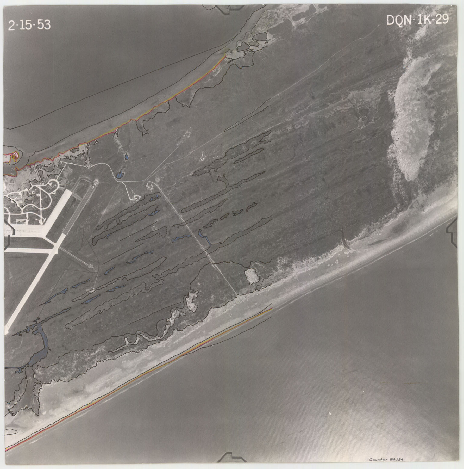
Flight Mission No. DQN-1K, Frame 29, Calhoun County
DQN-1K-29
-
Map/Doc
84134
-
Collection
General Map Collection
-
Object Dates
1953/2/15 (Creation Date)
-
People and Organizations
U. S. Department of Agriculture (Publisher)
-
Counties
Calhoun
-
Subjects
Aerial Photograph
-
Height x Width
15.5 x 15.3 inches
39.4 x 38.9 cm
-
Comments
Flown by Aero Exploration Company of Tulsa, Oklahoma.
Part of: General Map Collection
Cochran County

Print $20.00
- Digital $50.00
Cochran County
1899
Size 40.9 x 32.6 inches
Map/Doc 4744
Flight Mission No. DCL-7C, Frame 116, Kenedy County

Print $20.00
- Digital $50.00
Flight Mission No. DCL-7C, Frame 116, Kenedy County
1943
Size 18.6 x 22.4 inches
Map/Doc 86081
Nolan County Sketch File 15

Print $20.00
- Digital $50.00
Nolan County Sketch File 15
1929
Size 24.5 x 22.6 inches
Map/Doc 42165
Fannin County Sketch File 25

Print $4.00
- Digital $50.00
Fannin County Sketch File 25
1847
Size 8.5 x 10.9 inches
Map/Doc 22493
Matagorda County Sketch File 29

Print $20.00
- Digital $50.00
Matagorda County Sketch File 29
1909
Size 33.4 x 27.9 inches
Map/Doc 12044
Menard County Boundary File 13

Print $32.00
- Digital $50.00
Menard County Boundary File 13
Size 8.9 x 9.4 inches
Map/Doc 57121
Montague County Rolled Sketch 8

Print $20.00
- Digital $50.00
Montague County Rolled Sketch 8
Size 25.4 x 21.8 inches
Map/Doc 6792
Flight Mission No. BRE-1P, Frame 119, Nueces County

Print $20.00
- Digital $50.00
Flight Mission No. BRE-1P, Frame 119, Nueces County
1956
Size 18.7 x 22.7 inches
Map/Doc 86685
Bowie County Sketch File 8b

Print $6.00
- Digital $50.00
Bowie County Sketch File 8b
1927
Size 6.2 x 9.9 inches
Map/Doc 14875
Kent County Boundary File 2

Print $4.00
- Digital $50.00
Kent County Boundary File 2
Size 10.1 x 8.2 inches
Map/Doc 55822
Trinity County Sketch File 40

Print $20.00
- Digital $50.00
Trinity County Sketch File 40
1926
Size 16.5 x 21.8 inches
Map/Doc 12494
Haskell County Working Sketch 13

Print $20.00
- Digital $50.00
Haskell County Working Sketch 13
1983
Size 33.0 x 41.8 inches
Map/Doc 66071
You may also like
Flight Mission No. CRK-8P, Frame 121, Refugio County

Print $20.00
- Digital $50.00
Flight Mission No. CRK-8P, Frame 121, Refugio County
1956
Size 18.3 x 22.2 inches
Map/Doc 86976
Lynn County Boundary File 7b

Print $8.00
- Digital $50.00
Lynn County Boundary File 7b
Size 11.3 x 8.6 inches
Map/Doc 56651
Edwards County Working Sketch 102

Print $20.00
- Digital $50.00
Edwards County Working Sketch 102
1971
Size 35.0 x 25.5 inches
Map/Doc 68978
Lubbock County

Print $20.00
- Digital $50.00
Lubbock County
1915
Size 46.1 x 40.0 inches
Map/Doc 66911
Kendall County Sketch File 20

Print $42.00
- Digital $50.00
Kendall County Sketch File 20
1916
Size 9.7 x 6.3 inches
Map/Doc 28713
Map Showing Blocks 15, 16 & 18 S.P.R.R.Co.

Print $20.00
- Digital $50.00
Map Showing Blocks 15, 16 & 18 S.P.R.R.Co.
1933
Size 24.7 x 19.1 inches
Map/Doc 92282
Wichita County Sketch File 12a

Print $10.00
- Digital $50.00
Wichita County Sketch File 12a
1881
Size 14.2 x 8.6 inches
Map/Doc 40077
El Paso County Rolled Sketch 52

Print $20.00
- Digital $50.00
El Paso County Rolled Sketch 52
1929
Size 18.4 x 24.4 inches
Map/Doc 5842
Kerr County Rolled Sketch 15

Print $20.00
- Digital $50.00
Kerr County Rolled Sketch 15
1951
Size 14.8 x 20.8 inches
Map/Doc 7720
Panola County Working Sketch 3

Print $20.00
- Digital $50.00
Panola County Working Sketch 3
1935
Map/Doc 71412
Sterling County Rolled Sketch 29

Print $20.00
- Digital $50.00
Sterling County Rolled Sketch 29
Size 30.0 x 23.5 inches
Map/Doc 7854
Hutchinson County Working Sketch 2

Print $20.00
- Digital $50.00
Hutchinson County Working Sketch 2
Size 32.0 x 18.9 inches
Map/Doc 66360