Menard County Boundary File 13
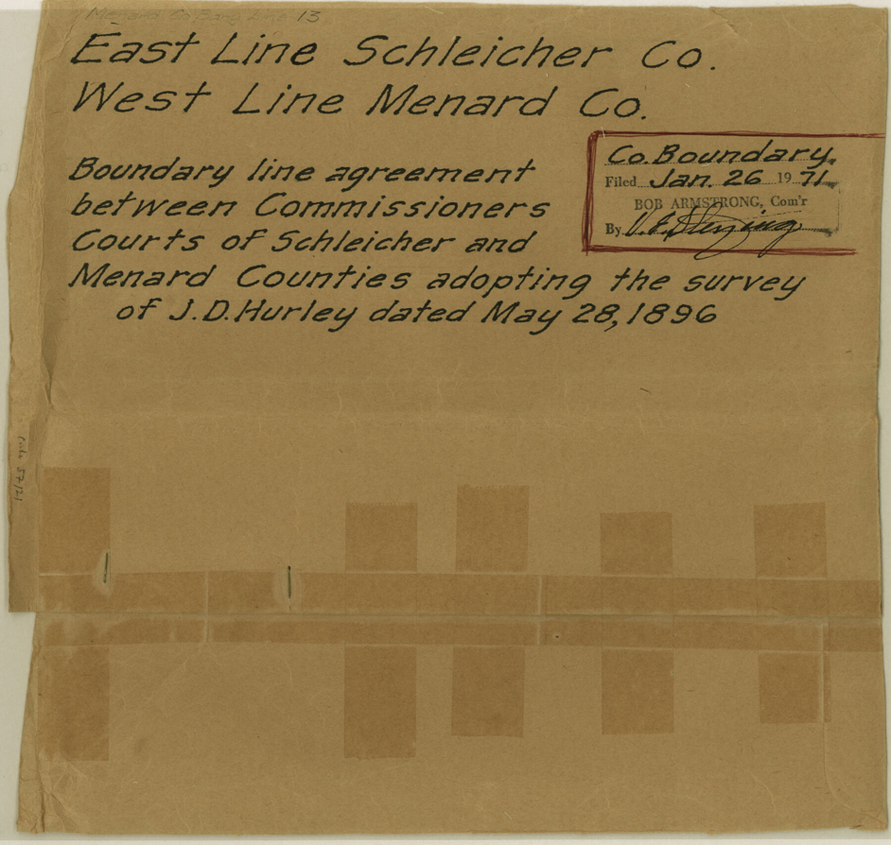
East Line Schleicher Co. West Line Menard Co., Boundary line agreement between Commissioners Courts of Schleicher and Menard Counties adopting the survey of J. D. Hurley dated May 28, 1896
-
Map/Doc
57121
-
Collection
General Map Collection
-
Counties
Menard
-
Subjects
County Boundaries
-
Height x Width
8.9 x 9.4 inches
22.6 x 23.9 cm
Part of: General Map Collection
Map of Colorado County

Print $20.00
- Digital $50.00
Map of Colorado County
1864
Size 22.1 x 25.0 inches
Map/Doc 3423
Flight Mission No. BQY-4M, Frame 65, Harris County

Print $20.00
- Digital $50.00
Flight Mission No. BQY-4M, Frame 65, Harris County
1953
Size 18.7 x 22.4 inches
Map/Doc 85274
Andrews County Rolled Sketch 14A

Print $20.00
- Digital $50.00
Andrews County Rolled Sketch 14A
1934
Size 31.2 x 23.6 inches
Map/Doc 77165

University Land Field Notes for Blocks 21 through 26 in Pecos County

University Land Field Notes for Blocks 21 through 26 in Pecos County
Map/Doc 81722
Upton County Rolled Sketch 36A

Print $40.00
- Digital $50.00
Upton County Rolled Sketch 36A
1952
Size 43.5 x 65.8 inches
Map/Doc 10661
[Missouri, Kansas & Texas] E. L. & R. R. Railroad, Morris Co.
![64273, [Missouri, Kansas & Texas] E. L. & R. R. Railroad, Morris Co., General Map Collection](https://historictexasmaps.com/wmedia_w700/maps/64273.tif.jpg)
Print $20.00
- Digital $50.00
[Missouri, Kansas & Texas] E. L. & R. R. Railroad, Morris Co.
1906
Size 13.1 x 28.4 inches
Map/Doc 64273
Travis County

Print $40.00
- Digital $50.00
Travis County
1936
Size 43.2 x 54.6 inches
Map/Doc 63078
Flight Mission No. CRC-3R, Frame 91, Chambers County

Print $20.00
- Digital $50.00
Flight Mission No. CRC-3R, Frame 91, Chambers County
1956
Size 18.7 x 22.4 inches
Map/Doc 84829
San Patricio County Working Sketch 21

Print $20.00
- Digital $50.00
San Patricio County Working Sketch 21
1981
Size 19.7 x 14.5 inches
Map/Doc 63783
Duval County Sketch File 51

Print $20.00
- Digital $50.00
Duval County Sketch File 51
Size 19.1 x 33.8 inches
Map/Doc 11401
Crane County State of Texas

Print $20.00
- Digital $50.00
Crane County State of Texas
1889
Size 22.9 x 17.6 inches
Map/Doc 4524
You may also like
Map of Cherokee County, Texas

Print $20.00
- Digital $50.00
Map of Cherokee County, Texas
1879
Size 30.8 x 24.0 inches
Map/Doc 696
Gregg County Sketch File 11

Print $12.00
- Digital $50.00
Gregg County Sketch File 11
1933
Size 14.4 x 8.9 inches
Map/Doc 24591
Fayette County Boundary File 6

Print $20.00
- Digital $50.00
Fayette County Boundary File 6
Size 14.4 x 9.0 inches
Map/Doc 53391
Amistad International Reservoir on Rio Grande 89b

Print $20.00
- Digital $50.00
Amistad International Reservoir on Rio Grande 89b
1950
Size 28.4 x 40.7 inches
Map/Doc 75519
[Area along West County Line]
![90832, [Area along West County Line], Twichell Survey Records](https://historictexasmaps.com/wmedia_w700/maps/90832-2.tif.jpg)
Print $2.00
- Digital $50.00
[Area along West County Line]
Size 6.0 x 9.6 inches
Map/Doc 90832
General Highway Map. Detail of Cities and Towns in Waller County, Texas [Hempstead and vicinity]
![79701, General Highway Map. Detail of Cities and Towns in Waller County, Texas [Hempstead and vicinity], Texas State Library and Archives](https://historictexasmaps.com/wmedia_w700/maps/79701.tif.jpg)
Print $20.00
General Highway Map. Detail of Cities and Towns in Waller County, Texas [Hempstead and vicinity]
1961
Size 24.8 x 18.2 inches
Map/Doc 79701
Colorado County Working Sketch 3

Print $20.00
- Digital $50.00
Colorado County Working Sketch 3
1911
Size 23.2 x 19.2 inches
Map/Doc 68103
Van Zandt County Working Sketch 7

Print $20.00
- Digital $50.00
Van Zandt County Working Sketch 7
1953
Size 17.7 x 18.1 inches
Map/Doc 72257
Nueces County Rolled Sketch 100

Print $20.00
- Digital $50.00
Nueces County Rolled Sketch 100
Size 30.6 x 40.7 inches
Map/Doc 10209
General Highway Map of Gaines County, Texas

Print $20.00
- Digital $50.00
General Highway Map of Gaines County, Texas
1951
Size 19.0 x 26.2 inches
Map/Doc 92644
Crockett County Sketch File 47

Print $6.00
- Digital $50.00
Crockett County Sketch File 47
1882
Size 14.3 x 8.8 inches
Map/Doc 19789
Knox County Boundary File 3

Print $54.00
- Digital $50.00
Knox County Boundary File 3
Size 8.9 x 7.7 inches
Map/Doc 65019