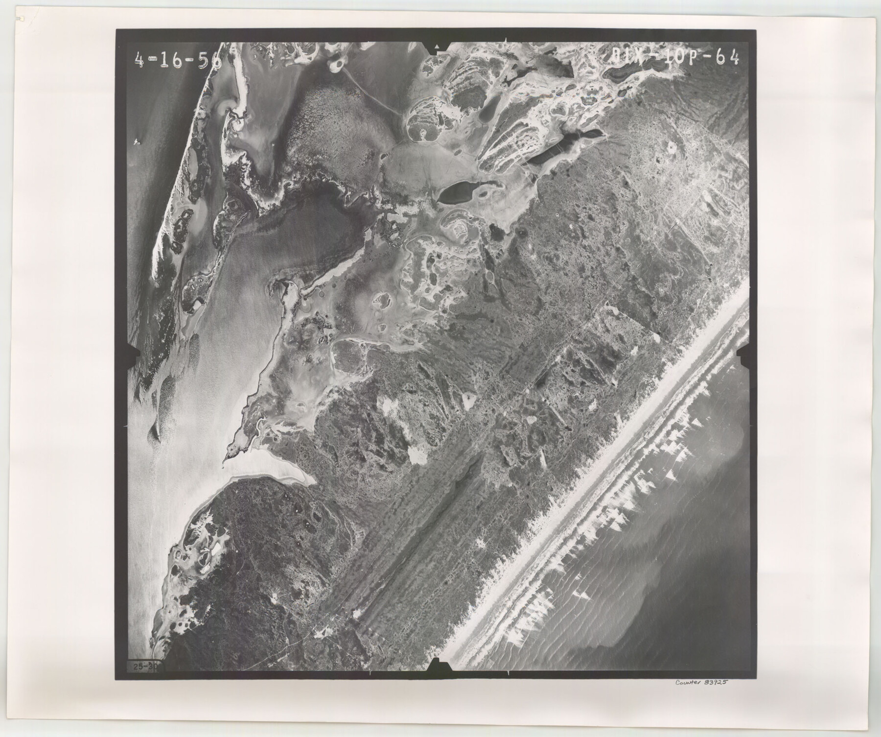
Flight Mission No. DIX-10P, Frame 64, Aransas County
DIX-10P-64
-
Map/Doc
83925
-
Collection
General Map Collection
-
Object Dates
1956/4/16 (Creation Date)
-
People and Organizations
U. S. Department of Agriculture (Publisher)
-
Counties
Aransas
-
Subjects
Aerial Photograph
-
Height x Width
18.7 x 22.3 inches
47.5 x 56.6 cm
-
Comments
Flown by V. L. Beavers and Associates of San Antonio, Texas.
Part of: General Map Collection
Stephens County Boundary File 3

Print $25.00
- Digital $50.00
Stephens County Boundary File 3
Size 14.2 x 8.8 inches
Map/Doc 58882
Wood County Sketch File 13

Print $24.00
- Digital $50.00
Wood County Sketch File 13
1866
Size 12.5 x 7.6 inches
Map/Doc 40668
Brewster County Rolled Sketch 83

Print $20.00
- Digital $50.00
Brewster County Rolled Sketch 83
1946
Size 43.4 x 43.7 inches
Map/Doc 8495
Map accompanying report of scout made by 2nd Lt. F. de I. Carrington. 1st Infantry

Print $20.00
- Digital $50.00
Map accompanying report of scout made by 2nd Lt. F. de I. Carrington. 1st Infantry
1881
Size 22.2 x 18.0 inches
Map/Doc 65407
Upton County Rolled Sketch 56

Print $158.00
- Digital $50.00
Upton County Rolled Sketch 56
1934
Size 10.0 x 15.1 inches
Map/Doc 49413
Liberty County Working Sketch 32

Print $20.00
- Digital $50.00
Liberty County Working Sketch 32
1945
Size 29.1 x 46.3 inches
Map/Doc 70491
Wichita County Rolled Sketch 6

Print $20.00
- Digital $50.00
Wichita County Rolled Sketch 6
Size 12.9 x 18.5 inches
Map/Doc 8243
Knox County Working Sketch 19

Print $20.00
- Digital $50.00
Knox County Working Sketch 19
1992
Size 25.0 x 35.6 inches
Map/Doc 70261
Fannin County

Print $20.00
- Digital $50.00
Fannin County
1946
Size 42.3 x 37.4 inches
Map/Doc 73145
Flight Mission No. CRK-3P, Frame 63, Refugio County

Print $20.00
- Digital $50.00
Flight Mission No. CRK-3P, Frame 63, Refugio County
1956
Size 18.5 x 22.4 inches
Map/Doc 86905
Cameron County Working Sketch 3

Print $20.00
- Digital $50.00
Cameron County Working Sketch 3
1964
Size 40.8 x 38.6 inches
Map/Doc 67882
Map of Harrison County

Print $20.00
- Digital $50.00
Map of Harrison County
1840
Size 44.6 x 34.5 inches
Map/Doc 1515
You may also like
Plat in Pecos County, Texas

Print $40.00
- Digital $50.00
Plat in Pecos County, Texas
1927
Size 58.3 x 37.9 inches
Map/Doc 89877
Map of Hutchinson County

Print $20.00
- Digital $50.00
Map of Hutchinson County
1898
Size 41.0 x 35.4 inches
Map/Doc 16856
Bowie County Working Sketch 16

Print $20.00
- Digital $50.00
Bowie County Working Sketch 16
1961
Size 17.8 x 17.2 inches
Map/Doc 67420
Rusk County Rolled Sketch 14

Print $20.00
- Digital $50.00
Rusk County Rolled Sketch 14
1997
Size 27.8 x 37.8 inches
Map/Doc 7549
Zapata County Rolled Sketch 23

Print $55.00
- Digital $50.00
Zapata County Rolled Sketch 23
Size 9.6 x 13.0 inches
Map/Doc 49630
Brazos River, East Waco Sheet

Print $6.00
- Digital $50.00
Brazos River, East Waco Sheet
1928
Size 31.6 x 25.9 inches
Map/Doc 65283
Castro County

Print $20.00
- Digital $50.00
Castro County
1932
Size 39.2 x 34.4 inches
Map/Doc 77234
Trinity River, Kaufman Sheet/Kings Creek

Print $6.00
- Digital $50.00
Trinity River, Kaufman Sheet/Kings Creek
1930
Size 32.6 x 27.0 inches
Map/Doc 65228
Flight Mission No. BRA-7M, Frame 75, Jefferson County

Print $20.00
- Digital $50.00
Flight Mission No. BRA-7M, Frame 75, Jefferson County
1953
Size 18.6 x 22.2 inches
Map/Doc 85497
Pecos County Rolled Sketch 177

Print $20.00
- Digital $50.00
Pecos County Rolled Sketch 177
1972
Size 27.4 x 38.0 inches
Map/Doc 7297
Ellwood Farms Subdivision Number 2 of the Spade Ranch

Print $20.00
- Digital $50.00
Ellwood Farms Subdivision Number 2 of the Spade Ranch
Size 21.9 x 31.4 inches
Map/Doc 90986
Concho County Sketch File 16

Print $20.00
- Digital $50.00
Concho County Sketch File 16
Size 8.2 x 18.6 inches
Map/Doc 11151