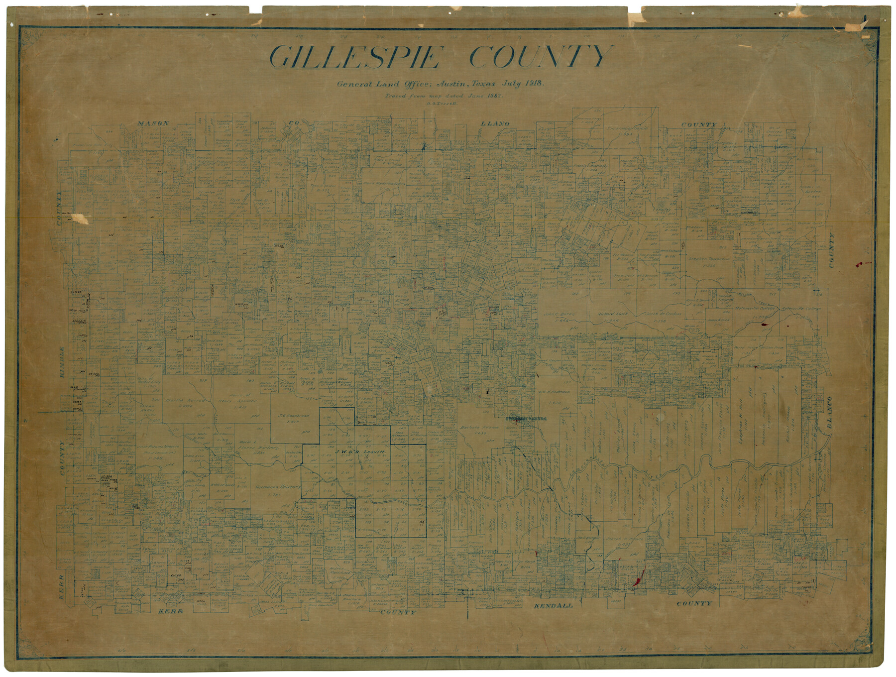
Gillespie County
-
Map/Doc
81950
-
Collection
General Map Collection
-
Object Dates
7/1918 (Creation Date)
-
People and Organizations
O.O. Terrell (Tracer)
-
Counties
Gillespie
-
Subjects
County
-
Height x Width
35.8 x 47.4 inches
90.9 x 120.4 cm
-
Comments
Traced from a map dated June 1887.
-
Features
Cain City
Baron's Creek
Live Oak Creek
Little Live Oak Creek
Flag Creek
North Pedernales River
Indian Creek
Cypress Creek
White Oak Creek
Spring Creek
Wolf's Creek
Deleware [sic] Creek
Large Creek
Bear Creek
Fredericksburg
Pedernales River
Grape Creek
Prong of Grape Creek
William's Creek
SAF&N
Bears Creek
Cottonwood Creek
Llano Road
West Prong of Mormon Creek
Wolf Creek
North Prong of Westgate Creek
Stone Branch of Pedernales River
SAF&N
Legion Creek
Mesquite Creek
Onion Creek
Threadgill's Creek
Mormon Creek
Walnut Creek
Squaw Creek
Cherry Spring Branch of Hickory Creek
Hickory Creek
Mica Creek
Enchanted Rock
Sandy Creek
Crabapple Creek
Road from Fredericksburg to Llano
Salt Creek
Legion
Mount Nebo
Coal Creek
Mount Hudson
Fredericksburg Road
Eduard's Creek
North Prong Threadgil's Creek
West Prong Crabapple Creek
Palo Alto Creek
Marshall Creek
Willow Creek
North Grape Creek
Iron Stone Branch [of Pedernales River]
Part of: General Map Collection
Montgomery County

Print $20.00
- Digital $50.00
Montgomery County
1901
Size 42.8 x 45.9 inches
Map/Doc 10794
La Salle County Working Sketch 25

Print $20.00
- Digital $50.00
La Salle County Working Sketch 25
1947
Size 32.8 x 41.0 inches
Map/Doc 70326
Flight Mission No. DQN-5K, Frame 79, Calhoun County

Print $20.00
- Digital $50.00
Flight Mission No. DQN-5K, Frame 79, Calhoun County
1953
Size 18.5 x 22.2 inches
Map/Doc 84412
Midland County Working Sketch 2

Print $20.00
- Digital $50.00
Midland County Working Sketch 2
Size 40.4 x 25.2 inches
Map/Doc 70982
Flight Mission No. DQO-3K, Frame 15, Galveston County

Print $20.00
- Digital $50.00
Flight Mission No. DQO-3K, Frame 15, Galveston County
1952
Size 18.7 x 22.4 inches
Map/Doc 85056
Cherokee County Sketch File 23

Print $20.00
- Digital $50.00
Cherokee County Sketch File 23
1922
Size 12.8 x 18.5 inches
Map/Doc 11073
Val Verde County Sketch File 45

Print $20.00
- Digital $50.00
Val Verde County Sketch File 45
1938
Size 21.3 x 16.5 inches
Map/Doc 12586
Kleberg County Rolled Sketch 10-25

Print $20.00
- Digital $50.00
Kleberg County Rolled Sketch 10-25
1952
Size 38.1 x 35.8 inches
Map/Doc 9365
Harris County Rolled Sketch 88

Print $20.00
- Digital $50.00
Harris County Rolled Sketch 88
1933
Size 34.6 x 23.1 inches
Map/Doc 6464
Flight Mission No. BRA-7M, Frame 20, Jefferson County

Print $20.00
- Digital $50.00
Flight Mission No. BRA-7M, Frame 20, Jefferson County
1953
Size 18.6 x 22.2 inches
Map/Doc 85471
Location St. L. & S. W. R. R. Through Cherokee County

Print $40.00
- Digital $50.00
Location St. L. & S. W. R. R. Through Cherokee County
Size 108.6 x 39.0 inches
Map/Doc 64043
Culberson County Working Sketch 15

Print $20.00
- Digital $50.00
Culberson County Working Sketch 15
1923
Size 19.9 x 21.5 inches
Map/Doc 68467
You may also like
Maverick County Working Sketch 1

Print $20.00
- Digital $50.00
Maverick County Working Sketch 1
1906
Size 11.5 x 11.1 inches
Map/Doc 70893
The Republic County of Matagorda. Refined, January 25, 1841

Print $20.00
The Republic County of Matagorda. Refined, January 25, 1841
2020
Size 19.3 x 21.8 inches
Map/Doc 96221
Zavala County Rolled Sketch 32

Print $20.00
- Digital $50.00
Zavala County Rolled Sketch 32
Size 22.5 x 38.2 inches
Map/Doc 8333
San Patricio County Rolled Sketch 38

Print $20.00
- Digital $50.00
San Patricio County Rolled Sketch 38
1950
Size 15.6 x 15.7 inches
Map/Doc 7588
Aransas County Sketch File 27

Print $23.00
- Digital $50.00
Aransas County Sketch File 27
Size 12.2 x 18.2 inches
Map/Doc 13224
Map of Falls County

Print $20.00
- Digital $50.00
Map of Falls County
1855
Size 21.4 x 23.9 inches
Map/Doc 3532
Gregg County Rolled Sketch 14

Print $20.00
- Digital $50.00
Gregg County Rolled Sketch 14
1940
Size 42.4 x 14.1 inches
Map/Doc 6037
Orange County Working Sketch 27

Print $20.00
- Digital $50.00
Orange County Working Sketch 27
1953
Size 31.0 x 22.9 inches
Map/Doc 71359
General Highway Map, King County, Texas

Print $20.00
General Highway Map, King County, Texas
1961
Size 18.2 x 24.6 inches
Map/Doc 79555
Flight Mission No. DAG-26K, Frame 80, Matagorda County

Print $20.00
- Digital $50.00
Flight Mission No. DAG-26K, Frame 80, Matagorda County
1953
Size 18.5 x 22.3 inches
Map/Doc 86585
Val Verde County Sketch File 28

Print $20.00
- Digital $50.00
Val Verde County Sketch File 28
Size 29.9 x 25.1 inches
Map/Doc 12573
Palo Pinto County Sketch File 22

Print $20.00
- Digital $50.00
Palo Pinto County Sketch File 22
1939
Size 19.6 x 15.0 inches
Map/Doc 12134