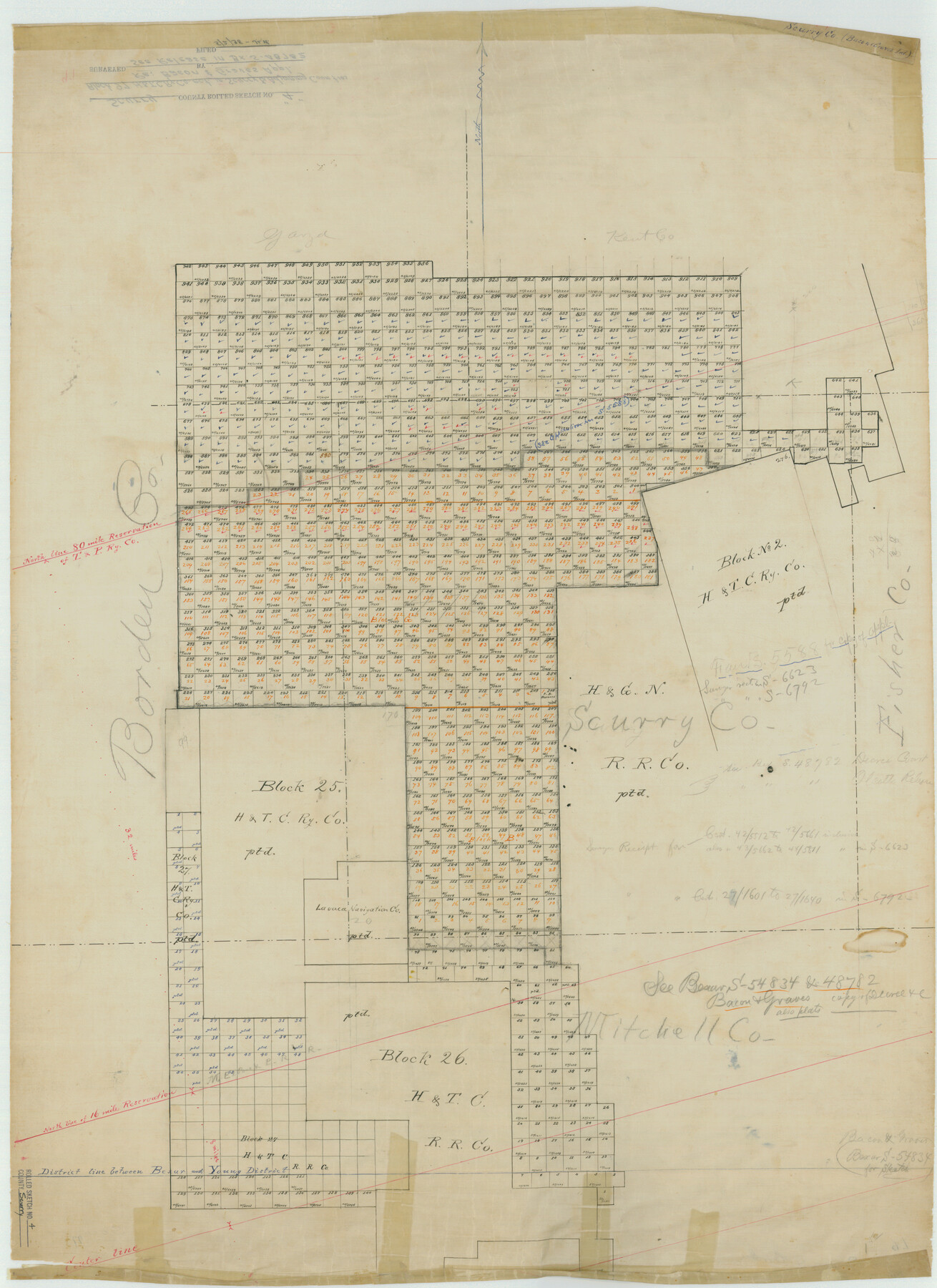
Scurry County Rolled Sketch 4
[Block 97, H. & T. C. R.R. Co. in Scurry and surrounding counties]
-
Map/Doc
7765
-
Collection
General Map Collection
-
Counties
Scurry Borden Kent Garza Mitchell
-
Subjects
Surveying Rolled Sketch
-
Height x Width
35.7 x 26.0 inches
90.7 x 66.0 cm
-
Medium
linen, manuscript
Part of: General Map Collection
Kimble County Working Sketch 56

Print $20.00
- Digital $50.00
Kimble County Working Sketch 56
1957
Size 34.6 x 41.9 inches
Map/Doc 70124
Brewster County Rolled Sketch 92

Print $20.00
- Digital $50.00
Brewster County Rolled Sketch 92
1950
Size 24.3 x 15.2 inches
Map/Doc 5250
Midland County Working Sketch Graphic Index

Print $20.00
- Digital $50.00
Midland County Working Sketch Graphic Index
1930
Size 43.3 x 35.3 inches
Map/Doc 76641
Lynn County Sketch File 14

Print $12.00
- Digital $50.00
Lynn County Sketch File 14
1916
Size 14.1 x 8.7 inches
Map/Doc 30491
Pecos County Working Sketch 123

Print $20.00
- Digital $50.00
Pecos County Working Sketch 123
1973
Size 42.4 x 24.2 inches
Map/Doc 71596
Pecos County Working Sketch 93

Print $40.00
- Digital $50.00
Pecos County Working Sketch 93
1966
Size 32.1 x 71.5 inches
Map/Doc 71566
Brewster County Rolled Sketch 29
Print $20.00
- Digital $50.00
Brewster County Rolled Sketch 29
1910
Size 17.5 x 18.5 inches
Map/Doc 5216
Fort Bend County Working Sketch 14

Print $20.00
- Digital $50.00
Fort Bend County Working Sketch 14
1948
Size 37.4 x 32.7 inches
Map/Doc 69220
Flight Mission No. DIX-10P, Frame 63, Aransas County

Print $20.00
- Digital $50.00
Flight Mission No. DIX-10P, Frame 63, Aransas County
1956
Size 18.7 x 22.3 inches
Map/Doc 83924
Coast Chart No. 212 - From Latitude 26° 33' to the Rio Grande Texas

Print $20.00
- Digital $50.00
Coast Chart No. 212 - From Latitude 26° 33' to the Rio Grande Texas
1886
Size 18.3 x 24.1 inches
Map/Doc 72835
Bell County Sketch File 35

Print $40.00
- Digital $50.00
Bell County Sketch File 35
1952
Size 22.0 x 24.3 inches
Map/Doc 10918
Texas Coordinate File 8

Print $4.00
- Digital $50.00
Texas Coordinate File 8
Size 11.3 x 8.7 inches
Map/Doc 75318
You may also like
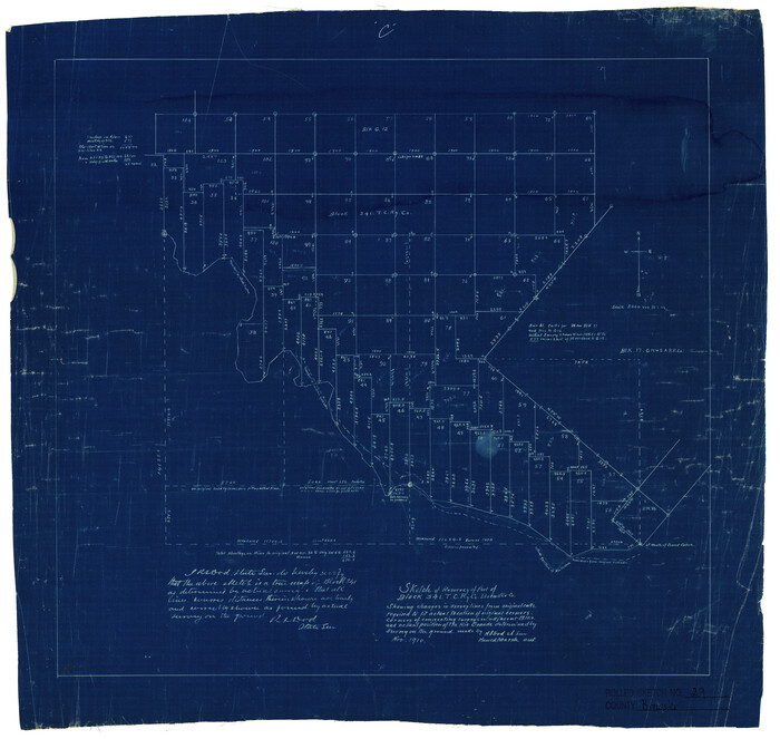
Fisher County Sketch File 19a

Print $42.00
- Digital $50.00
Fisher County Sketch File 19a
1898
Size 14.1 x 8.9 inches
Map/Doc 22595
Dallam County Sketch File 11

Print $4.00
- Digital $50.00
Dallam County Sketch File 11
1935
Size 11.8 x 7.2 inches
Map/Doc 20377
Colorado County Rolled Sketch 3

Print $20.00
- Digital $50.00
Colorado County Rolled Sketch 3
1943
Size 43.6 x 40.2 inches
Map/Doc 8642
Gregg County Sketch File 15

Print $6.00
- Digital $50.00
Gregg County Sketch File 15
1946
Size 14.3 x 8.8 inches
Map/Doc 24616
Trinity River, Walker's Lake Sheet/Richland Creek

Print $20.00
- Digital $50.00
Trinity River, Walker's Lake Sheet/Richland Creek
1931
Size 25.9 x 41.2 inches
Map/Doc 65226
Hardin County Sketch File 33

Print $20.00
- Digital $50.00
Hardin County Sketch File 33
Size 25.4 x 35.4 inches
Map/Doc 11632
Pecos County Rolled Sketch 168

Print $40.00
- Digital $50.00
Pecos County Rolled Sketch 168
Size 73.5 x 44.7 inches
Map/Doc 9748
Panola County Rolled Sketch 8

Print $20.00
- Digital $50.00
Panola County Rolled Sketch 8
1986
Size 20.1 x 18.0 inches
Map/Doc 7201
Cooke County Rolled Sketch 8

Print $20.00
- Digital $50.00
Cooke County Rolled Sketch 8
2003
Size 24.5 x 36.2 inches
Map/Doc 78649
Pecos County Rolled Sketch 26A

Print $40.00
- Digital $50.00
Pecos County Rolled Sketch 26A
1890
Size 56.4 x 19.5 inches
Map/Doc 9689
Uvalde County Working Sketch 66

Print $20.00
- Digital $50.00
Uvalde County Working Sketch 66
1942
Size 20.9 x 21.3 inches
Map/Doc 75968
[T. & P. RR. Co. Blocks 31-36, Townships 3N, 4N and 5N and surrounding area]
![93135, [T. & P. RR. Co. Blocks 31-36, Townships 3N, 4N and 5N and surrounding area], Twichell Survey Records](https://historictexasmaps.com/wmedia_w700/maps/93135-1.tif.jpg)
Print $40.00
- Digital $50.00
[T. & P. RR. Co. Blocks 31-36, Townships 3N, 4N and 5N and surrounding area]
Size 51.3 x 51.5 inches
Map/Doc 93135