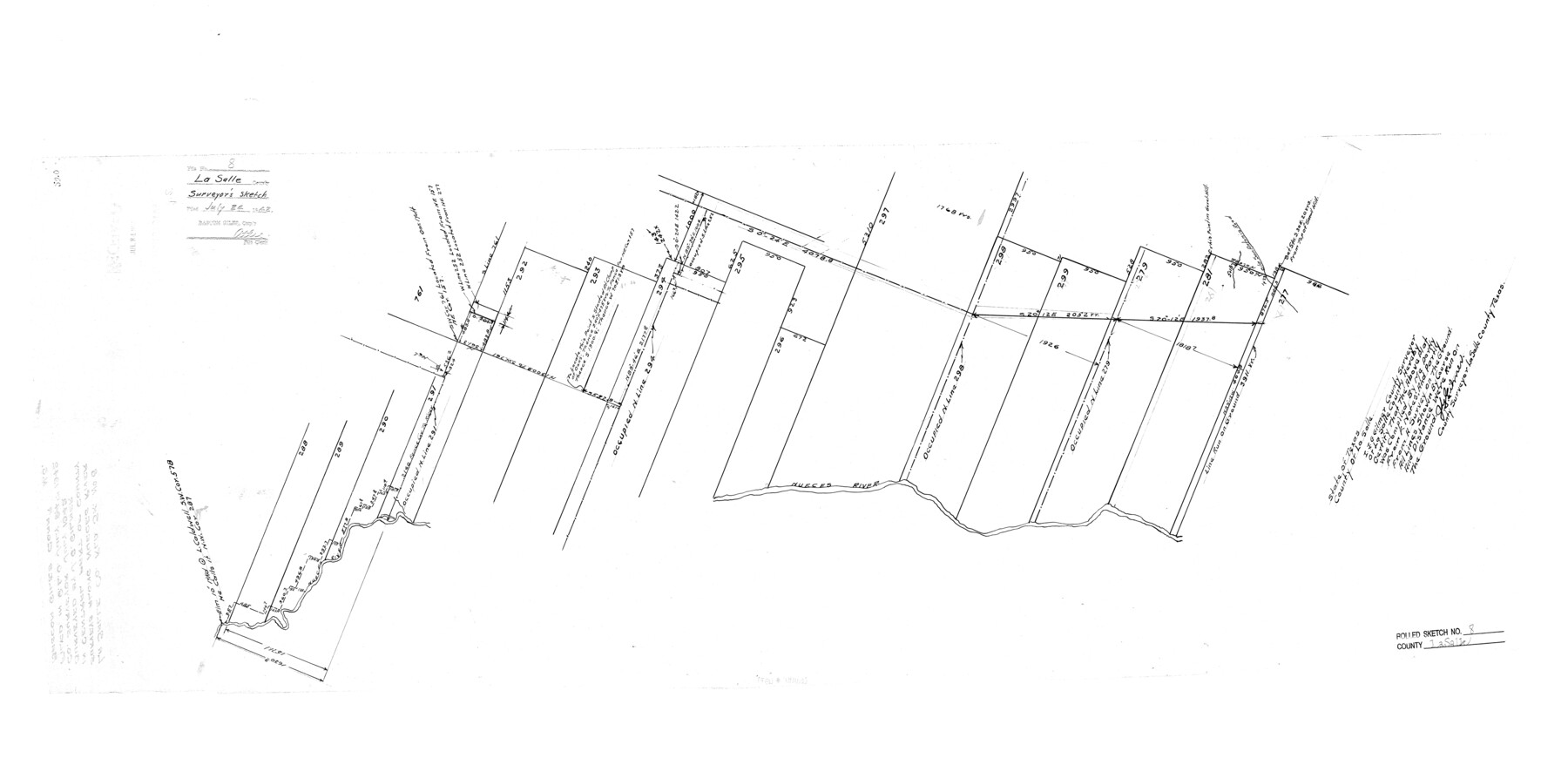
La Salle County Rolled Sketch 8
[Sketch of surveys along Nueces River in central part of La Salle County, Texas]
-
Map/Doc
6571
-
Collection
General Map Collection
-
Object Dates
1942/7/24 (File Date)
-
People and Organizations
J.G. Gilmer (Surveyor/Engineer)
-
Counties
La Salle
-
Subjects
Surveying Rolled Sketch
-
Height x Width
21.4 x 43.9 inches
54.4 x 111.5 cm
Part of: General Map Collection
Moore County Working Sketch 11

Print $20.00
- Digital $50.00
Moore County Working Sketch 11
1951
Size 33.1 x 29.8 inches
Map/Doc 71193
Leon County Working Sketch 5

Print $20.00
- Digital $50.00
Leon County Working Sketch 5
1905
Size 40.5 x 20.6 inches
Map/Doc 70404
Eastland County Working Sketch 40

Print $20.00
- Digital $50.00
Eastland County Working Sketch 40
1970
Size 27.9 x 26.0 inches
Map/Doc 68821
Wood County Working Sketch 12

Print $20.00
- Digital $50.00
Wood County Working Sketch 12
1964
Size 37.4 x 34.5 inches
Map/Doc 62012
[Sketch for Mineral Application 1112 - Colorado River, H. E. Chambers]
![65641, [Sketch for Mineral Application 1112 - Colorado River, H. E. Chambers], General Map Collection](https://historictexasmaps.com/wmedia_w700/maps/65641.tif.jpg)
Print $20.00
- Digital $50.00
[Sketch for Mineral Application 1112 - Colorado River, H. E. Chambers]
1918
Size 17.4 x 28.5 inches
Map/Doc 65641
Collingsworth County Working Sketch 2

Print $20.00
- Digital $50.00
Collingsworth County Working Sketch 2
1957
Size 42.5 x 20.1 inches
Map/Doc 63761
Wood County Rolled Sketch 4

Print $20.00
- Digital $50.00
Wood County Rolled Sketch 4
1943
Size 37.0 x 29.2 inches
Map/Doc 8283
Amistad International Reservoir on Rio Grande 94

Print $20.00
- Digital $50.00
Amistad International Reservoir on Rio Grande 94
1950
Size 28.6 x 41.0 inches
Map/Doc 75524
[Gulf, Colorado & Santa Fe]
![64592, [Gulf, Colorado & Santa Fe], General Map Collection](https://historictexasmaps.com/wmedia_w700/maps/64592.tif.jpg)
Print $40.00
- Digital $50.00
[Gulf, Colorado & Santa Fe]
1918
Size 33.2 x 110.5 inches
Map/Doc 64592
Henderson County Sketch File 2

Print $20.00
- Digital $50.00
Henderson County Sketch File 2
1850
Size 21.6 x 17.1 inches
Map/Doc 11755
Clay County Working Sketch 5

Print $20.00
- Digital $50.00
Clay County Working Sketch 5
1923
Size 41.2 x 35.9 inches
Map/Doc 68028
Maps of Gulf Intracoastal Waterway, Texas - Sabine River to the Rio Grande and connecting waterways including ship channels

Print $20.00
- Digital $50.00
Maps of Gulf Intracoastal Waterway, Texas - Sabine River to the Rio Grande and connecting waterways including ship channels
1966
Size 14.5 x 22.2 inches
Map/Doc 61960
You may also like
Southern Part of Laguna Madre

Print $20.00
- Digital $50.00
Southern Part of Laguna Madre
1981
Size 45.1 x 35.8 inches
Map/Doc 73546
Upton County Working Sketch 53

Print $20.00
- Digital $50.00
Upton County Working Sketch 53
1983
Size 26.8 x 31.2 inches
Map/Doc 69550
[Map showing T&P Lands in El Paso County]
![88937, [Map showing T&P Lands in El Paso County], Library of Congress](https://historictexasmaps.com/wmedia_w700/maps/88937.tif.jpg)
Print $20.00
[Map showing T&P Lands in El Paso County]
Size 22.3 x 17.3 inches
Map/Doc 88937
San Patricio County Rolled Sketch 25

Print $40.00
- Digital $50.00
San Patricio County Rolled Sketch 25
1925
Size 37.2 x 54.1 inches
Map/Doc 9887
Callahan County Working Sketch 12

Print $20.00
- Digital $50.00
Callahan County Working Sketch 12
1969
Size 25.6 x 38.5 inches
Map/Doc 67894
G. C. & S. F. Ry. Northern-Division, Alignment and Right of Way Map, Weatherford Branch, Johnson and Hood Counties, Texas

Print $40.00
- Digital $50.00
G. C. & S. F. Ry. Northern-Division, Alignment and Right of Way Map, Weatherford Branch, Johnson and Hood Counties, Texas
1935
Size 37.8 x 100.5 inches
Map/Doc 64649
Reeves County Sketch File 19

Print $9.00
- Digital $50.00
Reeves County Sketch File 19
1958
Size 11.3 x 8.9 inches
Map/Doc 35212
New Map of Texas with the Contiguous American and Mexican States

Print $20.00
- Digital $50.00
New Map of Texas with the Contiguous American and Mexican States
1836
Size 13.7 x 19.7 inches
Map/Doc 76795
A Traveler's Map of Spain and Portugal

A Traveler's Map of Spain and Portugal
Size 36.1 x 22.9 inches
Map/Doc 95937
Chambers County Rolled Sketch 7

Print $20.00
- Digital $50.00
Chambers County Rolled Sketch 7
Size 39.8 x 23.1 inches
Map/Doc 8611
[Wilson Strickland Survey]
![91374, [Wilson Strickland Survey], Twichell Survey Records](https://historictexasmaps.com/wmedia_w700/maps/91374-1.tif.jpg)
Print $20.00
- Digital $50.00
[Wilson Strickland Survey]
Size 38.1 x 31.5 inches
Map/Doc 91374
Nueces County Sketch File 26a

Print $14.00
- Digital $50.00
Nueces County Sketch File 26a
1894
Size 12.6 x 7.9 inches
Map/Doc 32581