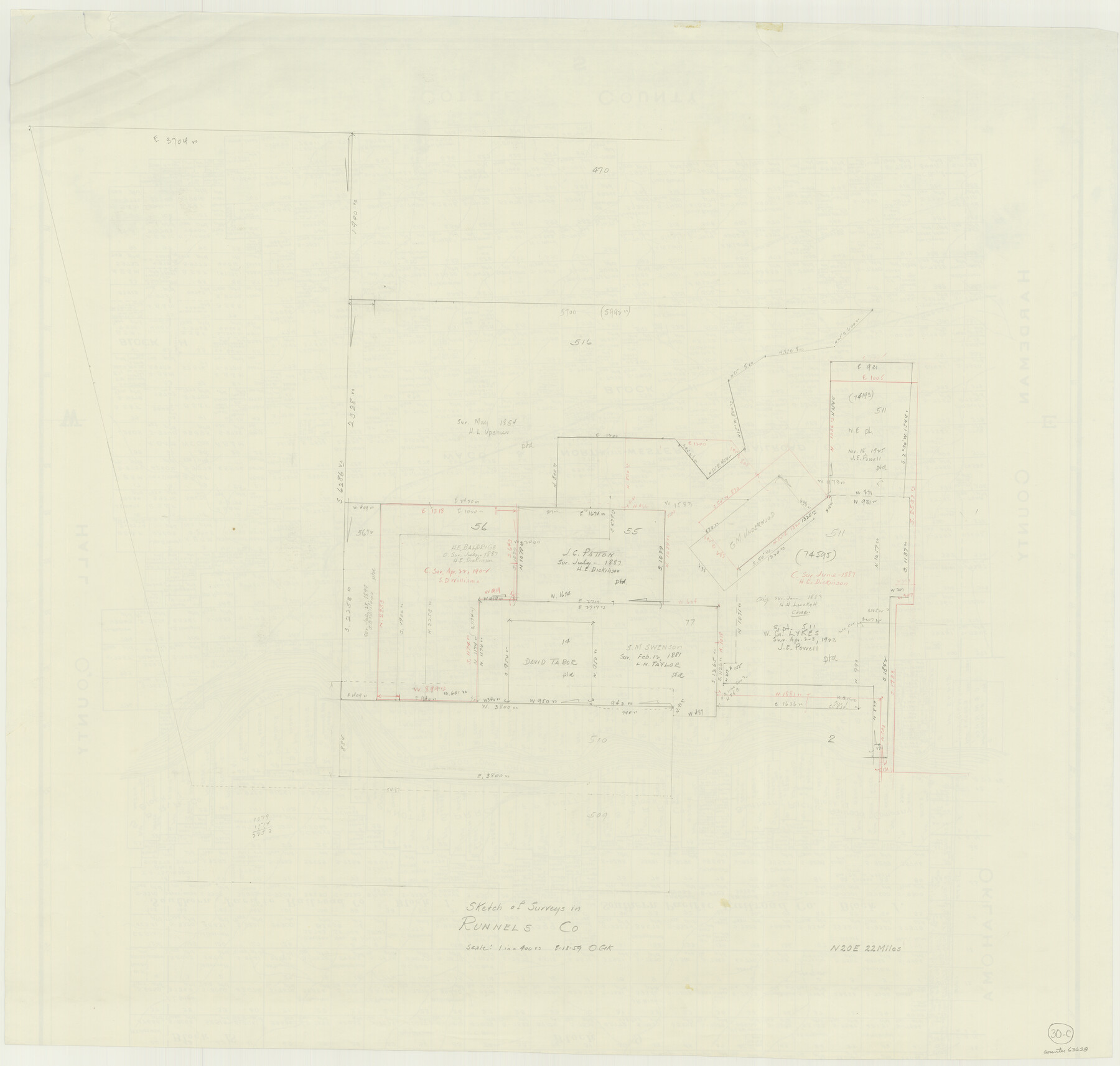
Runnels County Working Sketch 30c
-
Map/Doc
63628
-
Collection
General Map Collection
-
Object Dates
8/18/1959 (Creation Date)
-
People and Organizations
Otto G. Kurio (Draftsman)
-
Counties
Runnels
-
Subjects
Surveying Working Sketch
-
Height x Width
30.5 x 32.1 inches
77.5 x 81.5 cm
-
Scale
1" = 400 varas
Part of: General Map Collection

Lamar County Sketch File 12

Print $20.00
- Digital $50.00
Lamar County Sketch File 12
Size 19.5 x 23.3 inches
Map/Doc 11967
Menard County

Print $20.00
- Digital $50.00
Menard County
1942
Size 41.2 x 43.4 inches
Map/Doc 73238
Map showing resurvey of Capitol Leagues, Oldham Co., Texas

Print $40.00
- Digital $50.00
Map showing resurvey of Capitol Leagues, Oldham Co., Texas
1918
Size 38.6 x 51.0 inches
Map/Doc 1755
Nueces County Sketch File 38

Print $16.00
- Digital $50.00
Nueces County Sketch File 38
1931
Size 8.7 x 11.2 inches
Map/Doc 32615
Kimble County Working Sketch 13

Print $20.00
- Digital $50.00
Kimble County Working Sketch 13
1922
Size 23.8 x 20.8 inches
Map/Doc 70081
Flight Mission No. CRK-5P, Frame 158, Refugio County

Print $20.00
- Digital $50.00
Flight Mission No. CRK-5P, Frame 158, Refugio County
1956
Size 18.6 x 22.5 inches
Map/Doc 86939
Dimmit County Working Sketch 40

Print $40.00
- Digital $50.00
Dimmit County Working Sketch 40
1968
Size 42.9 x 59.0 inches
Map/Doc 68701
Map of east part of West Bay & SW part of Galveston Bay, Galveston County showing subdivision for mineral development

Print $20.00
- Digital $50.00
Map of east part of West Bay & SW part of Galveston Bay, Galveston County showing subdivision for mineral development
1951
Size 32.6 x 37.6 inches
Map/Doc 2975
Map of Waller County

Print $20.00
- Digital $50.00
Map of Waller County
1897
Size 46.7 x 28.9 inches
Map/Doc 16915
Gaines County Rolled Sketch 21

Print $20.00
- Digital $50.00
Gaines County Rolled Sketch 21
Size 29.0 x 24.9 inches
Map/Doc 5937
Jefferson County Sketch File 15a

Print $8.00
- Digital $50.00
Jefferson County Sketch File 15a
1872
Size 15.6 x 6.7 inches
Map/Doc 28156
You may also like
Motley County Sketch File F (S)

Print $14.00
- Digital $50.00
Motley County Sketch File F (S)
1904
Size 9.1 x 5.9 inches
Map/Doc 32179
Upton County Working Sketch 7

Print $20.00
- Digital $50.00
Upton County Working Sketch 7
1912
Size 26.3 x 29.9 inches
Map/Doc 69503
Jeff Davis County Sketch File 20

Print $56.00
- Digital $50.00
Jeff Davis County Sketch File 20
1923
Size 11.2 x 8.8 inches
Map/Doc 27978
Henderson County Rolled Sketch 11

Print $20.00
- Digital $50.00
Henderson County Rolled Sketch 11
1915
Size 29.4 x 42.6 inches
Map/Doc 75955
Newton County Working Sketch 2

Print $20.00
- Digital $50.00
Newton County Working Sketch 2
1905
Size 14.5 x 19.3 inches
Map/Doc 71248
San Jacinto County Working Sketch 2

Print $20.00
- Digital $50.00
San Jacinto County Working Sketch 2
1917
Size 18.7 x 15.9 inches
Map/Doc 63715
Flight Mission No. DQN-2K, Frame 190, Calhoun County

Print $20.00
- Digital $50.00
Flight Mission No. DQN-2K, Frame 190, Calhoun County
1953
Size 18.5 x 22.2 inches
Map/Doc 84331
Travis County Sketch File 44

Print $20.00
- Digital $50.00
Travis County Sketch File 44
1927
Size 21.6 x 19.3 inches
Map/Doc 12466
Fractional Township No. 8 South Range No. 15 East of the Indian Meridian, Indian Territory

Print $20.00
- Digital $50.00
Fractional Township No. 8 South Range No. 15 East of the Indian Meridian, Indian Territory
1896
Size 19.1 x 24.3 inches
Map/Doc 75227
Orange County Sketch File 24

Print $6.00
- Digital $50.00
Orange County Sketch File 24
Size 8.9 x 15.7 inches
Map/Doc 33353
Haskell County Working Sketch 10

Print $20.00
- Digital $50.00
Haskell County Working Sketch 10
1961
Size 26.8 x 20.4 inches
Map/Doc 66068
Val Verde County Working Sketch 88

Print $20.00
- Digital $50.00
Val Verde County Working Sketch 88
1973
Size 29.0 x 36.9 inches
Map/Doc 72223