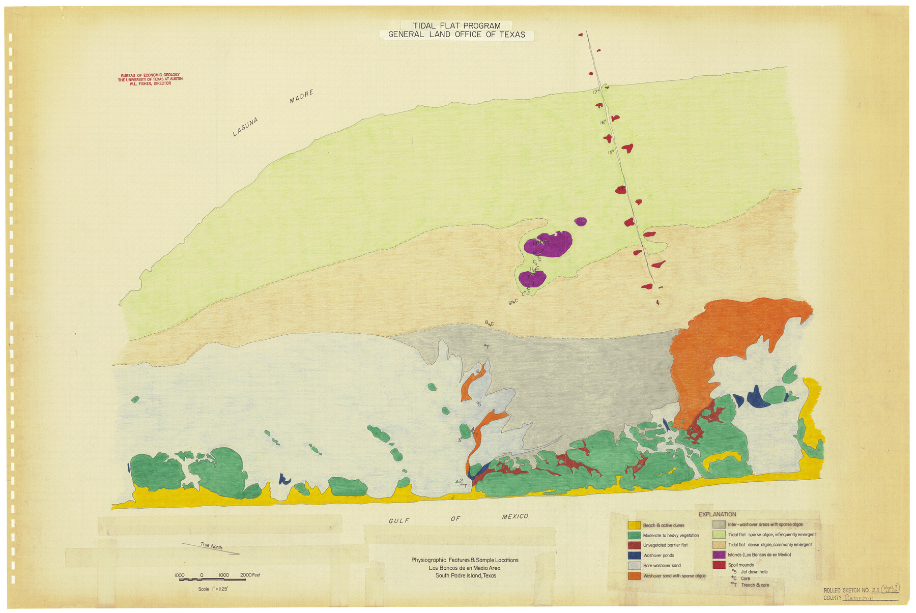
Cameron County Rolled Sketch 25
Physiographic Features & Sample Locations, Los Bancos de en Medio Area, South Padre Island, Texas [Page 3 of 10]
-
Map/Doc
5792
-
Collection
General Map Collection
-
Object Dates
1977 (Creation Date)
12/6/1983 (File Date)
-
People and Organizations
Bureau of Economic Geology, University of Texas (Publisher)
W.L. Fisher (Author)
-
Counties
Cameron
-
Subjects
Surveying Rolled Sketch
-
Height x Width
24.8 x 36.8 inches
63.0 x 93.5 cm
-
Medium
paper, etching/engraving/lithograph
-
Comments
See maps 5790-5799 for all sheets in this set.
Related maps
Cameron County Rolled Sketch 25

Print $20.00
- Digital $50.00
Cameron County Rolled Sketch 25
1977
Size 17.5 x 27.5 inches
Map/Doc 5790
Cameron County Rolled Sketch 25

Print $40.00
- Digital $50.00
Cameron County Rolled Sketch 25
1977
Size 25.0 x 72.9 inches
Map/Doc 5791
Cameron County Rolled Sketch 25

Print $20.00
- Digital $50.00
Cameron County Rolled Sketch 25
1977
Size 24.5 x 30.4 inches
Map/Doc 5793
Cameron County Rolled Sketch 25

Print $20.00
- Digital $50.00
Cameron County Rolled Sketch 25
1977
Size 24.9 x 36.7 inches
Map/Doc 5794
Cameron County Rolled Sketch 25

Print $20.00
- Digital $50.00
Cameron County Rolled Sketch 25
1977
Size 24.7 x 36.7 inches
Map/Doc 5795
Cameron County Rolled Sketch 25

Print $20.00
- Digital $50.00
Cameron County Rolled Sketch 25
1977
Size 24.6 x 36.7 inches
Map/Doc 5796
Cameron County Rolled Sketch 25

Print $20.00
- Digital $50.00
Cameron County Rolled Sketch 25
1977
Size 24.8 x 36.5 inches
Map/Doc 5797
Cameron County Rolled Sketch 25

Print $20.00
- Digital $50.00
Cameron County Rolled Sketch 25
1977
Size 24.8 x 36.6 inches
Map/Doc 5798
Cameron County Rolled Sketch 25

Print $20.00
- Digital $50.00
Cameron County Rolled Sketch 25
1977
Size 24.9 x 36.7 inches
Map/Doc 5799
Part of: General Map Collection
Flight Mission No. CRC-5R, Frame 20, Chambers County

Print $20.00
- Digital $50.00
Flight Mission No. CRC-5R, Frame 20, Chambers County
1956
Size 18.8 x 22.4 inches
Map/Doc 84942
Gillespie County

Print $40.00
- Digital $50.00
Gillespie County
1887
Size 38.9 x 49.8 inches
Map/Doc 4956
Baylor County Boundary File 1

Print $25.00
- Digital $50.00
Baylor County Boundary File 1
Size 9.3 x 8.4 inches
Map/Doc 50347
Map of Titus County

Print $20.00
- Digital $50.00
Map of Titus County
1857
Size 23.8 x 34.3 inches
Map/Doc 4857
Map of Panola County
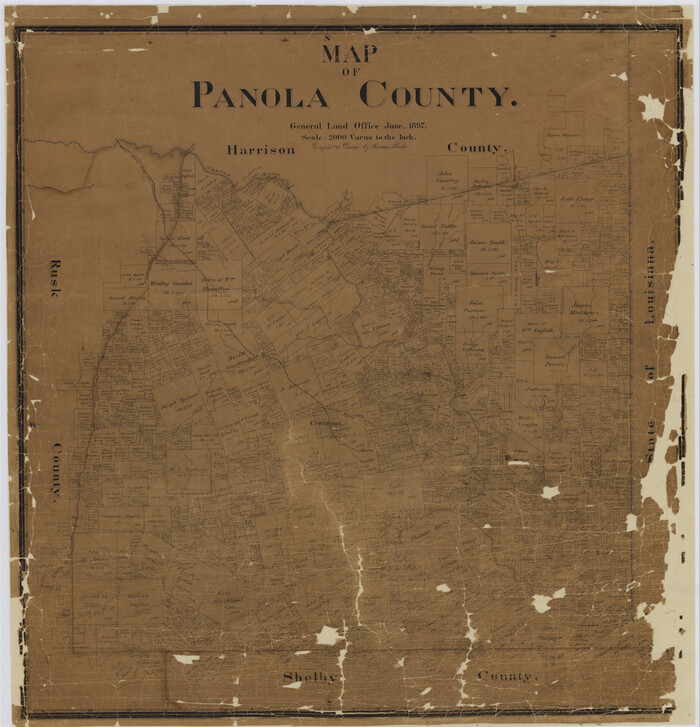
Print $20.00
- Digital $50.00
Map of Panola County
1897
Size 40.5 x 39.0 inches
Map/Doc 16785
Leon County Working Sketch 13

Print $20.00
- Digital $50.00
Leon County Working Sketch 13
1956
Size 23.0 x 22.7 inches
Map/Doc 70412
Denton County Sketch File 23

Print $5.00
- Digital $50.00
Denton County Sketch File 23
1862
Size 9.3 x 11.4 inches
Map/Doc 20748
Upshur County Working Sketch 15, revised

Print $20.00
- Digital $50.00
Upshur County Working Sketch 15, revised
1996
Size 43.3 x 37.4 inches
Map/Doc 78217
Matagorda County Rolled Sketch 11

Print $40.00
- Digital $50.00
Matagorda County Rolled Sketch 11
Size 39.8 x 62.0 inches
Map/Doc 8348
[Sketch for Mineral Applications 26885-6 - Reagan and Crockett Cos., W. H. Bland]
![65672, [Sketch for Mineral Applications 26885-6 - Reagan and Crockett Cos., W. H. Bland], General Map Collection](https://historictexasmaps.com/wmedia_w700/maps/65672-1.tif.jpg)
Print $40.00
- Digital $50.00
[Sketch for Mineral Applications 26885-6 - Reagan and Crockett Cos., W. H. Bland]
Size 51.1 x 37.3 inches
Map/Doc 65672
Jackson County Rolled Sketch 11

Print $20.00
- Digital $50.00
Jackson County Rolled Sketch 11
1941
Size 45.9 x 34.3 inches
Map/Doc 9260
Galveston County Sketch File 46

Print $20.00
- Digital $50.00
Galveston County Sketch File 46
1912
Size 14.0 x 34.1 inches
Map/Doc 11541
You may also like
Controlled Mosaic by Jack Amman Photogrammetric Engineers, Inc - Sheet 28

Print $20.00
- Digital $50.00
Controlled Mosaic by Jack Amman Photogrammetric Engineers, Inc - Sheet 28
1954
Size 21.1 x 24.1 inches
Map/Doc 83480
Flight Mission No. DIX-6P, Frame 180, Aransas County

Print $20.00
- Digital $50.00
Flight Mission No. DIX-6P, Frame 180, Aransas County
1956
Size 19.0 x 22.6 inches
Map/Doc 83842
Hemphill County Rolled Sketch 18

Print $20.00
- Digital $50.00
Hemphill County Rolled Sketch 18
Size 23.6 x 35.0 inches
Map/Doc 6200
Medina County Sketch File 19

Print $20.00
- Digital $50.00
Medina County Sketch File 19
1989
Size 32.5 x 21.0 inches
Map/Doc 12071
Sterling County Rolled Sketch 8

Print $20.00
- Digital $50.00
Sterling County Rolled Sketch 8
1884
Size 27.9 x 31.9 inches
Map/Doc 7844
Lynn County Rolled Sketch WR

Print $20.00
- Digital $50.00
Lynn County Rolled Sketch WR
Size 14.7 x 23.8 inches
Map/Doc 6656
Kaufman County Sketch File 17 1/2

Print $6.00
- Digital $50.00
Kaufman County Sketch File 17 1/2
1888
Size 17.0 x 11.1 inches
Map/Doc 28659
Roberts County Working Sketch 20

Print $20.00
- Digital $50.00
Roberts County Working Sketch 20
1977
Size 25.6 x 32.9 inches
Map/Doc 63546
Zavala County Rolled Sketch 16

Print $20.00
- Digital $50.00
Zavala County Rolled Sketch 16
Size 19.4 x 25.4 inches
Map/Doc 8321
Throckmorton County Rolled Sketch 6B

Print $20.00
- Digital $50.00
Throckmorton County Rolled Sketch 6B
2004
Size 20.3 x 24.2 inches
Map/Doc 82490
Swisher County Working Sketch 4

Print $20.00
- Digital $50.00
Swisher County Working Sketch 4
1960
Size 23.0 x 19.9 inches
Map/Doc 62415
Parker County Sketch File 9

Print $4.00
- Digital $50.00
Parker County Sketch File 9
Size 8.1 x 10.0 inches
Map/Doc 33538