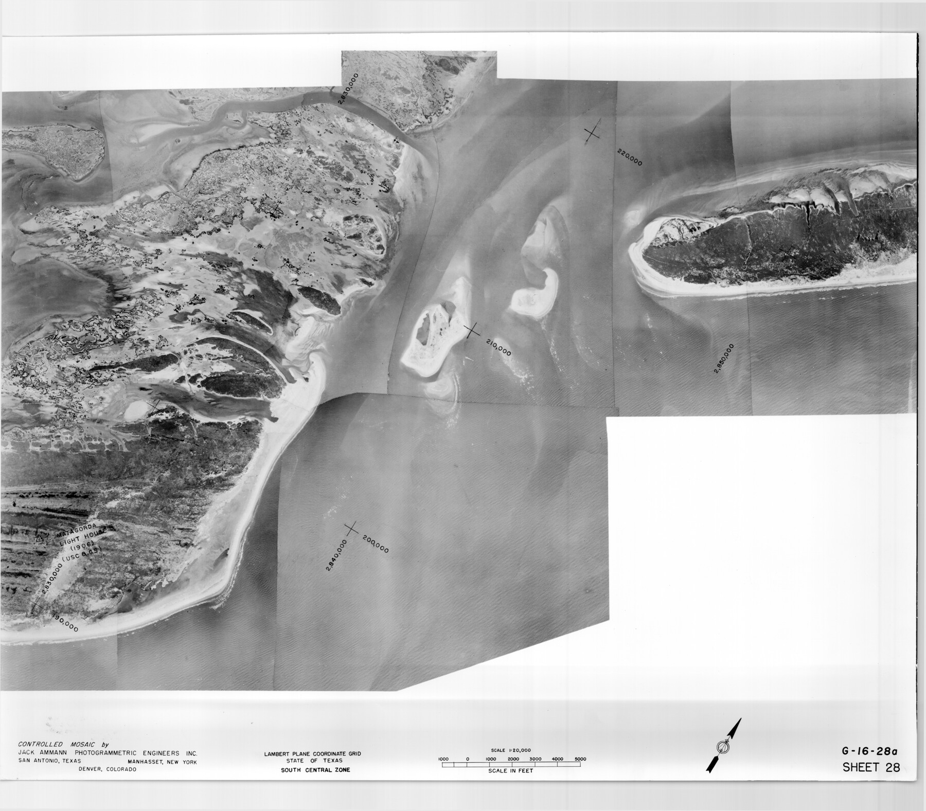
Controlled Mosaic by Jack Amman Photogrammetric Engineers, Inc - Sheet 28
[Coastal Aerial Photograph]
G-16-28a-b
-
Map/Doc
83480
-
Collection
General Map Collection
-
Object Dates
1954 (Creation Date)
-
Subjects
Aerial Photograph
-
Height x Width
21.1 x 24.1 inches
53.6 x 61.2 cm
-
Comments
Statement on reverse side: "The reverse reflects the data shown thereon which was obtained by aerial survey made from December 31, 1953 to March 17, 1954 by Jack Ammann Photogrammetric Engineers, Inc."
Part of: General Map Collection
Louisiana and Texas Intracoastal Waterway

Print $20.00
- Digital $50.00
Louisiana and Texas Intracoastal Waterway
1929
Size 13.8 x 19.9 inches
Map/Doc 83341
Bee County Sketch File 23

Print $8.00
- Digital $50.00
Bee County Sketch File 23
1878
Size 10.0 x 8.1 inches
Map/Doc 14318
Coleman County Sketch File 25

Print $40.00
- Digital $50.00
Coleman County Sketch File 25
1872
Size 12.5 x 15.8 inches
Map/Doc 18710
Van Zandt County Working Sketch 15

Print $20.00
- Digital $50.00
Van Zandt County Working Sketch 15
1982
Size 30.9 x 39.0 inches
Map/Doc 72265
Packery Channel

Print $20.00
- Digital $50.00
Packery Channel
1937
Size 23.8 x 22.4 inches
Map/Doc 3008
Crockett County Sketch File 6

Print $20.00
- Digital $50.00
Crockett County Sketch File 6
1877
Size 22.2 x 17.2 inches
Map/Doc 3457
Sterling County Rolled Sketch 18

Print $20.00
- Digital $50.00
Sterling County Rolled Sketch 18
Size 34.6 x 35.9 inches
Map/Doc 9950
Encinal County

Print $20.00
- Digital $50.00
Encinal County
1886
Size 32.2 x 23.6 inches
Map/Doc 3518
Nueces County Sketch File 20

Print $8.00
- Digital $50.00
Nueces County Sketch File 20
1881
Size 10.7 x 8.1 inches
Map/Doc 32553
Flight Mission No. CGI-3N, Frame 147, Cameron County

Print $20.00
- Digital $50.00
Flight Mission No. CGI-3N, Frame 147, Cameron County
1954
Size 18.8 x 22.4 inches
Map/Doc 84620
Maverick County Rolled Sketch 19

Print $20.00
- Digital $50.00
Maverick County Rolled Sketch 19
1955
Size 33.5 x 44.1 inches
Map/Doc 9494
Kaufman County Working Sketch 8

Print $20.00
- Digital $50.00
Kaufman County Working Sketch 8
1987
Size 35.7 x 42.3 inches
Map/Doc 66671
You may also like
[Section 35 1/2, Block C-41]
![92967, [Section 35 1/2, Block C-41], Twichell Survey Records](https://historictexasmaps.com/wmedia_w700/maps/92967-1.tif.jpg)
Print $20.00
- Digital $50.00
[Section 35 1/2, Block C-41]
1951
Size 23.9 x 9.2 inches
Map/Doc 92967
The Chief Justice County of Gonzales. Lands in Conflict with Victoria County

Print $20.00
The Chief Justice County of Gonzales. Lands in Conflict with Victoria County
2020
Size 22.3 x 21.7 inches
Map/Doc 96048
Castro County Sketch File 13

Print $4.00
- Digital $50.00
Castro County Sketch File 13
1962
Size 14.1 x 8.6 inches
Map/Doc 17509
Coast of Texas and its defences

Print $20.00
- Digital $50.00
Coast of Texas and its defences
1864
Size 27.3 x 18.1 inches
Map/Doc 72683
Harris County Historic Topographic C

Print $20.00
- Digital $50.00
Harris County Historic Topographic C
1916
Size 25.5 x 19.1 inches
Map/Doc 65851
Lubbock County

Print $20.00
- Digital $50.00
Lubbock County
1968
Size 42.1 x 34.1 inches
Map/Doc 73226
[St. Louis & Southwestern]
![64277, [St. Louis & Southwestern], General Map Collection](https://historictexasmaps.com/wmedia_w700/maps/64277.tif.jpg)
Print $20.00
- Digital $50.00
[St. Louis & Southwestern]
Size 20.6 x 28.7 inches
Map/Doc 64277
Flight Mission No. DQN-3K, Frame 71, Calhoun County

Print $20.00
- Digital $50.00
Flight Mission No. DQN-3K, Frame 71, Calhoun County
1953
Size 18.7 x 22.3 inches
Map/Doc 84362
[Sketch showing C. D. & W. A. Murphy's Pasture and Wint Barfield's Pasture]
![90885, [Sketch showing C. D. & W. A. Murphy's Pasture and Wint Barfield's Pasture], Twichell Survey Records](https://historictexasmaps.com/wmedia_w700/maps/90885-1.tif.jpg)
Print $20.00
- Digital $50.00
[Sketch showing C. D. & W. A. Murphy's Pasture and Wint Barfield's Pasture]
Size 31.9 x 27.4 inches
Map/Doc 90885
Calhoun County Aerial Photograph Index Sheet 5

Print $20.00
- Digital $50.00
Calhoun County Aerial Photograph Index Sheet 5
1953
Size 24.0 x 19.5 inches
Map/Doc 83673
Brooks County Rolled Sketch 11A

Print $20.00
- Digital $50.00
Brooks County Rolled Sketch 11A
1906
Size 18.1 x 24.6 inches
Map/Doc 76060
T. & N. O. R.R. Jefferson Co. North

Print $20.00
- Digital $50.00
T. & N. O. R.R. Jefferson Co. North
1917
Size 13.4 x 33.5 inches
Map/Doc 64056