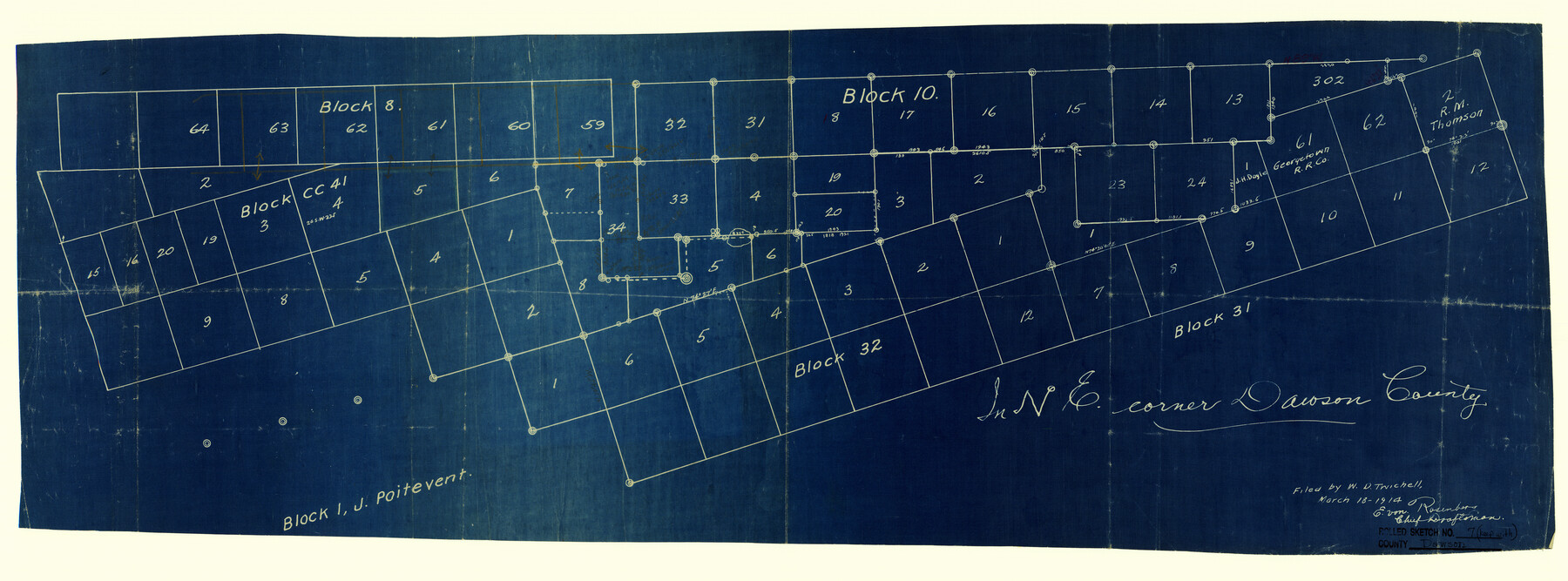
Dawson County Rolled Sketch 7
[Sketch in NE corner Dawson County]
-
Map/Doc
5693
-
Collection
General Map Collection
-
Object Dates
1914/3/18 (File Date)
-
Counties
Dawson Lynn Borden
-
Subjects
Surveying Rolled Sketch
-
Height x Width
14.1 x 38.1 inches
35.8 x 96.8 cm
-
Medium
blueprint/diazo
Part of: General Map Collection
Trinity River, Crandell Sheet/East Fork of Trinity River

Print $20.00
- Digital $50.00
Trinity River, Crandell Sheet/East Fork of Trinity River
1921
Size 42.0 x 35.5 inches
Map/Doc 65188
Northwest Part Pecos County

Print $20.00
- Digital $50.00
Northwest Part Pecos County
1975
Size 42.2 x 42.2 inches
Map/Doc 77395
Jefferson County Rolled Sketch 4

Print $40.00
- Digital $50.00
Jefferson County Rolled Sketch 4
Size 36.7 x 65.3 inches
Map/Doc 9269
La Salle County Working Sketch 36

Print $20.00
- Digital $50.00
La Salle County Working Sketch 36
1958
Size 18.8 x 42.6 inches
Map/Doc 70337
Baylor County Sketch File 12D

Print $40.00
- Digital $50.00
Baylor County Sketch File 12D
1900
Size 20.0 x 42.5 inches
Map/Doc 10323
Edwards County Working Sketch 125

Print $20.00
- Digital $50.00
Edwards County Working Sketch 125
1977
Size 22.3 x 23.5 inches
Map/Doc 69001
Red River County Working Sketch 81-4

Print $20.00
- Digital $50.00
Red River County Working Sketch 81-4
1987
Size 21.8 x 16.7 inches
Map/Doc 72067
Kenedy County Rolled Sketch 8

Print $20.00
- Digital $50.00
Kenedy County Rolled Sketch 8
1915
Size 19.0 x 30.6 inches
Map/Doc 6468
Kent County Working Sketch 23

Print $20.00
- Digital $50.00
Kent County Working Sketch 23
1987
Size 47.2 x 43.0 inches
Map/Doc 70030
Collin County Sketch File 12

Print $40.00
- Digital $50.00
Collin County Sketch File 12
1851
Size 24.3 x 31.3 inches
Map/Doc 11127
Hutchinson County Boundary File 2

Print $2.00
- Digital $50.00
Hutchinson County Boundary File 2
Size 11.2 x 8.8 inches
Map/Doc 55302
Webb County Sketch File 16

Print $20.00
- Digital $50.00
Webb County Sketch File 16
Size 37.1 x 24.5 inches
Map/Doc 12635
You may also like
[Sketch in vicinity of Wm. McCutcheon, S. H. Reid and John McGinley]
![90115, [Sketch in vicinity of Wm. McCutcheon, S. H. Reid and John McGinley], Twichell Survey Records](https://historictexasmaps.com/wmedia_w700/maps/90115-1.tif.jpg)
Print $20.00
- Digital $50.00
[Sketch in vicinity of Wm. McCutcheon, S. H. Reid and John McGinley]
1923
Size 20.0 x 13.2 inches
Map/Doc 90115
Flight Mission No. BQR-4K, Frame 70, Brazoria County

Print $20.00
- Digital $50.00
Flight Mission No. BQR-4K, Frame 70, Brazoria County
1952
Size 18.8 x 22.4 inches
Map/Doc 84003
[McLennan County School Leagues 3 and 4, Elizabeth Finley, Wm. Van Norman, Harvey Kendrick surveys and surveys to the west]
![90929, [McLennan County School Leagues 3 and 4, Elizabeth Finley, Wm. Van Norman, Harvey Kendrick surveys and surveys to the west], Twichell Survey Records](https://historictexasmaps.com/wmedia_w700/maps/90929-1.tif.jpg)
Print $20.00
- Digital $50.00
[McLennan County School Leagues 3 and 4, Elizabeth Finley, Wm. Van Norman, Harvey Kendrick surveys and surveys to the west]
Size 19.5 x 26.7 inches
Map/Doc 90929
Hudspeth County Rolled Sketch 36

Print $20.00
- Digital $50.00
Hudspeth County Rolled Sketch 36
1952
Size 30.8 x 19.9 inches
Map/Doc 6249
[Area along West County Line]
![90833, [Area along West County Line], Twichell Survey Records](https://historictexasmaps.com/wmedia_w700/maps/90833-2.tif.jpg)
Print $2.00
- Digital $50.00
[Area along West County Line]
Size 7.0 x 9.6 inches
Map/Doc 90833
Winkler County Working Sketch 4

Print $20.00
- Digital $50.00
Winkler County Working Sketch 4
1954
Size 36.7 x 30.1 inches
Map/Doc 72598
Nueces County Rolled Sketch 105

Print $96.00
Nueces County Rolled Sketch 105
1986
Size 18.1 x 25.4 inches
Map/Doc 7086
Waco, Tex., County Seat of McLennan Co.

Print $20.00
Waco, Tex., County Seat of McLennan Co.
1886
Size 23.1 x 32.7 inches
Map/Doc 89212
Flight Mission No. DQN-5K, Frame 32, Calhoun County

Print $20.00
- Digital $50.00
Flight Mission No. DQN-5K, Frame 32, Calhoun County
1953
Size 16.5 x 16.3 inches
Map/Doc 84383
Jeff Davis County Working Sketch 24

Print $40.00
- Digital $50.00
Jeff Davis County Working Sketch 24
1958
Size 24.9 x 52.9 inches
Map/Doc 66519
The Republic County of Rusk. Created, January 16, 1843

Print $20.00
The Republic County of Rusk. Created, January 16, 1843
2020
Size 19.1 x 21.7 inches
Map/Doc 96265
Tarrant County

Print $20.00
- Digital $50.00
Tarrant County
1942
Size 46.7 x 38.0 inches
Map/Doc 63057