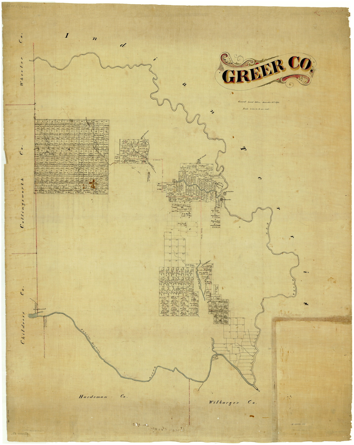
Greer Co.
-
Map/Doc
4962
-
Collection
General Map Collection
-
Object Dates
12/18/1883 (Creation Date)
-
People and Organizations
Texas General Land Office (Publisher)
-
Counties
Greer
-
Subjects
County
-
Height x Width
44.0 x 33.9 inches
111.8 x 86.1 cm
-
Comments
This land is now part of Oklahoma.
Part of: General Map Collection
Township 6 South Range 13 West, South Western District, Louisiana

Print $20.00
- Digital $50.00
Township 6 South Range 13 West, South Western District, Louisiana
1879
Size 19.6 x 24.8 inches
Map/Doc 65886
Limestone County Working Sketch 15

Print $20.00
- Digital $50.00
Limestone County Working Sketch 15
1936
Size 14.7 x 16.3 inches
Map/Doc 70565
Fifteenth Census 1930 Population - Texas

Print $20.00
- Digital $50.00
Fifteenth Census 1930 Population - Texas
1930
Size 19.5 x 22.6 inches
Map/Doc 2146
Harris County Working Sketch 9

Print $20.00
- Digital $50.00
Harris County Working Sketch 9
1908
Size 27.7 x 39.4 inches
Map/Doc 65901
Travis County Sketch File 4A

Print $8.00
- Digital $50.00
Travis County Sketch File 4A
1855
Size 8.4 x 11.2 inches
Map/Doc 38280
Wood County Sketch File 6

Print $8.00
- Digital $50.00
Wood County Sketch File 6
1877
Size 8.2 x 5.4 inches
Map/Doc 40641
Mason County Boundary File 1

Print $2.00
- Digital $50.00
Mason County Boundary File 1
Size 12.7 x 8.2 inches
Map/Doc 56829
Aransas County NRC Article 33.136 Location Key Sheet

Print $20.00
- Digital $50.00
Aransas County NRC Article 33.136 Location Key Sheet
1979
Size 27.0 x 23.0 inches
Map/Doc 87905

Bee County Working Sketch 33

Print $20.00
- Digital $50.00
Bee County Working Sketch 33
1980
Size 32.0 x 28.2 inches
Map/Doc 67284
Colorado County Working Sketch 30

Print $20.00
- Digital $50.00
Colorado County Working Sketch 30
1980
Size 22.2 x 19.8 inches
Map/Doc 68130
Highland Lakes of Central Texas

Print $20.00
- Digital $50.00
Highland Lakes of Central Texas
1947
Size 18.2 x 21.9 inches
Map/Doc 60291
You may also like
Floyd County Sketch File 21

Print $20.00
- Digital $50.00
Floyd County Sketch File 21
1914
Size 30.0 x 23.2 inches
Map/Doc 11486
Outer Continental Shelf Leasing Maps (Louisiana Offshore Operations)

Print $20.00
- Digital $50.00
Outer Continental Shelf Leasing Maps (Louisiana Offshore Operations)
1955
Size 10.3 x 11.6 inches
Map/Doc 76088
Baylor County Sketch File 23

Print $60.00
- Digital $50.00
Baylor County Sketch File 23
1927
Size 25.2 x 48.9 inches
Map/Doc 10324
Borden County Sketch File 10a

Print $40.00
- Digital $50.00
Borden County Sketch File 10a
Size 21.0 x 37.5 inches
Map/Doc 10935
Dimmit County Working Sketch 34

Print $20.00
- Digital $50.00
Dimmit County Working Sketch 34
1959
Size 22.8 x 17.0 inches
Map/Doc 68695
Nueces County Rolled Sketch 101

Print $88.00
Nueces County Rolled Sketch 101
1985
Size 18.2 x 24.6 inches
Map/Doc 7061
Flight Mission No. CRC-3R, Frame 42, Chambers County

Print $20.00
- Digital $50.00
Flight Mission No. CRC-3R, Frame 42, Chambers County
1956
Size 18.8 x 22.4 inches
Map/Doc 84815
Brewster County Sketch File NS-7

Print $14.00
- Digital $50.00
Brewster County Sketch File NS-7
1945
Size 11.3 x 8.8 inches
Map/Doc 15992
Irion County Working Sketch 8

Print $20.00
- Digital $50.00
Irion County Working Sketch 8
1937
Size 42.0 x 41.0 inches
Map/Doc 66417
Fractional Township No. 7 South Range No. 20 East of the Indian Meridian, Indian Territory

Print $20.00
- Digital $50.00
Fractional Township No. 7 South Range No. 20 East of the Indian Meridian, Indian Territory
1897
Size 19.2 x 24.2 inches
Map/Doc 75236
Hays County Sketch File 32

Print $8.00
- Digital $50.00
Hays County Sketch File 32
Size 14.3 x 8.8 inches
Map/Doc 26264
Red River County Working Sketch 43

Print $40.00
- Digital $50.00
Red River County Working Sketch 43
1968
Size 72.5 x 36.8 inches
Map/Doc 72026