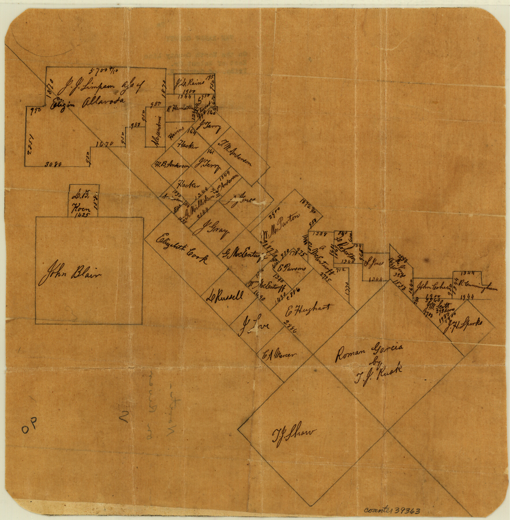
Van Zandt County Sketch File 2a
[Sketch of surveys in the northwest corner of the county]
-
Map/Doc
39363
-
Collection
General Map Collection
-
Counties
Van Zandt
-
Subjects
Surveying Sketch File
-
Height x Width
12.2 x 12.0 inches
31.0 x 30.5 cm
-
Medium
paper, manuscript
-
Features
Walnut Creek
Sabine River
Part of: General Map Collection

Matagorda County Rolled Sketch 37A

Print $40.00
- Digital $50.00
Matagorda County Rolled Sketch 37A
Size 48.7 x 41.1 inches
Map/Doc 10195
Henderson County Working Sketch 10

Print $20.00
- Digital $50.00
Henderson County Working Sketch 10
1925
Size 29.7 x 18.8 inches
Map/Doc 66143
Leon County Sketch File 20

Print $6.00
- Digital $50.00
Leon County Sketch File 20
Size 10.6 x 10.0 inches
Map/Doc 29770
Padre Island National Seashore

Print $4.00
- Digital $50.00
Padre Island National Seashore
Size 16.0 x 21.8 inches
Map/Doc 60527
Jack County Working Sketch 19

Print $20.00
- Digital $50.00
Jack County Working Sketch 19
1989
Size 21.5 x 29.4 inches
Map/Doc 66445
Map of Hill County

Print $20.00
- Digital $50.00
Map of Hill County
1884
Size 47.2 x 36.8 inches
Map/Doc 16851
Culberson County Sketch File RJ

Print $20.00
- Digital $50.00
Culberson County Sketch File RJ
1927
Size 16.9 x 24.4 inches
Map/Doc 5789
Right-of-Way and Track Map, Houston and Brazos Valley Ry. Co. operated by the Houston and Brazos Valley Ry. Co.

Print $40.00
- Digital $50.00
Right-of-Way and Track Map, Houston and Brazos Valley Ry. Co. operated by the Houston and Brazos Valley Ry. Co.
1918
Size 24.9 x 56.5 inches
Map/Doc 64608
Hudspeth County Sketch File 7

Print $6.00
- Digital $50.00
Hudspeth County Sketch File 7
1900
Size 14.2 x 8.7 inches
Map/Doc 26892
Flight Mission No. DQO-3K, Frame 28, Galveston County

Print $20.00
- Digital $50.00
Flight Mission No. DQO-3K, Frame 28, Galveston County
1952
Size 18.1 x 22.3 inches
Map/Doc 85069
Crockett County Working Sketch 61

Print $20.00
- Digital $50.00
Crockett County Working Sketch 61
1955
Size 36.5 x 33.2 inches
Map/Doc 68394
You may also like
Harris County Sketch File 100

Print $518.00
- Digital $50.00
Harris County Sketch File 100
1991
Size 11.5 x 8.8 inches
Map/Doc 25674
Aransas County Sketch File 29

Print $24.00
- Digital $50.00
Aransas County Sketch File 29
Size 7.8 x 8.1 inches
Map/Doc 13234
Morris County Rolled Sketch 2A

Print $20.00
- Digital $50.00
Morris County Rolled Sketch 2A
Size 24.3 x 19.2 inches
Map/Doc 10284
Brewster County Rolled Sketch 127

Print $20.00
- Digital $50.00
Brewster County Rolled Sketch 127
1969
Size 39.0 x 43.8 inches
Map/Doc 8521
Loving County Working Sketch 18

Print $40.00
- Digital $50.00
Loving County Working Sketch 18
1978
Size 65.2 x 43.2 inches
Map/Doc 70652


Marion County Working Sketch 12a

Print $20.00
- Digital $50.00
Marion County Working Sketch 12a
1953
Size 23.9 x 33.2 inches
Map/Doc 70788
Matagorda County Working Sketch 15

Print $40.00
- Digital $50.00
Matagorda County Working Sketch 15
1954
Size 49.3 x 44.5 inches
Map/Doc 70873
Zavala County Sketch File 47

Print $6.00
- Digital $50.00
Zavala County Sketch File 47
1937
Size 11.3 x 9.0 inches
Map/Doc 41430
Map of Bexar County

Print $40.00
- Digital $50.00
Map of Bexar County
1845
Size 90.6 x 81.0 inches
Map/Doc 82242
Map of Texas with Parts of the Adjoining States

Print $20.00
Map of Texas with Parts of the Adjoining States
1836
Size 29.8 x 24.1 inches
Map/Doc 93963