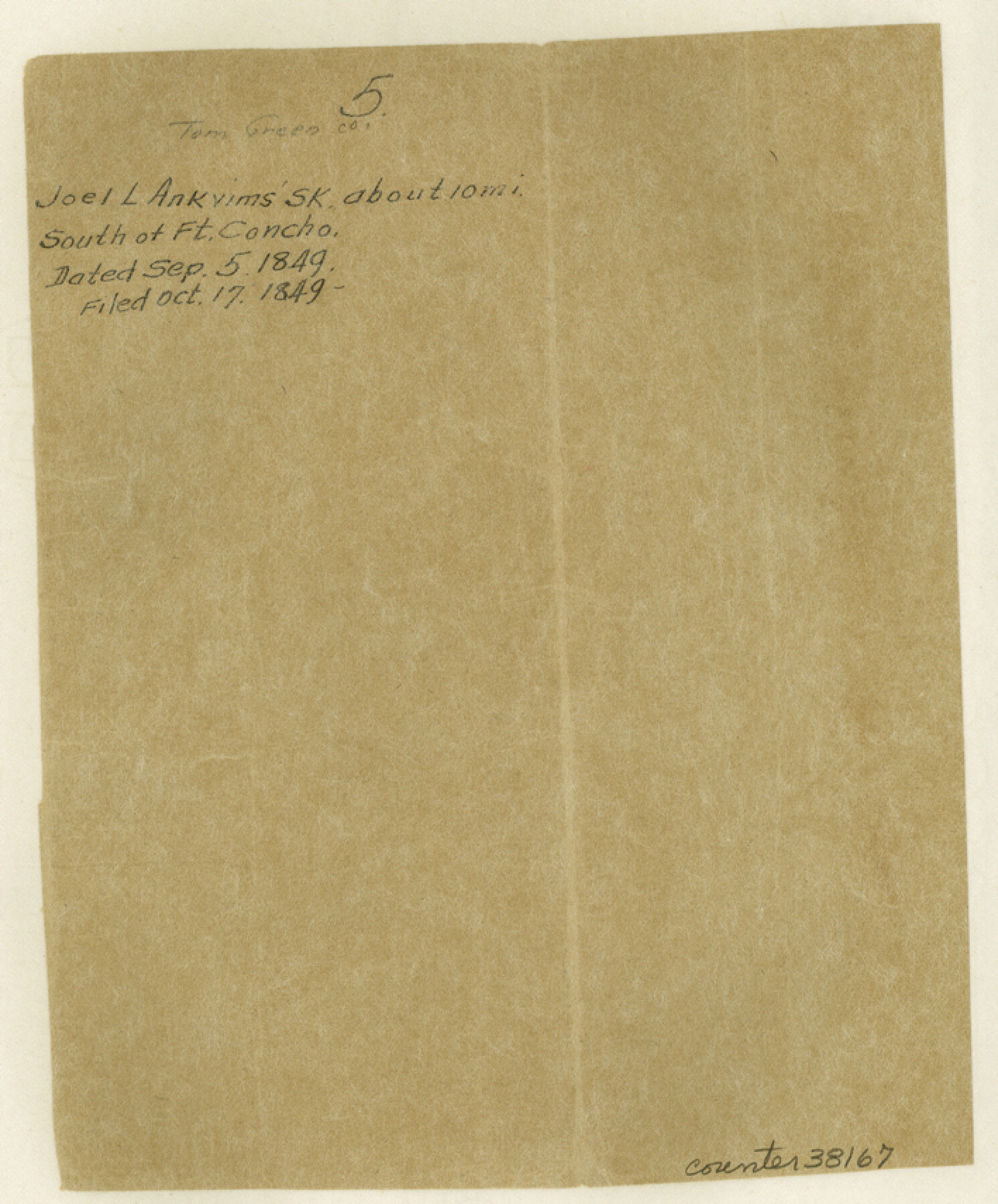
Tom Green County Sketch File 5
[Sketch of surveys on the south fork of the Concho River with connecting line to surveys on Kickapoo Creek in Concho County]
-
Map/Doc
38167
-
Collection
General Map Collection
-
Object Dates
9/5/1849 (Creation Date)
10/17/1849 (File Date)
-
Counties
Tom Green Concho
-
Subjects
Surveying Sketch File
-
Height x Width
8.5 x 7.1 inches
21.6 x 18.0 cm
-
Medium
paper, manuscript
-
Features
South Fork of Concho River
Kickapoo Creek
Part of: General Map Collection
Flight Mission No. DCL-4C, Frame 145, Kenedy County

Print $20.00
- Digital $50.00
Flight Mission No. DCL-4C, Frame 145, Kenedy County
1943
Size 18.6 x 22.4 inches
Map/Doc 85823
Bandera County Working Sketch 34

Print $20.00
- Digital $50.00
Bandera County Working Sketch 34
1963
Size 36.5 x 29.2 inches
Map/Doc 67630

Johnson County Boundary File 51

Print $66.00
- Digital $50.00
Johnson County Boundary File 51
Size 8.5 x 4.2 inches
Map/Doc 55589
Harris County Sketch File 23a

Print $13.00
- Digital $50.00
Harris County Sketch File 23a
1839
Size 9.7 x 6.0 inches
Map/Doc 25379
Kimble County Working Sketch 24

Print $20.00
- Digital $50.00
Kimble County Working Sketch 24
1930
Size 23.3 x 17.4 inches
Map/Doc 70092
Montgomery County Texas Historical Map

Montgomery County Texas Historical Map
Size 23.2 x 35.5 inches
Map/Doc 94403
Travis County Rolled Sketch 22

Print $20.00
- Digital $50.00
Travis County Rolled Sketch 22
1937
Size 23.4 x 26.1 inches
Map/Doc 8023
Hudspeth County Rolled Sketch 72

Print $40.00
- Digital $50.00
Hudspeth County Rolled Sketch 72
1992
Size 36.7 x 49.0 inches
Map/Doc 9235
Kimble County Rolled Sketch 40

Print $20.00
- Digital $50.00
Kimble County Rolled Sketch 40
Size 27.5 x 22.4 inches
Map/Doc 6530
Jefferson County Rolled Sketch 2

Print $20.00
- Digital $50.00
Jefferson County Rolled Sketch 2
1904
Size 33.1 x 44.7 inches
Map/Doc 6383
Jasper County Sketch File 22

Print $4.00
- Digital $50.00
Jasper County Sketch File 22
1910
Size 8.8 x 7.7 inches
Map/Doc 27822
You may also like
Irion County Rolled Sketch 12

Print $40.00
- Digital $50.00
Irion County Rolled Sketch 12
1945
Size 37.5 x 51.9 inches
Map/Doc 75943
Map of Texas in 1836

Print $20.00
- Digital $50.00
Map of Texas in 1836
1936
Size 32.1 x 24.4 inches
Map/Doc 2110
Sutton County Rolled Sketch 42

Print $20.00
- Digital $50.00
Sutton County Rolled Sketch 42
Size 16.2 x 20.1 inches
Map/Doc 7884
Terrell County Working Sketch 19

Print $20.00
- Digital $50.00
Terrell County Working Sketch 19
1932
Size 18.6 x 25.6 inches
Map/Doc 69801
Houston Ship Channel, Alexander Island to Carpenter Bayou

Print $20.00
- Digital $50.00
Houston Ship Channel, Alexander Island to Carpenter Bayou
1971
Size 34.9 x 46.0 inches
Map/Doc 69908
Zapata County Working Sketch 11

Print $20.00
- Digital $50.00
Zapata County Working Sketch 11
1958
Size 38.1 x 28.7 inches
Map/Doc 62062
Intracoastal Waterway, Houma, LA to Corpus Christi, TX

Print $20.00
- Digital $50.00
Intracoastal Waterway, Houma, LA to Corpus Christi, TX
Size 26.6 x 20.8 inches
Map/Doc 61907
North Shore of West Bay and Galveston Island

Print $40.00
- Digital $50.00
North Shore of West Bay and Galveston Island
1933
Size 36.4 x 56.9 inches
Map/Doc 69931
Chambers County Rolled Sketch 33

Print $71.00
- Digital $50.00
Chambers County Rolled Sketch 33
1950
Size 10.7 x 15.6 inches
Map/Doc 44106
[Capitol Leagues, Blocks 49 H. & T. C. RR. Company, Block LC2]
![90769, [Capitol Leagues, Blocks 49 H. & T. C. RR. Company, Block LC2], Twichell Survey Records](https://historictexasmaps.com/wmedia_w700/maps/90769-1.tif.jpg)
Print $20.00
- Digital $50.00
[Capitol Leagues, Blocks 49 H. & T. C. RR. Company, Block LC2]
1883
Size 39.2 x 24.8 inches
Map/Doc 90769
Refugio County Working Sketch 5

Print $20.00
- Digital $50.00
Refugio County Working Sketch 5
1938
Size 36.5 x 42.2 inches
Map/Doc 63514
Mason County Boundary File 3

Print $52.00
- Digital $50.00
Mason County Boundary File 3
Size 13.7 x 8.7 inches
Map/Doc 56838