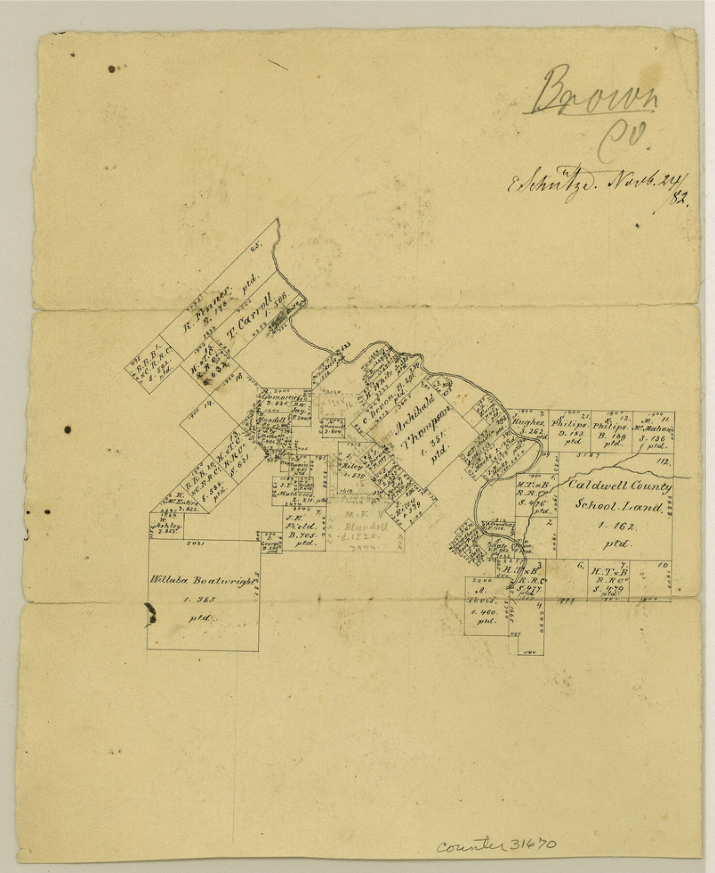
Mills County Sketch File 22
[Office sketch of area along Pecan Bayou northwest of Goldthwaite]
-
Map/Doc
31670
-
Collection
General Map Collection
-
Object Dates
11/24/1882 (Creation Date)
-
People and Organizations
E. Schutze (Draftsman)
-
Counties
Mills
-
Subjects
Surveying Sketch File
-
Height x Width
9.8 x 8.0 inches
24.9 x 20.3 cm
-
Medium
paper, manuscript
Part of: General Map Collection
McMullen County Sketch File 44

Print $6.00
- Digital $50.00
McMullen County Sketch File 44
1942
Size 14.2 x 8.8 inches
Map/Doc 31426
San Luis Pass to Matagorda Bay

Print $20.00
- Digital $50.00
San Luis Pass to Matagorda Bay
1924
Size 34.5 x 45.6 inches
Map/Doc 69959
Kinney County Rolled Sketch 20

Print $40.00
- Digital $50.00
Kinney County Rolled Sketch 20
1979
Size 37.8 x 59.7 inches
Map/Doc 9357
Morris County Rolled Sketch 2A

Print $20.00
- Digital $50.00
Morris County Rolled Sketch 2A
Size 24.0 x 18.8 inches
Map/Doc 10257
Sketch Showing Beach Groins 6th St to 39th St - Galveston, Tex.

Print $20.00
- Digital $50.00
Sketch Showing Beach Groins 6th St to 39th St - Galveston, Tex.
1928
Size 21.0 x 36.4 inches
Map/Doc 73626
Mills County Boundary File 1a

Print $60.00
- Digital $50.00
Mills County Boundary File 1a
Size 9.7 x 31.6 inches
Map/Doc 57273
Uvalde County Sketch File 29

Print $8.00
- Digital $50.00
Uvalde County Sketch File 29
1873
Size 13.0 x 8.3 inches
Map/Doc 39028
Montgomery County Sketch File 4

Print $8.00
- Digital $50.00
Montgomery County Sketch File 4
1854
Size 12.0 x 8.1 inches
Map/Doc 31775
Andrews County Rolled Sketch 6

Print $40.00
- Digital $50.00
Andrews County Rolled Sketch 6
1928
Size 43.9 x 56.9 inches
Map/Doc 8363
Floyd County Sketch File 6

Print $2.00
- Digital $50.00
Floyd County Sketch File 6
Size 9.1 x 14.4 inches
Map/Doc 22696
Donley County Sketch File 6

Print $16.00
- Digital $50.00
Donley County Sketch File 6
1881
Size 12.9 x 8.5 inches
Map/Doc 21230
Bell County Sketch File 26

Print $14.00
- Digital $50.00
Bell County Sketch File 26
1886
Size 14.2 x 8.8 inches
Map/Doc 14426
You may also like
Webb County Sketch File 9-2

Print $4.00
- Digital $50.00
Webb County Sketch File 9-2
1916
Size 11.3 x 8.6 inches
Map/Doc 39764
Saline Ranch in Mason, Kimble and Menard Counties

Print $20.00
- Digital $50.00
Saline Ranch in Mason, Kimble and Menard Counties
1916
Size 28.3 x 27.2 inches
Map/Doc 75806
Pecos County Working Sketch 85

Print $20.00
- Digital $50.00
Pecos County Working Sketch 85
1962
Size 45.4 x 35.7 inches
Map/Doc 71557
Erath County Rolled Sketch 1

Print $40.00
- Digital $50.00
Erath County Rolled Sketch 1
1962
Size 37.6 x 69.0 inches
Map/Doc 8882
Flight Mission No. DQO-3K, Frame 24, Galveston County

Print $20.00
- Digital $50.00
Flight Mission No. DQO-3K, Frame 24, Galveston County
1952
Size 18.7 x 22.4 inches
Map/Doc 85065
Wise County Working Sketch 5

Print $20.00
- Digital $50.00
Wise County Working Sketch 5
1948
Size 25.7 x 23.4 inches
Map/Doc 72619
Terrell County Sketch File 10

Print $44.00
- Digital $50.00
Terrell County Sketch File 10
1902
Size 9.7 x 4.6 inches
Map/Doc 37910
San Jacinto River and Tributaries, Texas - Survey of 1939

Print $20.00
- Digital $50.00
San Jacinto River and Tributaries, Texas - Survey of 1939
1939
Size 27.7 x 40.5 inches
Map/Doc 60310
Zavala County Working Sketch 23

Print $40.00
- Digital $50.00
Zavala County Working Sketch 23
1980
Size 77.3 x 43.6 inches
Map/Doc 62098
Stephens County Sketch File 26

Print $10.00
- Digital $50.00
Stephens County Sketch File 26
Size 14.1 x 8.8 inches
Map/Doc 37096
Brazos River, Brazos River Sheet 1

Print $20.00
- Digital $50.00
Brazos River, Brazos River Sheet 1
1926
Size 20.6 x 24.6 inches
Map/Doc 78264
Grayson County Boundary File 4

Print $16.00
- Digital $50.00
Grayson County Boundary File 4
Size 12.7 x 8.0 inches
Map/Doc 53948