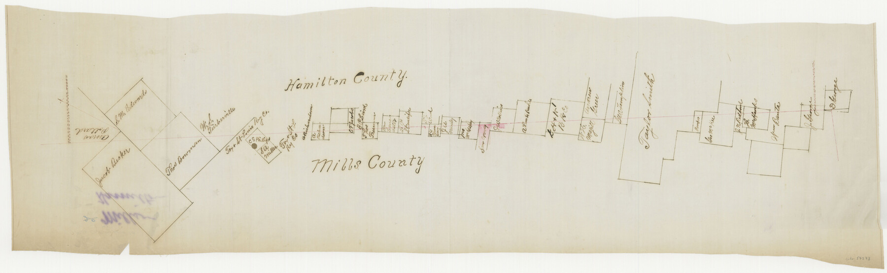
Mills County Boundary File 1a
-
Map/Doc
57273
-
Collection
General Map Collection
-
Counties
Mills
-
Subjects
County Boundaries
-
Height x Width
9.7 x 31.6 inches
24.6 x 80.3 cm
Part of: General Map Collection
Runnels County Working Sketch 3

Print $20.00
- Digital $50.00
Runnels County Working Sketch 3
1888
Size 22.1 x 20.3 inches
Map/Doc 63599
El Paso County Working Sketch 3

Print $20.00
- Digital $50.00
El Paso County Working Sketch 3
1916
Size 26.9 x 41.3 inches
Map/Doc 69025
[Sketch for Mineral Application 26501 - Sabine River, T. A. Oldhausen]
![2842, [Sketch for Mineral Application 26501 - Sabine River, T. A. Oldhausen], General Map Collection](https://historictexasmaps.com/wmedia_w700/maps/2842.tif.jpg)
Print $20.00
- Digital $50.00
[Sketch for Mineral Application 26501 - Sabine River, T. A. Oldhausen]
1931
Size 24.0 x 36.9 inches
Map/Doc 2842
Flight Mission No. DIX-6P, Frame 122, Aransas County

Print $20.00
- Digital $50.00
Flight Mission No. DIX-6P, Frame 122, Aransas County
1956
Size 19.1 x 22.4 inches
Map/Doc 83828
Jeff Davis County Working Sketch 11

Print $20.00
- Digital $50.00
Jeff Davis County Working Sketch 11
1947
Size 23.3 x 43.1 inches
Map/Doc 66506
Webb County Sketch File 4-2

Print $20.00
- Digital $50.00
Webb County Sketch File 4-2
1925
Size 26.3 x 18.1 inches
Map/Doc 12615
Van Zandt County Sketch File 39

Print $6.00
- Digital $50.00
Van Zandt County Sketch File 39
1871
Size 10.8 x 13.4 inches
Map/Doc 39484
Map of the District of San Patricio and Nueces

Print $40.00
- Digital $50.00
Map of the District of San Patricio and Nueces
Size 93.8 x 67.5 inches
Map/Doc 1955
Cottle County Sketch File 13

Print $20.00
- Digital $50.00
Cottle County Sketch File 13
1904
Size 15.8 x 15.8 inches
Map/Doc 11195
Presidio County Rolled Sketch 143

Print $20.00
- Digital $50.00
Presidio County Rolled Sketch 143
Size 40.2 x 36.8 inches
Map/Doc 90046
Flight Mission No. DCL-4C, Frame 97, Kenedy County

Print $20.00
- Digital $50.00
Flight Mission No. DCL-4C, Frame 97, Kenedy County
1943
Size 18.6 x 22.4 inches
Map/Doc 85818
Wichita County Working Sketch 13

Print $20.00
- Digital $50.00
Wichita County Working Sketch 13
1921
Size 16.5 x 32.8 inches
Map/Doc 72523
You may also like
Amarillo Improvements for Sawville-Amarillo Heights

Print $40.00
- Digital $50.00
Amarillo Improvements for Sawville-Amarillo Heights
Size 37.2 x 62.1 inches
Map/Doc 89789
[Map of Resurvey of Block 34 and 35, Township 5 N]
![90551, [Map of Resurvey of Block 34 and 35, Township 5 N], Twichell Survey Records](https://historictexasmaps.com/wmedia_w700/maps/90551-1.tif.jpg)
Print $20.00
- Digital $50.00
[Map of Resurvey of Block 34 and 35, Township 5 N]
1915
Size 25.5 x 16.4 inches
Map/Doc 90551

Wilbarger County Sketch File 9

Print $4.00
- Digital $50.00
Wilbarger County Sketch File 9
1885
Size 12.7 x 8.2 inches
Map/Doc 40181
Trinity River, Crandell Sheet/East Fork of Trinity River

Print $20.00
- Digital $50.00
Trinity River, Crandell Sheet/East Fork of Trinity River
1921
Size 42.0 x 35.5 inches
Map/Doc 65188
Marion County Sketch File 11

Print $4.00
- Digital $50.00
Marion County Sketch File 11
1902
Size 11.2 x 8.6 inches
Map/Doc 30581
Val Verde County Working Sketch 113

Print $40.00
- Digital $50.00
Val Verde County Working Sketch 113
2003
Size 54.9 x 34.6 inches
Map/Doc 78492
Cooke County Sketch File 9a

Print $4.00
- Digital $50.00
Cooke County Sketch File 9a
Size 8.2 x 9.4 inches
Map/Doc 19240
Flight Mission No. DIX-10P, Frame 64, Aransas County

Print $20.00
- Digital $50.00
Flight Mission No. DIX-10P, Frame 64, Aransas County
1956
Size 18.7 x 22.3 inches
Map/Doc 83925
Copy of Surveyor's Field Book, Morris Browning - In Blocks 7, 5 & 4, I&GNRRCo., Hutchinson and Carson Counties, Texas

Print $2.00
- Digital $50.00
Copy of Surveyor's Field Book, Morris Browning - In Blocks 7, 5 & 4, I&GNRRCo., Hutchinson and Carson Counties, Texas
1888
Size 6.9 x 8.8 inches
Map/Doc 62280
Collingsworth County Sketch File 8

Print $4.00
- Digital $50.00
Collingsworth County Sketch File 8
Size 7.4 x 11.6 inches
Map/Doc 18889
Brown County Sketch File 26

Print $40.00
- Digital $50.00
Brown County Sketch File 26
Size 18.4 x 24.4 inches
Map/Doc 11023