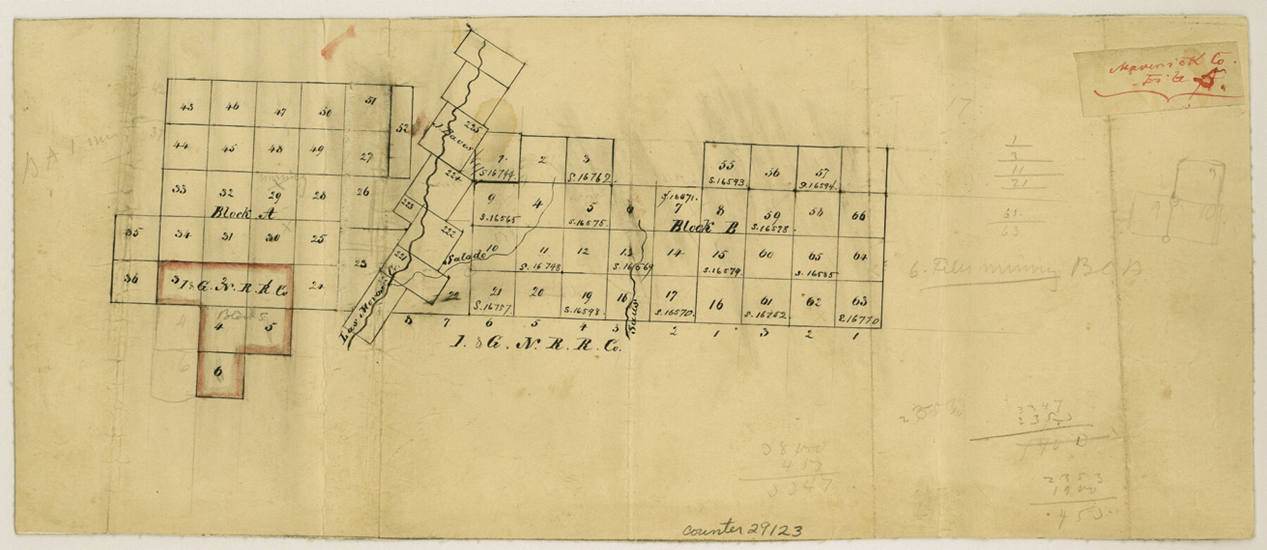
Kinney County Sketch File 5
[Sketch of area in and around Blocks A and B in south part of the county]
-
Map/Doc
29123
-
Collection
General Map Collection
-
Counties
Kinney Maverick
-
Subjects
Surveying Sketch File
-
Height x Width
5.7 x 13.1 inches
14.5 x 33.3 cm
-
Medium
paper, manuscript
-
Features
Salado Creek
Las Meranos Creek
Saus Creek
Part of: General Map Collection
Randall County

Print $20.00
- Digital $50.00
Randall County
1958
Size 43.0 x 35.1 inches
Map/Doc 73269
Flight Mission No. CRC-4R, Frame 83, Chambers County

Print $20.00
- Digital $50.00
Flight Mission No. CRC-4R, Frame 83, Chambers County
1956
Size 18.8 x 22.5 inches
Map/Doc 84888
Howard County

Print $20.00
- Digital $50.00
Howard County
1922
Size 42.3 x 36.2 inches
Map/Doc 95535
Brewster County Rolled Sketch 72

Print $20.00
- Digital $50.00
Brewster County Rolled Sketch 72
1941
Size 42.0 x 28.4 inches
Map/Doc 5238
Jackson County Aerial Photograph Index Sheet 6

Print $20.00
- Digital $50.00
Jackson County Aerial Photograph Index Sheet 6
1956
Size 21.2 x 15.7 inches
Map/Doc 83705
Rusk County Sketch File Z

Print $6.00
Rusk County Sketch File Z
1850
Size 15.8 x 9.0 inches
Map/Doc 35539
Flight Mission No. BRA-16M, Frame 175, Jefferson County

Print $20.00
- Digital $50.00
Flight Mission No. BRA-16M, Frame 175, Jefferson County
1953
Size 18.6 x 22.4 inches
Map/Doc 85773
Map of the Fort Worth & Denver City Railway

Print $40.00
- Digital $50.00
Map of the Fort Worth & Denver City Railway
1887
Size 19.9 x 57.9 inches
Map/Doc 64477
Edwards County Sketch File 22

Print $8.00
- Digital $50.00
Edwards County Sketch File 22
1890
Size 14.4 x 8.9 inches
Map/Doc 21743
Oldham County Working Sketch Graphic Index

Print $40.00
- Digital $50.00
Oldham County Working Sketch Graphic Index
1925
Size 42.2 x 51.7 inches
Map/Doc 76657
Flight Mission No. DCL-6C, Frame 25, Kenedy County

Print $20.00
- Digital $50.00
Flight Mission No. DCL-6C, Frame 25, Kenedy County
1943
Size 18.4 x 22.4 inches
Map/Doc 85882
San Jacinto County Working Sketch 21

Print $20.00
- Digital $50.00
San Jacinto County Working Sketch 21
1939
Size 32.1 x 25.5 inches
Map/Doc 63734
You may also like
Lake Buchanan, Burnet and Llano Counties, Texas

Print $20.00
- Digital $50.00
Lake Buchanan, Burnet and Llano Counties, Texas
1935
Size 20.7 x 14.4 inches
Map/Doc 3136
Hamilton County Rolled Sketch 3

Print $20.00
- Digital $50.00
Hamilton County Rolled Sketch 3
1919
Size 20.6 x 26.2 inches
Map/Doc 6070
Maverick County Sketch File 14

Print $4.00
- Digital $50.00
Maverick County Sketch File 14
1883
Size 11.1 x 8.5 inches
Map/Doc 31111
[Sketch of part of Blks. 4, 6, B5, 2Z, M6, M8, and M13]
![89643, [Sketch of part of Blks. 4, 6, B5, 2Z, M6, M8, and M13], Twichell Survey Records](https://historictexasmaps.com/wmedia_w700/maps/89643-1.tif.jpg)
Print $40.00
- Digital $50.00
[Sketch of part of Blks. 4, 6, B5, 2Z, M6, M8, and M13]
Size 55.2 x 26.8 inches
Map/Doc 89643
Gray County Sketch File A

Print $20.00
- Digital $50.00
Gray County Sketch File A
1889
Size 14.2 x 14.6 inches
Map/Doc 24456
Milam County Working Sketch 13

Print $20.00
- Digital $50.00
Milam County Working Sketch 13
2004
Size 34.1 x 46.0 inches
Map/Doc 83578

[D. & P. Blk. G6 in SE Armstrong and SW Donley Counties]
![90269, [D. & P. Blk. G6 in SE Armstrong and SW Donley Counties], Twichell Survey Records](https://historictexasmaps.com/wmedia_w700/maps/90269-1.tif.jpg)
Print $3.00
- Digital $50.00
[D. & P. Blk. G6 in SE Armstrong and SW Donley Counties]
Size 11.7 x 9.4 inches
Map/Doc 90269
Nacogdoches County

Print $40.00
- Digital $50.00
Nacogdoches County
1950
Size 48.1 x 44.1 inches
Map/Doc 95598
Crockett County Working Sketch Graphic Index - northwest part - sheet A

Print $40.00
- Digital $50.00
Crockett County Working Sketch Graphic Index - northwest part - sheet A
1983
Size 37.0 x 48.2 inches
Map/Doc 76509
Flight Mission No. CGI-3G, Frame 16, Cameron County

Print $20.00
- Digital $50.00
Flight Mission No. CGI-3G, Frame 16, Cameron County
1950
Size 18.5 x 18.3 inches
Map/Doc 84664
Flight Mission No. CGI-3N, Frame 73, Cameron County

Print $20.00
- Digital $50.00
Flight Mission No. CGI-3N, Frame 73, Cameron County
1954
Size 18.4 x 22.4 inches
Map/Doc 84567