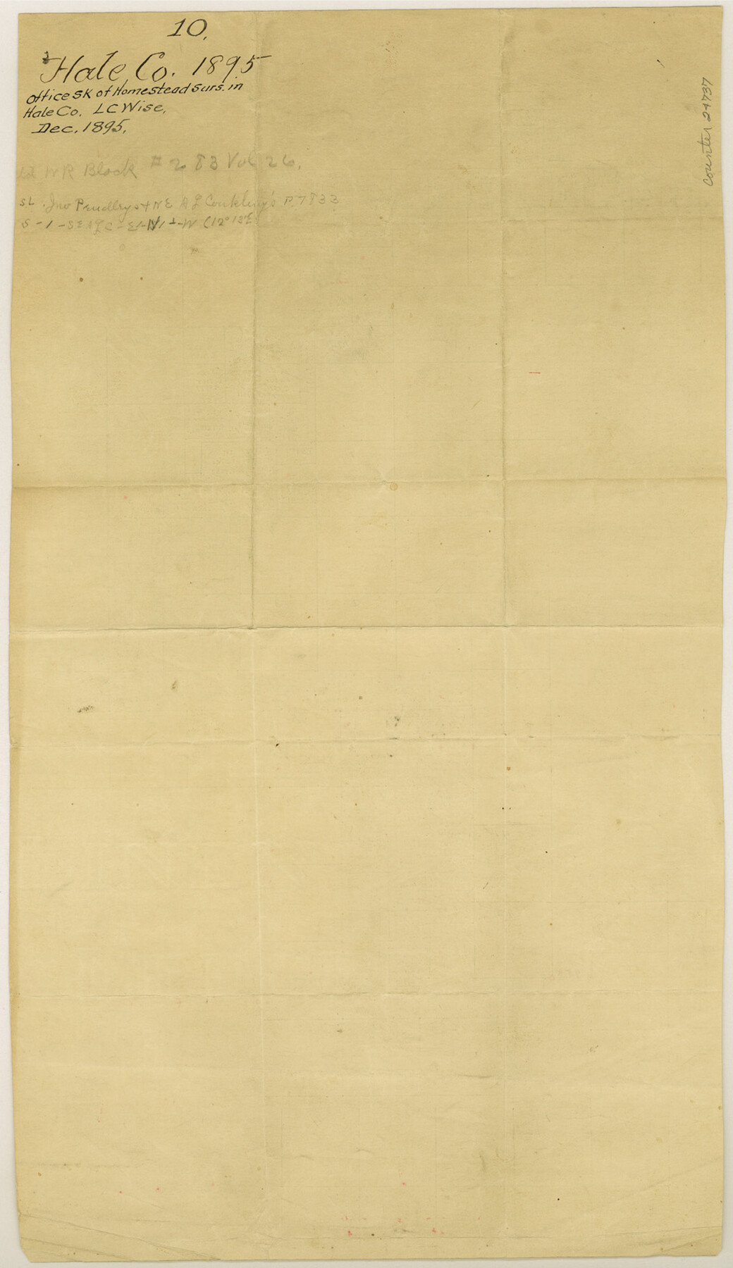
Hale County Sketch File 10
[Office sketch of homestead surveys]
-
Map/Doc
24737
-
Collection
General Map Collection
-
Object Dates
1895 (Creation Date)
-
People and Organizations
L.C. Wise (Surveyor/Engineer)
-
Counties
Hale
-
Subjects
Surveying Sketch File
-
Height x Width
16.3 x 9.4 inches
41.4 x 23.9 cm
-
Medium
paper, manuscript
Part of: General Map Collection
Harris County Historic Topographic 4

Print $20.00
- Digital $50.00
Harris County Historic Topographic 4
1916
Size 14.5 x 24.6 inches
Map/Doc 65814
Lee County Sketch File 1

Print $4.00
- Digital $50.00
Lee County Sketch File 1
1856
Size 13.1 x 8.2 inches
Map/Doc 29678
El Paso County Boundary File 13

Print $37.00
- Digital $50.00
El Paso County Boundary File 13
Size 11.1 x 8.6 inches
Map/Doc 53161
Houston County Working Sketch 16

Print $20.00
- Digital $50.00
Houston County Working Sketch 16
1962
Size 13.4 x 15.6 inches
Map/Doc 66246
Right of Way and Track Map Houston & Texas Central R.R. operated by the T. and N. O. R.R. Co., Fort Worth Branch

Print $40.00
- Digital $50.00
Right of Way and Track Map Houston & Texas Central R.R. operated by the T. and N. O. R.R. Co., Fort Worth Branch
1918
Size 30.7 x 56.4 inches
Map/Doc 64542
Stonewall County Rolled Sketch 20

Print $40.00
- Digital $50.00
Stonewall County Rolled Sketch 20
1951
Size 30.1 x 55.4 inches
Map/Doc 63915
Gaines County Rolled Sketch 15C

Print $40.00
- Digital $50.00
Gaines County Rolled Sketch 15C
Size 128.4 x 22.8 inches
Map/Doc 75928
Coast Chart No. 211 - Padre I. and Laguna Madre Lat. 27° 12' to Lat. 26° 33' Texas

Print $20.00
- Digital $50.00
Coast Chart No. 211 - Padre I. and Laguna Madre Lat. 27° 12' to Lat. 26° 33' Texas
1890
Size 27.5 x 18.3 inches
Map/Doc 72823
Coast Chart No. 210 - Aransas Pass and Corpus Christi Bay with the coast to latitude 27° 12', Texas

Print $20.00
- Digital $50.00
Coast Chart No. 210 - Aransas Pass and Corpus Christi Bay with the coast to latitude 27° 12', Texas
1907
Size 15.4 x 23.5 inches
Map/Doc 73451
Borden County Sketch File 11

Print $4.00
- Digital $50.00
Borden County Sketch File 11
1892
Size 11.0 x 8.9 inches
Map/Doc 14730
Cottle County Working Sketch 11

Print $20.00
- Digital $50.00
Cottle County Working Sketch 11
1943
Size 19.2 x 24.1 inches
Map/Doc 68321
Starr County Sketch File 42

Print $20.00
- Digital $50.00
Starr County Sketch File 42
1941
Size 19.0 x 21.6 inches
Map/Doc 12341
You may also like
J No. 4 - Reconnaissance of Catalina Harbor And the Anchorage on the N.E. Side of the Island, California

Print $20.00
- Digital $50.00
J No. 4 - Reconnaissance of Catalina Harbor And the Anchorage on the N.E. Side of the Island, California
1852
Size 18.3 x 13.1 inches
Map/Doc 97231
Dawson County Boundary File 3 (3)

Print $60.00
- Digital $50.00
Dawson County Boundary File 3 (3)
Size 11.0 x 35.8 inches
Map/Doc 52369
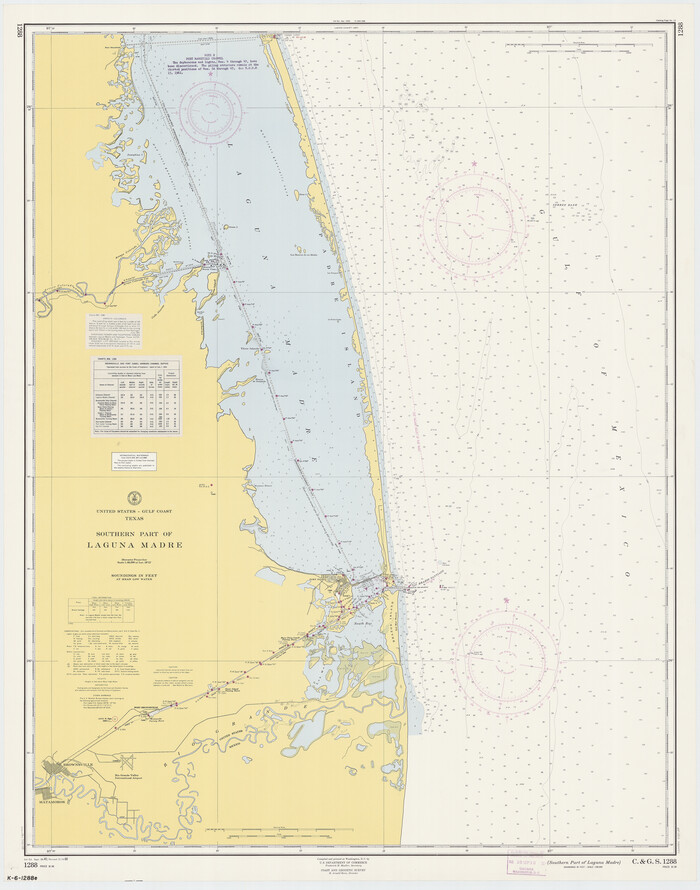
Southern Part of Laguna Madre
Print $20.00
- Digital $50.00
Southern Part of Laguna Madre
1960
Size 44.1 x 34.6 inches
Map/Doc 73538
Pecos County Sketch File 56

Print $20.00
- Digital $50.00
Pecos County Sketch File 56
Size 35.6 x 28.6 inches
Map/Doc 10571
Orange County Sketch File 9

Print $20.00
- Digital $50.00
Orange County Sketch File 9
1874
Size 12.7 x 22.9 inches
Map/Doc 12117
Anderson County Rolled Sketch 11

Print $20.00
- Digital $50.00
Anderson County Rolled Sketch 11
1956
Size 33.4 x 34.4 inches
Map/Doc 8366

Archer County Working Sketch 7

Print $20.00
- Digital $50.00
Archer County Working Sketch 7
1921
Size 32.6 x 24.9 inches
Map/Doc 67147
General Highway Map. Detail of Cities and Towns in Gray County, Texas. [Pampa and vicinity]
![79484, General Highway Map. Detail of Cities and Towns in Gray County, Texas. [Pampa and vicinity], Texas State Library and Archives](https://historictexasmaps.com/wmedia_w700/maps/79484.tif.jpg)
Print $20.00
General Highway Map. Detail of Cities and Towns in Gray County, Texas. [Pampa and vicinity]
1961
Size 24.7 x 18.1 inches
Map/Doc 79484
[Map of the Fort Worth & Denver City Railway]
![64433, [Map of the Fort Worth & Denver City Railway], General Map Collection](https://historictexasmaps.com/wmedia_w700/maps/64433.tif.jpg)
Print $40.00
- Digital $50.00
[Map of the Fort Worth & Denver City Railway]
1887
Size 22.2 x 110.1 inches
Map/Doc 64433
Amistad International Reservoir on Rio Grande 99

Print $20.00
- Digital $50.00
Amistad International Reservoir on Rio Grande 99
1950
Size 28.4 x 40.7 inches
Map/Doc 75530
Flight Mission No. CGI-4N, Frame 161, Cameron County

Print $20.00
- Digital $50.00
Flight Mission No. CGI-4N, Frame 161, Cameron County
1955
Size 18.7 x 22.4 inches
Map/Doc 84669