Comal County Sketch File 9 1/2
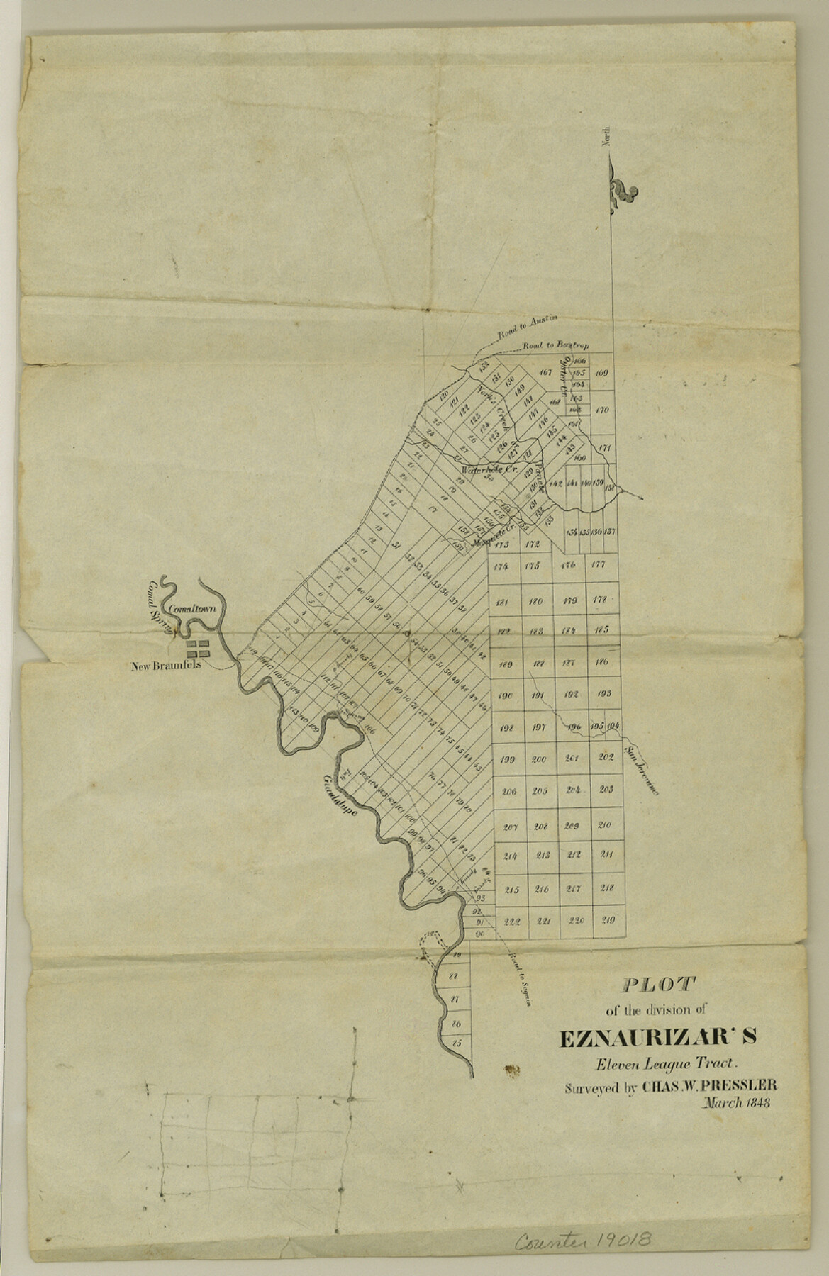
Plot of the division of Eznaurizar's Eleven League Tract surveyed by Chas. W. Pressler March 1848
-
Map/Doc
19018
-
Collection
General Map Collection
-
Object Dates
3/1848 (Survey Date)
-
People and Organizations
Chas. W. Pressler (Surveyor/Engineer)
-
Counties
Comal Guadalupe Hays
-
Subjects
Surveying Sketch File
-
Height x Width
12.9 x 8.4 inches
32.8 x 21.3 cm
-
Medium
paper, manuscript
-
Features
Road to Austin
Road to Bastrop
York's Creek
Waterhole Creek
Oyster Creek
Comaltown
Comal Spring
New Braunfels
Mesquete [sic] Creek
San Jeronimo [sic] Creek
Guadalupe River
Road to Seguin
Part of: General Map Collection
Freestone County Working Sketch 19

Print $20.00
- Digital $50.00
Freestone County Working Sketch 19
1980
Size 39.3 x 44.4 inches
Map/Doc 69261
Reeves County Rolled Sketch 19

Print $20.00
- Digital $50.00
Reeves County Rolled Sketch 19
1969
Size 23.8 x 21.5 inches
Map/Doc 7488
Travis County Sketch File 21

Print $4.00
- Digital $50.00
Travis County Sketch File 21
1875
Size 12.8 x 8.4 inches
Map/Doc 38325
Matagorda County Working Sketch 25

Print $20.00
- Digital $50.00
Matagorda County Working Sketch 25
1975
Size 20.1 x 27.8 inches
Map/Doc 70883
Pecos County Sketch File 2

Print $20.00
- Digital $50.00
Pecos County Sketch File 2
1880
Size 12.7 x 8.2 inches
Map/Doc 33652
Marshall Ford Dam right of way survey, General Ownership Map

Print $40.00
- Digital $50.00
Marshall Ford Dam right of way survey, General Ownership Map
1942
Size 36.6 x 55.9 inches
Map/Doc 60402
Gray County Sketch File A

Print $20.00
- Digital $50.00
Gray County Sketch File A
1889
Size 14.2 x 14.6 inches
Map/Doc 24456
Menard County Sketch File 20

Print $8.00
- Digital $50.00
Menard County Sketch File 20
1911
Size 14.2 x 8.7 inches
Map/Doc 31548
Lubbock County Sketch File 14

Print $4.00
- Digital $50.00
Lubbock County Sketch File 14
1892
Size 11.2 x 8.9 inches
Map/Doc 30438
Wharton County Working Sketch 11

Print $20.00
- Digital $50.00
Wharton County Working Sketch 11
1976
Size 42.2 x 40.8 inches
Map/Doc 72475
Baylor County Working Sketch 5

Print $20.00
- Digital $50.00
Baylor County Working Sketch 5
1940
Size 11.9 x 30.4 inches
Map/Doc 67290
Flight Mission No. CGI-3N, Frame 164, Cameron County

Print $20.00
- Digital $50.00
Flight Mission No. CGI-3N, Frame 164, Cameron County
1954
Size 18.5 x 22.2 inches
Map/Doc 84628
You may also like
Kendall County Boundary File 54

Print $16.00
- Digital $50.00
Kendall County Boundary File 54
Size 8.6 x 3.5 inches
Map/Doc 55769
Terry County Sketch File 15

Print $10.00
- Digital $50.00
Terry County Sketch File 15
1944
Size 11.3 x 8.9 inches
Map/Doc 38034
Flight Mission No. CRE-1R, Frame 135, Jackson County

Print $20.00
- Digital $50.00
Flight Mission No. CRE-1R, Frame 135, Jackson County
1956
Size 16.2 x 15.8 inches
Map/Doc 85343
Terrell County Sketch File 26

Print $38.00
- Digital $50.00
Terrell County Sketch File 26
1937
Size 10.9 x 8.2 inches
Map/Doc 37961
Flight Mission No. CLL-1N, Frame 105, Willacy County

Print $20.00
- Digital $50.00
Flight Mission No. CLL-1N, Frame 105, Willacy County
1954
Size 18.4 x 22.1 inches
Map/Doc 87039
Red River County Working Sketch 13

Print $20.00
- Digital $50.00
Red River County Working Sketch 13
1947
Size 37.1 x 39.9 inches
Map/Doc 71996
Aransas County Rolled Sketch 33

Print $20.00
- Digital $50.00
Aransas County Rolled Sketch 33
1997
Size 24.5 x 36.8 inches
Map/Doc 78495
America's Fun-Tier: Texas 1965 Official Highway Travel Map

Digital $50.00
America's Fun-Tier: Texas 1965 Official Highway Travel Map
Size 28.2 x 36.4 inches
Map/Doc 94326
San Patricio County Rolled Sketch 7B

Print $20.00
- Digital $50.00
San Patricio County Rolled Sketch 7B
1870
Size 42.3 x 29.1 inches
Map/Doc 7573
Map of the Fort Worth and Denver City Railway, through Wilbarger County Texas, 1882

Print $40.00
- Digital $50.00
Map of the Fort Worth and Denver City Railway, through Wilbarger County Texas, 1882
Size 22.9 x 121.1 inches
Map/Doc 64426
Harris County Rolled Sketch 88

Print $20.00
- Digital $50.00
Harris County Rolled Sketch 88
1936
Size 35.0 x 22.8 inches
Map/Doc 6125
Sketch of H. & T. C. RR. Co. Lands on the Canadian River in Oldham and Wheeler Districts

Print $40.00
- Digital $50.00
Sketch of H. & T. C. RR. Co. Lands on the Canadian River in Oldham and Wheeler Districts
1884
Size 88.9 x 23.8 inches
Map/Doc 93193