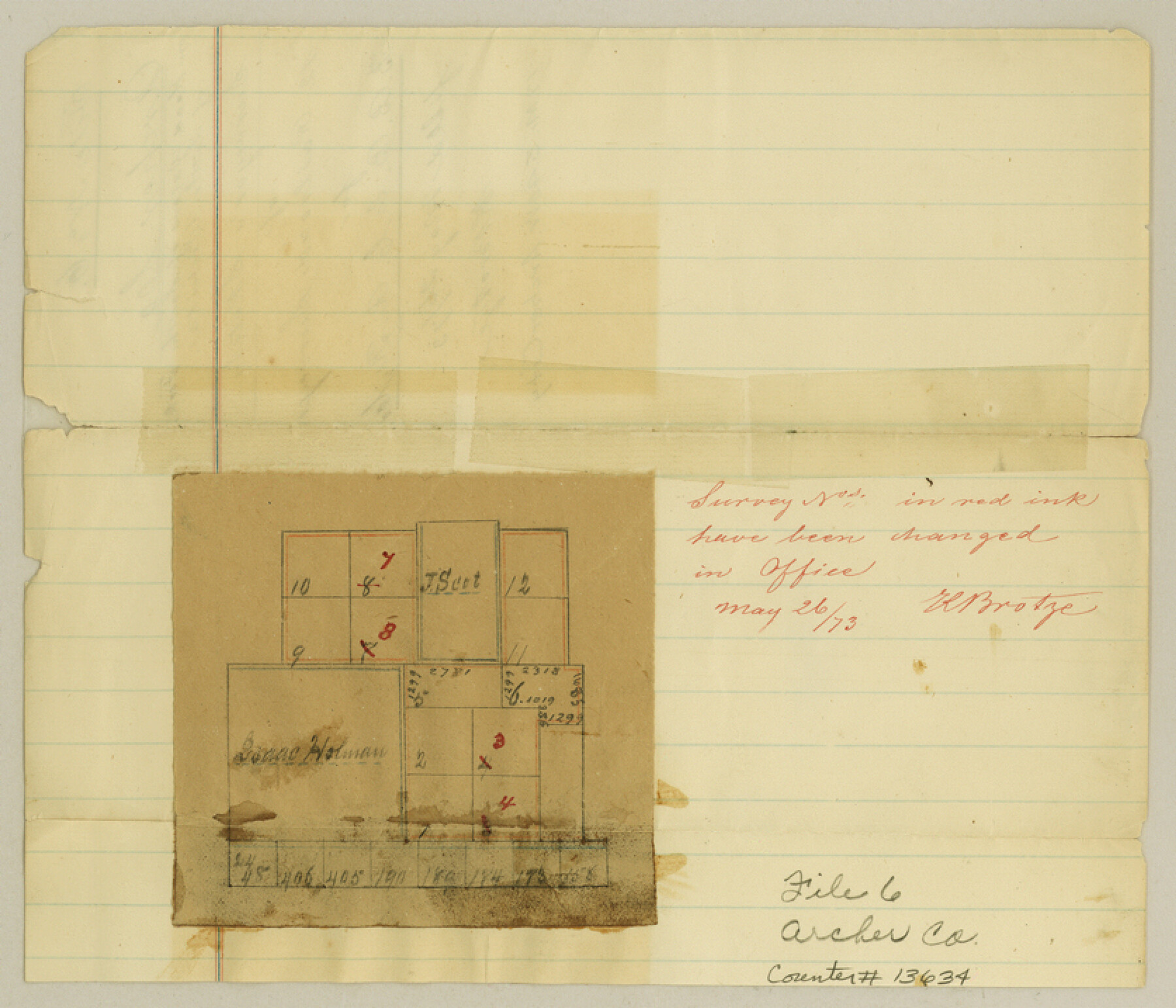
Archer County Sketch File 6
[Surveyor's sketch of 12 B. B. B. & C. R.R. Co. surveys on headwaters of the South Fork of Little Wichita River]
-
Map/Doc
13634
-
Collection
General Map Collection
-
Object Dates
1873/5/26 (File Date)
-
Counties
Archer
-
Subjects
Surveying Sketch File
-
Height x Width
7.2 x 8.4 inches
18.3 x 21.3 cm
-
Medium
paper, manuscript
Part of: General Map Collection
[Reconnaissance report of Lieut. Scariott around Laguna del Madre and up to Fort San Saba]
![73006, [Reconnaissance report of Lieut. Scariott around Laguna del Madre and up to Fort San Saba], General Map Collection](https://historictexasmaps.com/wmedia_w700/maps/73006.tif.jpg)
Print $20.00
- Digital $50.00
[Reconnaissance report of Lieut. Scariott around Laguna del Madre and up to Fort San Saba]
Size 25.2 x 18.2 inches
Map/Doc 73006
Trinity River, Irving Sheet

Print $4.00
- Digital $50.00
Trinity River, Irving Sheet
1925
Size 20.7 x 17.9 inches
Map/Doc 65212
Lavaca County Sketch File 4

Print $6.00
- Digital $50.00
Lavaca County Sketch File 4
Size 8.2 x 15.3 inches
Map/Doc 29636
Kleberg County Rolled Sketch 10-16

Print $20.00
- Digital $50.00
Kleberg County Rolled Sketch 10-16
1952
Size 37.0 x 33.2 inches
Map/Doc 9381
Val Verde County Rolled Sketch 30

Print $20.00
- Digital $50.00
Val Verde County Rolled Sketch 30
1884
Size 43.8 x 26.4 inches
Map/Doc 8111


McLennan County Sketch File 21

Print $4.00
- Digital $50.00
McLennan County Sketch File 21
Size 9.0 x 8.2 inches
Map/Doc 31294
Map of Nacogdoches County

Print $40.00
- Digital $50.00
Map of Nacogdoches County
1839
Size 81.0 x 40.9 inches
Map/Doc 93374
Hutchinson County Working Sketch 45

Print $20.00
- Digital $50.00
Hutchinson County Working Sketch 45
1979
Size 20.3 x 17.5 inches
Map/Doc 66405
Jim Hogg Co. [and] Brooks Co.
![4756, Jim Hogg Co. [and] Brooks Co., General Map Collection](https://historictexasmaps.com/wmedia_w700/maps/4756.tif.jpg)
Print $20.00
- Digital $50.00
Jim Hogg Co. [and] Brooks Co.
1913
Size 31.8 x 41.8 inches
Map/Doc 4756

You may also like
[Robertson Co.]
![4488, [Robertson Co.], Maddox Collection](https://historictexasmaps.com/wmedia_w700/maps/4488.tif.jpg)
Print $20.00
- Digital $50.00
[Robertson Co.]
1880
Size 32.3 x 44.3 inches
Map/Doc 4488
Kerr County Boundary File 4b

Print $14.00
- Digital $50.00
Kerr County Boundary File 4b
Size 14.3 x 8.8 inches
Map/Doc 64809
Hamilton County Boundary File 1

Print $22.00
- Digital $50.00
Hamilton County Boundary File 1
Size 8.6 x 8.1 inches
Map/Doc 54183
[Sketch Showing Blocks O18 and B11]
![93108, [Sketch Showing Blocks O18 and B11], Twichell Survey Records](https://historictexasmaps.com/wmedia_w700/maps/93108-1.tif.jpg)
Print $3.00
- Digital $50.00
[Sketch Showing Blocks O18 and B11]
Size 15.5 x 11.9 inches
Map/Doc 93108
Crockett County Sketch File 17

Print $10.00
- Digital $50.00
Crockett County Sketch File 17
1881
Size 12.7 x 8.0 inches
Map/Doc 19678
Galveston County Rolled Sketch Z62

Print $20.00
- Digital $50.00
Galveston County Rolled Sketch Z62
1933
Size 34.7 x 22.7 inches
Map/Doc 5994
Flight Mission No. DQO-2K, Frame 144, Galveston County

Print $20.00
- Digital $50.00
Flight Mission No. DQO-2K, Frame 144, Galveston County
1952
Size 18.8 x 22.5 inches
Map/Doc 85041
Sutton County Sketch File 36a

Print $61.00
- Digital $50.00
Sutton County Sketch File 36a
Size 9.0 x 9.0 inches
Map/Doc 37472
[Sketch for Mineral Application 36425 - Jefferson County, Ley C. Moore]
![65616, [Sketch for Mineral Application 36425 - Jefferson County, Ley C. Moore], General Map Collection](https://historictexasmaps.com/wmedia_w700/maps/65616.tif.jpg)
Print $40.00
- Digital $50.00
[Sketch for Mineral Application 36425 - Jefferson County, Ley C. Moore]
1942
Size 49.2 x 35.0 inches
Map/Doc 65616
Orange County Sketch File 29

Print $4.00
- Digital $50.00
Orange County Sketch File 29
1922
Size 11.2 x 8.8 inches
Map/Doc 33358

Map showing those portions of Texas traversed by Rock Island Lines and connections

Print $20.00
- Digital $50.00
Map showing those portions of Texas traversed by Rock Island Lines and connections
1904
Size 15.6 x 12.2 inches
Map/Doc 96588