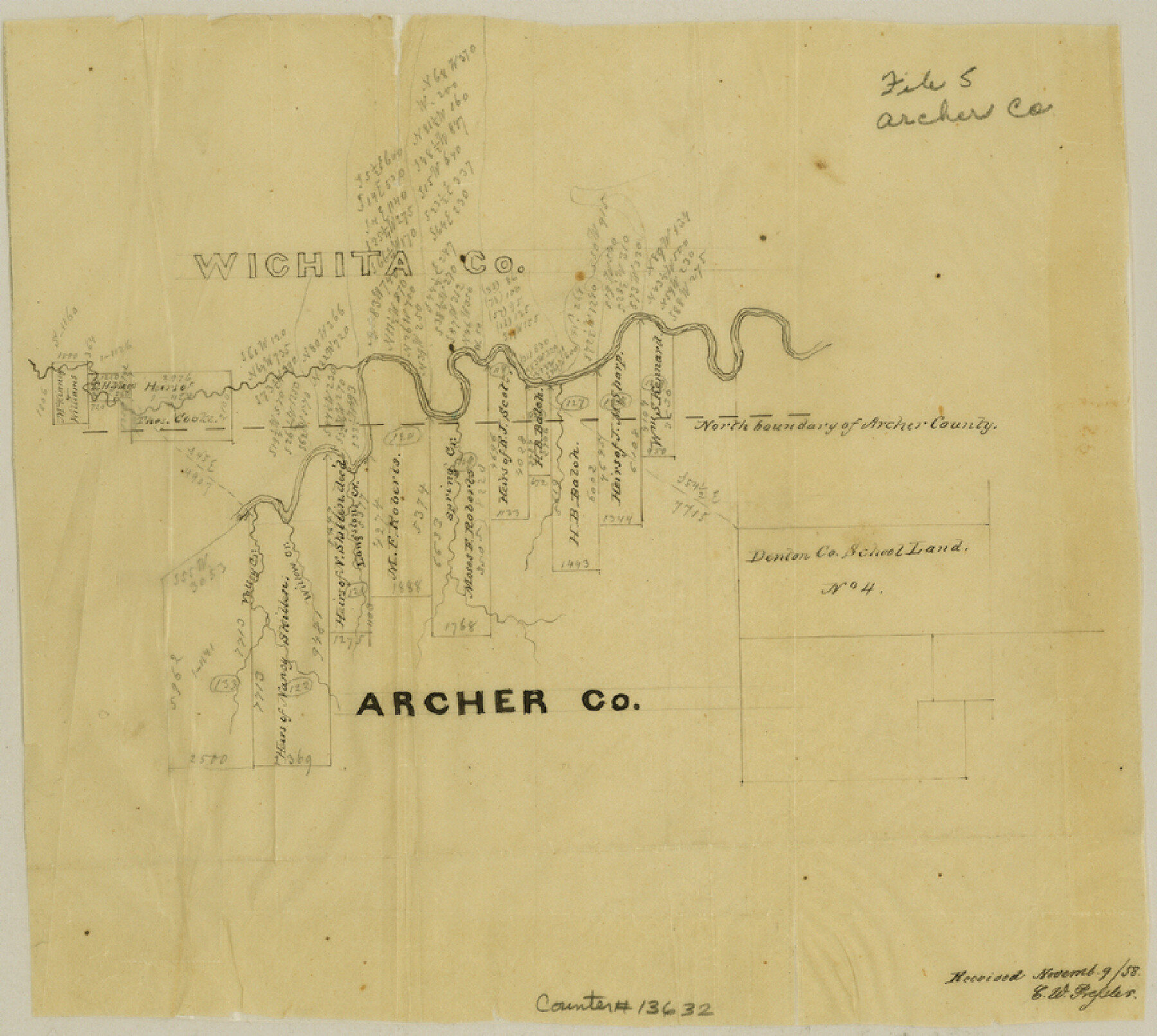
Archer County Sketch File 5
[Sketch of surveys on Wichita River in Wichita and Archer Counties]
-
Map/Doc
13632
-
Collection
General Map Collection
-
Object Dates
1858/11/9 (File Date)
1858 (Creation Date)
-
Counties
Archer Wichita
-
Subjects
Surveying Sketch File
-
Height x Width
7.8 x 8.7 inches
19.8 x 22.1 cm
-
Medium
paper, manuscript
Part of: General Map Collection
Sterling County Rolled Sketch 13

Print $20.00
- Digital $50.00
Sterling County Rolled Sketch 13
1945
Size 34.9 x 27.3 inches
Map/Doc 7847
Fort Bend County Working Sketch 1

Print $20.00
- Digital $50.00
Fort Bend County Working Sketch 1
Size 16.0 x 27.4 inches
Map/Doc 69207
Flight Mission No. BQY-4M, Frame 53, Harris County

Print $20.00
- Digital $50.00
Flight Mission No. BQY-4M, Frame 53, Harris County
1953
Size 18.6 x 22.3 inches
Map/Doc 85262
Harris County Rolled Sketch 64

Print $20.00
- Digital $50.00
Harris County Rolled Sketch 64
1936
Size 35.0 x 40.3 inches
Map/Doc 9123
Il Texas: La Ferrovia New York Texas-Messicana, La Colonizzazione Italiana della costa del Texas

Print $20.00
- Digital $50.00
Il Texas: La Ferrovia New York Texas-Messicana, La Colonizzazione Italiana della costa del Texas
1881
Size 17.6 x 22.0 inches
Map/Doc 97406
Jefferson County NRC Article 33.136 Location Key Sheet

Print $20.00
- Digital $50.00
Jefferson County NRC Article 33.136 Location Key Sheet
1970
Size 27.0 x 23.0 inches
Map/Doc 77028
Live Oak County Working Sketch 20

Print $20.00
- Digital $50.00
Live Oak County Working Sketch 20
1962
Size 29.7 x 35.7 inches
Map/Doc 70605
Flight Mission No. DCL-7C, Frame 17, Kenedy County

Print $20.00
- Digital $50.00
Flight Mission No. DCL-7C, Frame 17, Kenedy County
1943
Size 15.3 x 15.2 inches
Map/Doc 86009
Hopkins County Sketch File 23

Print $4.00
- Digital $50.00
Hopkins County Sketch File 23
1871
Size 12.6 x 8.4 inches
Map/Doc 26732
Controlled Mosaic by Jack Amman Photogrammetric Engineers, Inc - Sheet 33

Print $20.00
- Digital $50.00
Controlled Mosaic by Jack Amman Photogrammetric Engineers, Inc - Sheet 33
1954
Size 20.0 x 24.0 inches
Map/Doc 83486
Presidio County Working Sketch 47

Print $20.00
- Digital $50.00
Presidio County Working Sketch 47
1950
Size 30.2 x 39.5 inches
Map/Doc 71724
Limestone County Working Sketch 14

Print $20.00
- Digital $50.00
Limestone County Working Sketch 14
1922
Size 36.2 x 34.1 inches
Map/Doc 70564
You may also like
Bee County Sketch File 19

Print $6.00
- Digital $50.00
Bee County Sketch File 19
Size 12.7 x 8.4 inches
Map/Doc 14305
Dickens County Rolled Sketch P

Print $20.00
- Digital $50.00
Dickens County Rolled Sketch P
1917
Size 41.2 x 36.9 inches
Map/Doc 8782
Map of Nacogdoches County

Print $20.00
- Digital $50.00
Map of Nacogdoches County
1857
Size 22.9 x 24.3 inches
Map/Doc 3907
Lampasas County Working Sketch 17

Print $20.00
- Digital $50.00
Lampasas County Working Sketch 17
1977
Size 24.0 x 13.2 inches
Map/Doc 70294
Garza County Rolled Sketch 6E

Print $20.00
- Digital $50.00
Garza County Rolled Sketch 6E
1913
Size 19.2 x 15.6 inches
Map/Doc 5999
Jim Wells County Working Sketch 1

Print $20.00
- Digital $50.00
Jim Wells County Working Sketch 1
Size 17.2 x 22.2 inches
Map/Doc 66599
Flight Mission No. BRA-7M, Frame 36, Jefferson County

Print $20.00
- Digital $50.00
Flight Mission No. BRA-7M, Frame 36, Jefferson County
1953
Size 18.7 x 22.3 inches
Map/Doc 85487
Flight Mission No. DQO-12K, Frame 37, Galveston County

Print $20.00
- Digital $50.00
Flight Mission No. DQO-12K, Frame 37, Galveston County
1952
Size 18.7 x 22.4 inches
Map/Doc 85228
United States - Gulf Coast - Padre I. and Laguna Madre Lat. 27° 12' to Lat. 26° 33' Texas

Print $20.00
- Digital $50.00
United States - Gulf Coast - Padre I. and Laguna Madre Lat. 27° 12' to Lat. 26° 33' Texas
1913
Size 26.9 x 18.2 inches
Map/Doc 72820
Shelby County Working Sketch 3

Print $20.00
- Digital $50.00
Shelby County Working Sketch 3
1940
Size 28.9 x 19.4 inches
Map/Doc 63856
J. De Cordova's Map of the State of Texas Compiled from the records of the General Land Office of the State

Print $20.00
- Digital $50.00
J. De Cordova's Map of the State of Texas Compiled from the records of the General Land Office of the State
1854
Size 25.6 x 23.4 inches
Map/Doc 93903
Tyler County Sketch File 8

Print $4.00
- Digital $50.00
Tyler County Sketch File 8
Size 8.6 x 6.8 inches
Map/Doc 38642