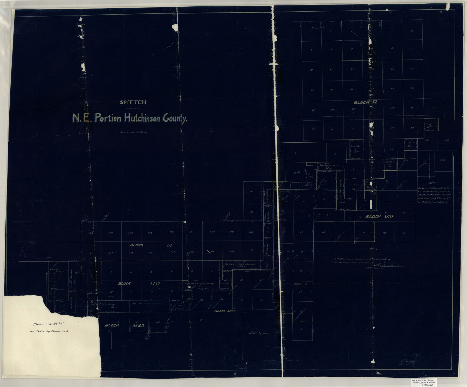
Hutchinson County Sketch File 20m
Sketch N.E. Portion Hutchinson County
-
Map/Doc
10501
-
Collection
General Map Collection
-
People and Organizations
W.D. Twichell (Surveyor/Engineer)
-
Counties
Hutchinson Hansford Ochiltree Roberts
-
Subjects
Surveying Sketch File
-
Height x Width
36.2 x 43.6 inches
92.0 x 110.7 cm
-
Medium
blueprint/diazo
-
Scale
1" = 1000 varas
Part of: General Map Collection
Crockett County Working Sketch 97

Print $20.00
- Digital $50.00
Crockett County Working Sketch 97
1979
Size 39.4 x 37.4 inches
Map/Doc 68430
Uvalde County

Print $20.00
- Digital $50.00
Uvalde County
1976
Size 42.7 x 46.4 inches
Map/Doc 73310
Flight Mission No. BRE-1P, Frame 33, Nueces County

Print $20.00
- Digital $50.00
Flight Mission No. BRE-1P, Frame 33, Nueces County
1956
Size 18.5 x 22.2 inches
Map/Doc 86629
Flight Mission No. DCL-4C, Frame 6, Kenedy County

Print $20.00
- Digital $50.00
Flight Mission No. DCL-4C, Frame 6, Kenedy County
1943
Size 18.6 x 22.2 inches
Map/Doc 85807
Panola County Working Sketch 15

Print $40.00
- Digital $50.00
Panola County Working Sketch 15
1945
Map/Doc 71424
Orange County Sketch File 11a

Print $4.00
- Digital $50.00
Orange County Sketch File 11a
1884
Size 6.1 x 6.1 inches
Map/Doc 33322
Eastland County Working Sketch 58

Print $20.00
- Digital $50.00
Eastland County Working Sketch 58
1985
Size 25.5 x 39.6 inches
Map/Doc 68839
Map of Anderson County

Print $20.00
- Digital $50.00
Map of Anderson County
1855
Size 23.7 x 28.9 inches
Map/Doc 3225
Flight Mission No. DQO-3K, Frame 20, Galveston County

Print $20.00
- Digital $50.00
Flight Mission No. DQO-3K, Frame 20, Galveston County
1952
Size 18.8 x 22.6 inches
Map/Doc 85061
Cameron County Rolled Sketch 14

Print $53.00
- Digital $50.00
Cameron County Rolled Sketch 14
1954
Size 6.8 x 8.8 inches
Map/Doc 43894
Flight Mission No. CRC-1R, Frame 95, Chambers County

Print $20.00
- Digital $50.00
Flight Mission No. CRC-1R, Frame 95, Chambers County
1956
Size 18.7 x 22.3 inches
Map/Doc 84710
Right of Way and Track Map, Dayton-Goose Creek Ry. Co., Station 612+40 to Station 792+00

Print $40.00
- Digital $50.00
Right of Way and Track Map, Dayton-Goose Creek Ry. Co., Station 612+40 to Station 792+00
1917
Size 25.3 x 56.5 inches
Map/Doc 64368
You may also like
Flight Mission No. DCL-4C, Frame 7, Kenedy County

Print $20.00
- Digital $50.00
Flight Mission No. DCL-4C, Frame 7, Kenedy County
1943
Size 18.6 x 22.3 inches
Map/Doc 85808
[Surveying Sketch of Northern Portion of Hutchinson County]
![5065, [Surveying Sketch of Northern Portion of Hutchinson County], Maddox Collection](https://historictexasmaps.com/wmedia_w700/maps/5065.tif.jpg)
Print $20.00
- Digital $50.00
[Surveying Sketch of Northern Portion of Hutchinson County]
1890
Size 26.5 x 42.5 inches
Map/Doc 5065
Parker County Boundary File 3

Print $4.00
- Digital $50.00
Parker County Boundary File 3
Size 11.2 x 8.8 inches
Map/Doc 57838
Chambers County Working Sketch 30

Print $20.00
- Digital $50.00
Chambers County Working Sketch 30
2012
Size 29.2 x 43.9 inches
Map/Doc 93400

Working Sketch Compiled From Original Field Notes Showing Surveys in Reagan and Irion Counties

Print $20.00
- Digital $50.00
Working Sketch Compiled From Original Field Notes Showing Surveys in Reagan and Irion Counties
Size 36.2 x 20.2 inches
Map/Doc 92331
Coast Chart No. 210 Aransas Pass and Corpus Christi Bay with the coast to latitude 27° 12' Texas

Print $20.00
- Digital $50.00
Coast Chart No. 210 Aransas Pass and Corpus Christi Bay with the coast to latitude 27° 12' Texas
1913
Size 27.9 x 18.3 inches
Map/Doc 72806
Ellis County Sketch File 7

Print $40.00
- Digital $50.00
Ellis County Sketch File 7
1859
Size 12.2 x 15.6 inches
Map/Doc 21839
Flight Mission No. CRC-1R, Frame 93, Chambers County

Print $20.00
- Digital $50.00
Flight Mission No. CRC-1R, Frame 93, Chambers County
1956
Size 18.7 x 22.6 inches
Map/Doc 84708
Entrance to Sabine Pass, Texas from survey of May and June 1892 under the direction of Major James B. Quinn, Corps of Engineers, USA

Print $20.00
- Digital $50.00
Entrance to Sabine Pass, Texas from survey of May and June 1892 under the direction of Major James B. Quinn, Corps of Engineers, USA
1892
Size 18.8 x 32.9 inches
Map/Doc 94154
No. 2 Chart of Corpus Christi Pass, Texas

Print $20.00
- Digital $50.00
No. 2 Chart of Corpus Christi Pass, Texas
1878
Size 18.3 x 27.2 inches
Map/Doc 73028
Medina County Working Sketch 23

Print $20.00
- Digital $50.00
Medina County Working Sketch 23
Size 43.8 x 43.1 inches
Map/Doc 70938