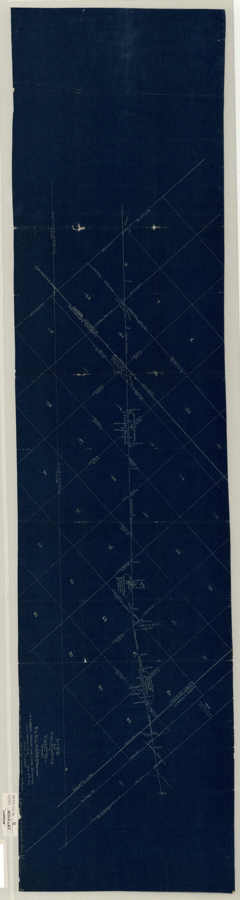
Hockley County Sketch File 9
Map and Field Notes of D.&N.T. Ry. Through E. L. Ellwoods "Pasture" in Lubbock, Hockley and Lamb Counties
-
Map/Doc
10491
-
Collection
General Map Collection
-
Object Dates
9/6/1912 (File Date)
6/19/1912 (Creation Date)
-
Counties
Hockley Lamb Lubbock
-
Subjects
Surveying Sketch File
-
Height x Width
48.2 x 12.8 inches
122.4 x 32.5 cm
-
Medium
blueprint/diazo
-
Scale
1:2000
Part of: General Map Collection

Starr County Rolled Sketch 34

Print $20.00
- Digital $50.00
Starr County Rolled Sketch 34
1945
Size 20.8 x 17.9 inches
Map/Doc 7831
Cooke County Working Sketch 6

Print $20.00
- Digital $50.00
Cooke County Working Sketch 6
1935
Size 21.4 x 22.1 inches
Map/Doc 68243
Cameron County Sketch File 12

Print $222.00
- Digital $50.00
Cameron County Sketch File 12
Size 10.8 x 7.4 inches
Map/Doc 17236
Edwards County Working Sketch 118

Print $20.00
- Digital $50.00
Edwards County Working Sketch 118
1974
Size 19.5 x 30.4 inches
Map/Doc 68994
Flight Mission No. DQO-7K, Frame 77, Galveston County

Print $20.00
- Digital $50.00
Flight Mission No. DQO-7K, Frame 77, Galveston County
1952
Size 18.9 x 22.6 inches
Map/Doc 85104
Plot of land tracts situated in Austin Co. west of Mill Creek opposite and above the fork of the same

Print $2.00
- Digital $50.00
Plot of land tracts situated in Austin Co. west of Mill Creek opposite and above the fork of the same
1845
Size 7.7 x 8.1 inches
Map/Doc 224
[Map of] North America
![88884, [Map of] North America, General Map Collection](https://historictexasmaps.com/wmedia_w700/maps/88884.tif.jpg)
Print $3.00
- Digital $50.00
[Map of] North America
1834
Size 11.0 x 8.5 inches
Map/Doc 88884
Trinity County Sketch File 36a

Print $40.00
- Digital $50.00
Trinity County Sketch File 36a
1921
Size 18.5 x 8.6 inches
Map/Doc 38589
Hudspeth County Sketch File 21a

Print $10.00
- Digital $50.00
Hudspeth County Sketch File 21a
Size 10.6 x 8.4 inches
Map/Doc 26969
Brooks County Boundary File 1a

Print $40.00
- Digital $50.00
Brooks County Boundary File 1a
Size 63.8 x 7.1 inches
Map/Doc 50836
Upton County Boundary File 2

Print $6.00
- Digital $50.00
Upton County Boundary File 2
Size 14.4 x 8.9 inches
Map/Doc 59517
You may also like
Nautical Chart 885-SC Intracoastal Waterway - Ellender to Galveston Bay, Louisiana-Texas

Print $40.00
- Digital $50.00
Nautical Chart 885-SC Intracoastal Waterway - Ellender to Galveston Bay, Louisiana-Texas
1972
Size 16.1 x 59.4 inches
Map/Doc 69836
Matagorda County Rolled Sketch 40

Print $20.00
- Digital $50.00
Matagorda County Rolled Sketch 40
Size 24.6 x 27.4 inches
Map/Doc 6704
Flight Mission No. DIX-6P, Frame 195, Aransas County

Print $20.00
- Digital $50.00
Flight Mission No. DIX-6P, Frame 195, Aransas County
1956
Size 19.0 x 22.7 inches
Map/Doc 83857
The Chief Justice Counties. Late Summer 1837

Print $20.00
The Chief Justice Counties. Late Summer 1837
2020
Size 16.8 x 19.1 inches
Map/Doc 96079
Dimmit County Sketch File 26

Print $6.00
- Digital $50.00
Dimmit County Sketch File 26
Size 13.5 x 10.2 inches
Map/Doc 21144
Carta Particular de las Costas Setentrionales del Seno Mexicano que comprehende las de la Florída Ocidental las Márgenes de la Luisiana y toda la rivera que sigue por la Bahía de S. Bernardo y el Rio Bravo del Norte hasta la Laguna Madre

Carta Particular de las Costas Setentrionales del Seno Mexicano que comprehende las de la Florída Ocidental las Márgenes de la Luisiana y toda la rivera que sigue por la Bahía de S. Bernardo y el Rio Bravo del Norte hasta la Laguna Madre
1807
Size 27.3 x 40.3 inches
Map/Doc 94565
O'Neall Terrace Annex, a Re-Subdivision of the South One-half of Blocks 25 and 31 and all of Blocks 30, 32, and 33 of McCrummen's Second Addition, Lubbock, Texas

Print $20.00
- Digital $50.00
O'Neall Terrace Annex, a Re-Subdivision of the South One-half of Blocks 25 and 31 and all of Blocks 30, 32, and 33 of McCrummen's Second Addition, Lubbock, Texas
1928
Size 23.2 x 27.6 inches
Map/Doc 92747
Flight Mission No. DIX-10P, Frame 183, Aransas County

Print $20.00
- Digital $50.00
Flight Mission No. DIX-10P, Frame 183, Aransas County
1956
Size 18.4 x 22.1 inches
Map/Doc 83973
Texas Intracoastal Waterway - Laguna Madre - Dagger Hill to Potrero Grande

Print $20.00
- Digital $50.00
Texas Intracoastal Waterway - Laguna Madre - Dagger Hill to Potrero Grande
1960
Size 38.7 x 27.2 inches
Map/Doc 73510
Controlled Mosaic by Jack Amman Photogrammetric Engineers, Inc - Sheet 20

Print $20.00
- Digital $50.00
Controlled Mosaic by Jack Amman Photogrammetric Engineers, Inc - Sheet 20
1954
Size 20.0 x 24.0 inches
Map/Doc 83468
Flight Mission No. CGI-1N, Frame 168, Cameron County

Print $20.00
- Digital $50.00
Flight Mission No. CGI-1N, Frame 168, Cameron County
1955
Size 18.5 x 22.2 inches
Map/Doc 84503
[Townships 1 through 5 North, Blocks 34, 35, and 36]
![92587, [Townships 1 through 5 North, Blocks 34, 35, and 36], Twichell Survey Records](https://historictexasmaps.com/wmedia_w700/maps/92587-1.tif.jpg)
Print $20.00
- Digital $50.00
[Townships 1 through 5 North, Blocks 34, 35, and 36]
Size 41.7 x 21.4 inches
Map/Doc 92587