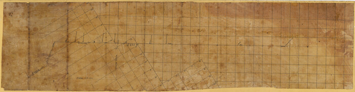
Ward County Rolled Sketch A

Print $40.00
- Digital $50.00
Ward County Rolled Sketch A
Size: 42.6 x 56.3 inches
10099
Ward County Rolled Sketch 3

Print $40.00
- Digital $50.00
Ward County Rolled Sketch 3
Size: 65.3 x 25.7 inches
10101
Ward County Rolled Sketch 4

Print $20.00
- Digital $50.00
Ward County Rolled Sketch 4
Size: 39.3 x 47.2 inches
10102
Ward County Rolled Sketch 12

Print $20.00
- Digital $50.00
Ward County Rolled Sketch 12
Size: 38.2 x 47.8 inches
10107
Ward County Rolled Sketch 12A

Print $20.00
- Digital $50.00
Ward County Rolled Sketch 12A
Size: 34.7 x 46.5 inches
10108
Ward County Rolled Sketch 24D

Print $40.00
- Digital $50.00
Ward County Rolled Sketch 24D
Size: 45.6 x 69.0 inches
10113
Crane County Sketch File 1

Print $20.00
- Digital $50.00
Crane County Sketch File 1
Size: 44.8 x 14.6 inches
10343
Ward County Sketch File 2

Print $40.00
- Digital $50.00
Ward County Sketch File 2
Size: 25.0 x 62.7 inches
10426
Ward County Sketch File 6

Print $20.00
- Digital $50.00
Ward County Sketch File 6
Size: 21.6 x 45.5 inches
10427
Crane County Sketch File 3a

Print $20.00
- Digital $50.00
Crane County Sketch File 3a
Size: 20.8 x 13.0 inches
11205
Ward County Sketch File 8

Print $20.00
- Digital $50.00
Ward County Sketch File 8
Size: 13.3 x 22.8 inches
12599
Ward County Sketch File L

Print $20.00
- Digital $50.00
Ward County Sketch File L
Size: 23.8 x 29.6 inches
12601
Ward County Sketch File 12

Print $4.00
- Digital $50.00
Ward County Sketch File 12
Size: 14.3 x 8.8 inches
39638
Revised Sectional Map No. 3 showing land surveys in counties of Loving, Reeves and Culberson and portions of Winkler, Ward, Pecos and Jeff Davis, Texas

Print $20.00
- Digital $50.00
Revised Sectional Map No. 3 showing land surveys in counties of Loving, Reeves and Culberson and portions of Winkler, Ward, Pecos and Jeff Davis, Texas
Size: 19.0 x 24.7 inches
4478
Ward County Rolled Sketch 26

Print $28.00
- Digital $50.00
Ward County Rolled Sketch 26
Size: 9.9 x 15.0 inches
49468
Revised Sectional Map showing land surveys in counties of Loving and Reeves

Print $20.00
- Digital $50.00
Revised Sectional Map showing land surveys in counties of Loving and Reeves
Size: 18.0 x 17.7 inches
5053
Ward County Boundary File 1

Print $12.00
- Digital $50.00
Ward County Boundary File 1
Size: 14.4 x 9.0 inches
59667
Ward County Boundary File 2

Print $4.00
- Digital $50.00
Ward County Boundary File 2
Size: 11.1 x 8.9 inches
59673
Ward County Boundary File 3

Print $18.00
- Digital $50.00
Ward County Boundary File 3
Size: 14.4 x 8.8 inches
59675
Ward County Boundary File 3a

Print $22.00
- Digital $50.00
Ward County Boundary File 3a
Size: 13.1 x 8.6 inches
59684
Ward County Working Sketch 43

Print $40.00
- Digital $50.00
Ward County Working Sketch 43
Size: 57.3 x 36.8 inches
72349
Reeves County Rolled Sketch 6

Print $20.00
- Digital $50.00
Reeves County Rolled Sketch 6
Size: 22.6 x 29.0 inches
7478
[Sketch of Surveys in Ward County, Texas]
Print $20.00
- Digital $50.00
[Sketch of Surveys in Ward County, Texas]
Size: 9.7 x 37.1 inches
75767
Lands of Gunter & Munson and Maddox Bros. & Anderson, Tom Green Co. Tex.

Print $20.00
- Digital $50.00
Lands of Gunter & Munson and Maddox Bros. & Anderson, Tom Green Co. Tex.
Size: 20.4 x 30.7 inches
75787
Andrews County Rolled Sketch 42

Print $20.00
- Digital $50.00
Andrews County Rolled Sketch 42
Size: 27.3 x 36.0 inches
77182
Ward County Rolled Sketch 24F

Print $40.00
- Digital $50.00
Ward County Rolled Sketch 24F
Size: 30.5 x 65.2 inches
78232
Ward County Rolled Sketch 24A

Print $20.00
- Digital $50.00
Ward County Rolled Sketch 24A
Size: 19.9 x 42.3 inches
8164
PSL Field Notes for Blocks B14 and B16 in Crane and Ector Counties, Blocks B18 and B20 in Crane and Ward Counties, and Blocks B17, B21, B22, B23, B24, B25, and B26 in Crane County

PSL Field Notes for Blocks B14 and B16 in Crane and Ector Counties, Blocks B18 and B20 in Crane and Ward Counties, and Blocks B17, B21, B22, B23, B24, B25, and B26 in Crane County
81646
PSL Field Notes for Blocks B13, B18, and B28 in Crane and Ward Counties, and Blocks B19, B20, and B29 in Ward County

PSL Field Notes for Blocks B13, B18, and B28 in Crane and Ward Counties, and Blocks B19, B20, and B29 in Ward County
81647
PSL Field Notes for Block B27 in Crane County and Block B28 in Crane and Ward Counties

PSL Field Notes for Block B27 in Crane County and Block B28 in Crane and Ward Counties
81648
Ward County Rolled Sketch A
Print $40.00
- Digital $50.00
Ward County Rolled Sketch A
-
Size
42.6 x 56.3 inches
-
Map/Doc
10099
Ward County Rolled Sketch 3
Print $40.00
- Digital $50.00
Ward County Rolled Sketch 3
-
Size
65.3 x 25.7 inches
-
Map/Doc
10101
Ward County Rolled Sketch 4
Print $20.00
- Digital $50.00
Ward County Rolled Sketch 4
-
Size
39.3 x 47.2 inches
-
Map/Doc
10102
Ward County Rolled Sketch 12
Print $20.00
- Digital $50.00
Ward County Rolled Sketch 12
-
Size
38.2 x 47.8 inches
-
Map/Doc
10107
Ward County Rolled Sketch 12A
Print $20.00
- Digital $50.00
Ward County Rolled Sketch 12A
-
Size
34.7 x 46.5 inches
-
Map/Doc
10108
Ward County Rolled Sketch 24D
Print $40.00
- Digital $50.00
Ward County Rolled Sketch 24D
-
Size
45.6 x 69.0 inches
-
Map/Doc
10113
Crane County Sketch File 1
Print $20.00
- Digital $50.00
Crane County Sketch File 1
-
Size
44.8 x 14.6 inches
-
Map/Doc
10343
Ward County Sketch File 2
Print $40.00
- Digital $50.00
Ward County Sketch File 2
-
Size
25.0 x 62.7 inches
-
Map/Doc
10426
Ward County Sketch File 6
Print $20.00
- Digital $50.00
Ward County Sketch File 6
-
Size
21.6 x 45.5 inches
-
Map/Doc
10427
Crane County Sketch File 3a
Print $20.00
- Digital $50.00
Crane County Sketch File 3a
-
Size
20.8 x 13.0 inches
-
Map/Doc
11205
Ward County Sketch File 8
Print $20.00
- Digital $50.00
Ward County Sketch File 8
-
Size
13.3 x 22.8 inches
-
Map/Doc
12599
Ward County Sketch File L
Print $20.00
- Digital $50.00
Ward County Sketch File L
-
Size
23.8 x 29.6 inches
-
Map/Doc
12601
Ward County Sketch File 12
Print $4.00
- Digital $50.00
Ward County Sketch File 12
-
Size
14.3 x 8.8 inches
-
Map/Doc
39638
Revised Sectional Map No. 3 showing land surveys in counties of Loving, Reeves and Culberson and portions of Winkler, Ward, Pecos and Jeff Davis, Texas
Print $20.00
- Digital $50.00
Revised Sectional Map No. 3 showing land surveys in counties of Loving, Reeves and Culberson and portions of Winkler, Ward, Pecos and Jeff Davis, Texas
-
Size
19.0 x 24.7 inches
-
Map/Doc
4478
Ward County Rolled Sketch 26
Print $28.00
- Digital $50.00
Ward County Rolled Sketch 26
-
Size
9.9 x 15.0 inches
-
Map/Doc
49468
Revised Sectional Map showing land surveys in counties of Loving and Reeves
Print $20.00
- Digital $50.00
Revised Sectional Map showing land surveys in counties of Loving and Reeves
-
Size
18.0 x 17.7 inches
-
Map/Doc
5053
Ward County Boundary File 1
Print $12.00
- Digital $50.00
Ward County Boundary File 1
-
Size
14.4 x 9.0 inches
-
Map/Doc
59667
Ward County Boundary File 2
Print $4.00
- Digital $50.00
Ward County Boundary File 2
-
Size
11.1 x 8.9 inches
-
Map/Doc
59673
Ward County Boundary File 3
Print $18.00
- Digital $50.00
Ward County Boundary File 3
-
Size
14.4 x 8.8 inches
-
Map/Doc
59675
Ward County Boundary File 3a
Print $22.00
- Digital $50.00
Ward County Boundary File 3a
-
Size
13.1 x 8.6 inches
-
Map/Doc
59684
Ward County Working Sketch 43
Print $40.00
- Digital $50.00
Ward County Working Sketch 43
-
Size
57.3 x 36.8 inches
-
Map/Doc
72349
Reeves County Rolled Sketch 6
Print $20.00
- Digital $50.00
Reeves County Rolled Sketch 6
-
Size
22.6 x 29.0 inches
-
Map/Doc
7478
[Sketch of Surveys in Ward County, Texas]
Print $20.00
- Digital $50.00
[Sketch of Surveys in Ward County, Texas]
-
Size
9.7 x 37.1 inches
-
Map/Doc
75767
Lands of Gunter & Munson and Maddox Bros. & Anderson, Tom Green Co. Tex.
Print $20.00
- Digital $50.00
Lands of Gunter & Munson and Maddox Bros. & Anderson, Tom Green Co. Tex.
-
Size
20.4 x 30.7 inches
-
Map/Doc
75787
Andrews County Rolled Sketch 42
Print $20.00
- Digital $50.00
Andrews County Rolled Sketch 42
-
Size
27.3 x 36.0 inches
-
Map/Doc
77182
Ward County Rolled Sketch 24F
Print $40.00
- Digital $50.00
Ward County Rolled Sketch 24F
-
Size
30.5 x 65.2 inches
-
Map/Doc
78232
Ward County Rolled Sketch 24A
Print $20.00
- Digital $50.00
Ward County Rolled Sketch 24A
-
Size
19.9 x 42.3 inches
-
Map/Doc
8164
PSL Field Notes for Blocks B14 and B16 in Crane and Ector Counties, Blocks B18 and B20 in Crane and Ward Counties, and Blocks B17, B21, B22, B23, B24, B25, and B26 in Crane County
PSL Field Notes for Blocks B14 and B16 in Crane and Ector Counties, Blocks B18 and B20 in Crane and Ward Counties, and Blocks B17, B21, B22, B23, B24, B25, and B26 in Crane County
-
Map/Doc
81646
PSL Field Notes for Blocks B13, B18, and B28 in Crane and Ward Counties, and Blocks B19, B20, and B29 in Ward County
PSL Field Notes for Blocks B13, B18, and B28 in Crane and Ward Counties, and Blocks B19, B20, and B29 in Ward County
-
Map/Doc
81647
PSL Field Notes for Block B27 in Crane County and Block B28 in Crane and Ward Counties
PSL Field Notes for Block B27 in Crane County and Block B28 in Crane and Ward Counties
-
Map/Doc
81648