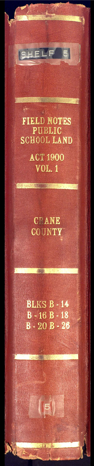
PSL Field Notes for Blocks B14 and B16 in Crane and Ector Counties, Blocks B18 and B20 in Crane and Ward Counties, and Blocks B17, B21, B22, B23, B24, B25, and B26 in Crane County
Field Notes, Public School Land Vol. 1, Crane County Blocks B14, B16, B18, B20, B26
-
Map/Doc
81646
-
Collection
General Map Collection
-
People and Organizations
Frank F. Friend (Surveyor/Engineer)
Charles Rogan (GLO Commissioner)
W.D. Twichell (Surveyor/Engineer)
Otha Draper (Surveyor/Engineer)
William Alley (Surveyor/Engineer)
-
Counties
Ector Ward Crane
-
Subjects
Bound Volume Public School Land
-
Medium
paper, bound volume
-
Comments
See 97176 for an index to the Public School Land field note volumes.
Related maps
Public School Land Field Note Volume Index

Public School Land Field Note Volume Index
2023
Size 8.5 x 11.0 inches
Map/Doc 97176
Part of: General Map Collection
Palo Pinto County Rolled Sketch 5

Print $40.00
- Digital $50.00
Palo Pinto County Rolled Sketch 5
Size 54.4 x 36.0 inches
Map/Doc 76021
Val Verde County Sketch File 2

Print $8.00
- Digital $50.00
Val Verde County Sketch File 2
1885
Size 12.8 x 8.0 inches
Map/Doc 39169
Hamilton County Working Sketch 24

Print $20.00
- Digital $50.00
Hamilton County Working Sketch 24
1979
Size 34.7 x 33.6 inches
Map/Doc 63362
Flight Mission No. CUG-2P, Frame 27, Kleberg County

Print $20.00
- Digital $50.00
Flight Mission No. CUG-2P, Frame 27, Kleberg County
1956
Size 18.9 x 22.5 inches
Map/Doc 86192
Palo Pinto County Working Sketch 11

Print $20.00
- Digital $50.00
Palo Pinto County Working Sketch 11
1942
Size 21.2 x 22.1 inches
Map/Doc 71394
Crockett County Working Sketch 72

Print $20.00
- Digital $50.00
Crockett County Working Sketch 72
1963
Size 43.9 x 38.5 inches
Map/Doc 68405
Sketch exhibiting the San Antonio River from the source to the fork of Goliad

Print $20.00
- Digital $50.00
Sketch exhibiting the San Antonio River from the source to the fork of Goliad
Size 27.5 x 16.6 inches
Map/Doc 73009
Kerr County Rolled Sketch 20

Print $20.00
- Digital $50.00
Kerr County Rolled Sketch 20
1955
Size 30.2 x 35.2 inches
Map/Doc 6502
Part of Laguna Madre from Mosquito Trangulation Station to Sand Triangulation Station

Print $20.00
- Digital $50.00
Part of Laguna Madre from Mosquito Trangulation Station to Sand Triangulation Station
1881
Size 16.4 x 26.9 inches
Map/Doc 73488
Flight Mission No. CUI-1H, Frame 95, Milam County

Print $20.00
- Digital $50.00
Flight Mission No. CUI-1H, Frame 95, Milam County
1951
Size 18.4 x 22.2 inches
Map/Doc 86603
Austin County Working Sketch 8

Print $20.00
- Digital $50.00
Austin County Working Sketch 8
1992
Size 28.7 x 31.6 inches
Map/Doc 67249
Galveston County Sketch File 21

Print $4.00
- Digital $50.00
Galveston County Sketch File 21
1838
Size 13.3 x 8.3 inches
Map/Doc 23392
You may also like
Carte des Côtes du Golfe du Mexique compris entre la Pointe Sud de la Presqu'Ile de la Floride et la Pointe Nord de la Presqu'Ile d'Yucatan

Print $20.00
- Digital $50.00
Carte des Côtes du Golfe du Mexique compris entre la Pointe Sud de la Presqu'Ile de la Floride et la Pointe Nord de la Presqu'Ile d'Yucatan
1800
Size 26.0 x 37.5 inches
Map/Doc 95322
Ellis County Sketch File 6

Print $24.00
- Digital $50.00
Ellis County Sketch File 6
Size 12.3 x 8.2 inches
Map/Doc 21836
Outer Continental Shelf Leasing Maps (Louisiana Offshore Operations)

Print $20.00
- Digital $50.00
Outer Continental Shelf Leasing Maps (Louisiana Offshore Operations)
1959
Size 18.1 x 14.3 inches
Map/Doc 76110
The Republic County of Brazos. December 29, 1845

Print $20.00
The Republic County of Brazos. December 29, 1845
2020
Size 20.6 x 21.7 inches
Map/Doc 96117
Flight Mission No. DCL-7C, Frame 76, Kenedy County

Print $20.00
- Digital $50.00
Flight Mission No. DCL-7C, Frame 76, Kenedy County
1943
Size 15.4 x 15.1 inches
Map/Doc 86062

Maps of Gulf Intracoastal Waterway, Texas - Sabine River to the Rio Grande and connecting waterways including ship channels

Print $20.00
- Digital $50.00
Maps of Gulf Intracoastal Waterway, Texas - Sabine River to the Rio Grande and connecting waterways including ship channels
1966
Size 14.2 x 20.1 inches
Map/Doc 61990
Comanche County Working Sketch 3

Print $20.00
- Digital $50.00
Comanche County Working Sketch 3
1919
Size 21.9 x 12.6 inches
Map/Doc 68137
Duval County Sketch File 36a

Print $10.00
- Digital $50.00
Duval County Sketch File 36a
1935
Size 11.4 x 8.8 inches
Map/Doc 21380
Throckmorton County Sketch File 7

Print $8.00
- Digital $50.00
Throckmorton County Sketch File 7
Size 14.3 x 8.8 inches
Map/Doc 38090
Cochran County Sketch File 7

Print $10.00
- Digital $50.00
Cochran County Sketch File 7
1940
Size 11.2 x 8.6 inches
Map/Doc 18550
Hudspeth County Sketch File 20a

Print $10.00
- Digital $50.00
Hudspeth County Sketch File 20a
Size 10.8 x 8.2 inches
Map/Doc 26964